MyTopo
Upper Nutria New Mexico US Topo Map
Couldn't load pickup availability
Also explore the Upper Nutria Forest Service Topo of this same quad for updated USFS data
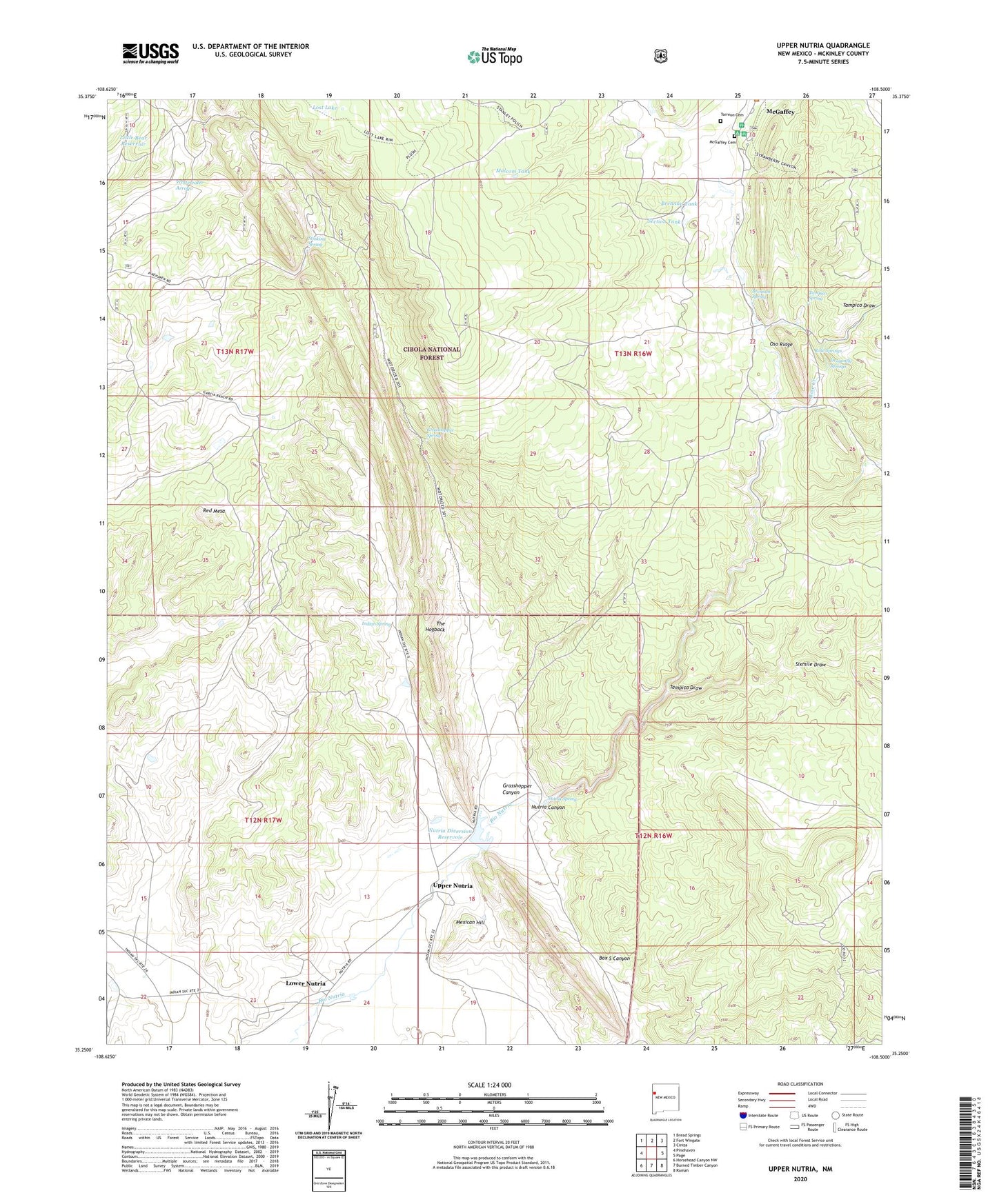
2023 topographic map quadrangle Upper Nutria in the state of New Mexico. Scale: 1:24000. Based on the newly updated USGS 7.5' US Topo map series, this map is in the following counties: McKinley. The map contains contour data, water features, and other items you are used to seeing on USGS maps, but also has updated roads and other features. This is the next generation of topographic maps. Printed on high-quality waterproof paper with UV fade-resistant inks.
Quads adjacent to this one:
West: Pinehaven
Northwest: Bread Springs
North: Fort Wingate
Northeast: Ciniza
East: Page
Southeast: Ramah
South: Burned Timber Canyon
Southwest: Horsehead Canyon NW
This map covers the same area as the classic USGS quad with code o35108c5.
Contains the following named places: Agua Remora, Brennan Spring, Brennan Tank, Dragonfly Springs, Garcia Ranch, Grasshopper Canyon, Grasshopper Spring, Indian Spring, Jurgensen Pit, Little Bear Reservoir, Lost Lake, Lower Nutria, Malcom Tank, McGaffey Camp and Picnic Grounds, McGaffey Cemetery, McGaffey Census Designated Place, McGaffey Lookout Tower, Mexican Hill, Nutria Canyon, Nutria Diversion Reservoir, Nutria Spring, Red Mesa, Rose Creek, Rose Springs, Section Tank, Sixmile Draw, Stinking Spring, Tampico Draw, Tampico Spring, Torreon Cemetery, Upper Nutria, Upper Nutria Limestone Pit