MyTopo
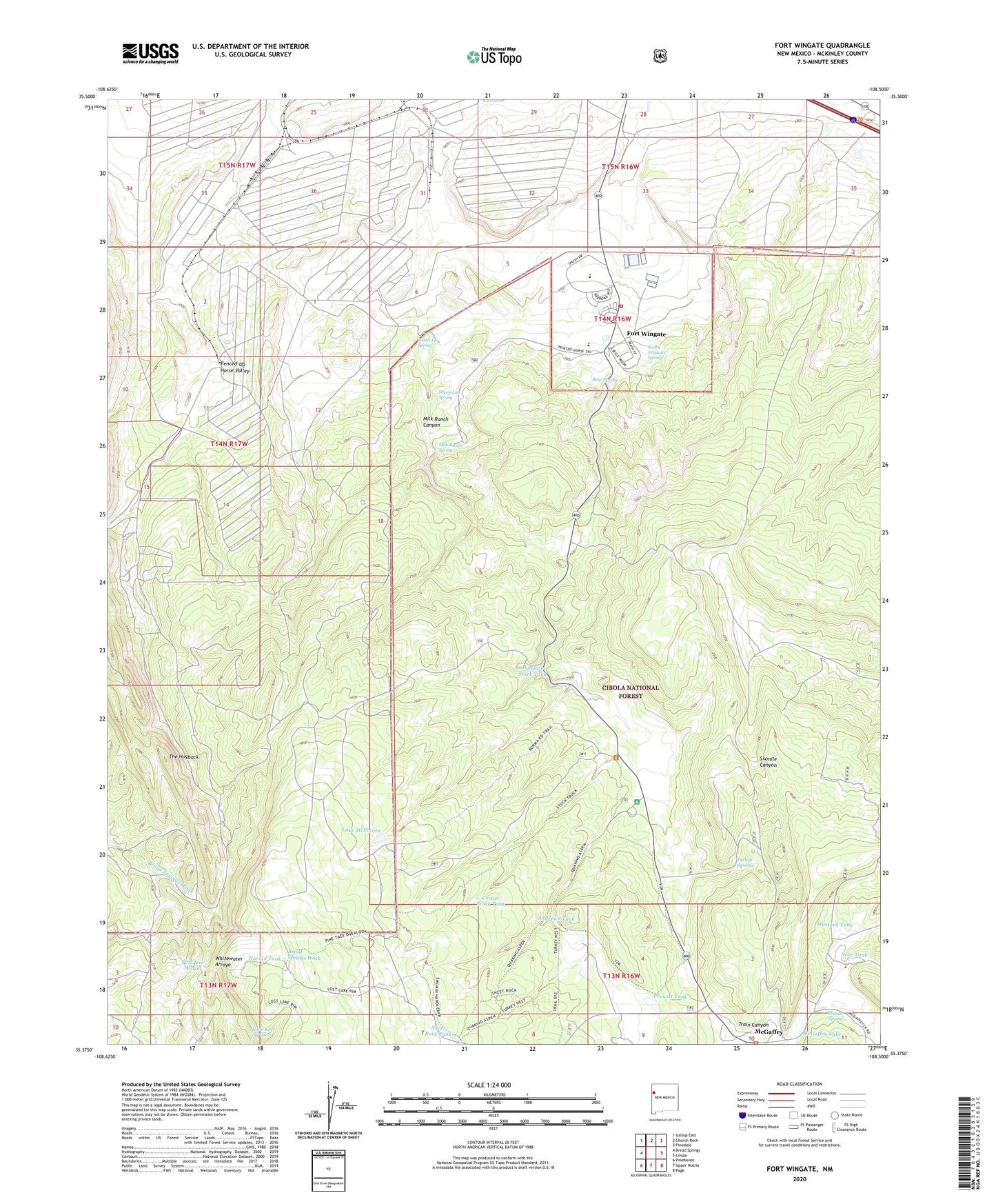
Fort Wingate New Mexico US Topo Map
Couldn't load pickup availability
Also explore the Fort Wingate Forest Service Topo of this same quad for updated USFS data
2023 topographic map quadrangle Fort Wingate in the state of New Mexico. Scale: 1:24000. Based on the newly updated USGS 7.5' US Topo map series, this map is in the following counties: McKinley. The map contains contour data, water features, and other items you are used to seeing on USGS maps, but also has updated roads and other features. This is the next generation of topographic maps. Printed on high-quality waterproof paper with UV fade-resistant inks.
Quads adjacent to this one:
West: Bread Springs
Northwest: Gallup East
North: Church Rock
Northeast: Pinedale
East: Ciniza
Southeast: Page
South: Upper Nutria
Southwest: Pinehaven
This map covers the same area as the classic USGS quad with code o35108d5.
Contains the following named places: 10002 Water Well, Andrews Tank, Aspen Drop Structure, Bear Spring, Chaco Cliffs Historical Marker, Corner Stock Tank, Fenced-Up Horse Valley, Fort Wingate, Fort Wingate Army Depot Well, Fort Wingate Census Designated Place, Fort Wingate Historic District, Fort Wingate Historic Site, Fort Wingate Historical Marker, Fort Wingate Post Office, Fort Wingate Spring, Fort Wingate Volunteer Fire Department, Fort Wingate Weather Station, Fort Wingate Workcenter, Gallup Ranger Station, Harold Tank, Lake McFerren, Little Bear Spring, McGaffey, McGaffey Lake, McGaffey Lake Dam, McGaffey Post Office, McGaffey Weather Station, Milk Ranch Canyon, Milk Ranch Spring, Mustard Tank, Prewitt Tank, Quaking Aspen Campground, Red Rock Division, Saint Eleanor Parish, Santa Fe Spring, Seep Tank, Sheep Lab Spring, Sheet Rock Tank, Shuster Spring, The Church of Jesus Christ of Latter Day Saints - Fort Wingate Branch, Train Canyon, Turkey Springs, Wingate Elementary School, Wingate High School, Wingate Stock Tank