MyTopo
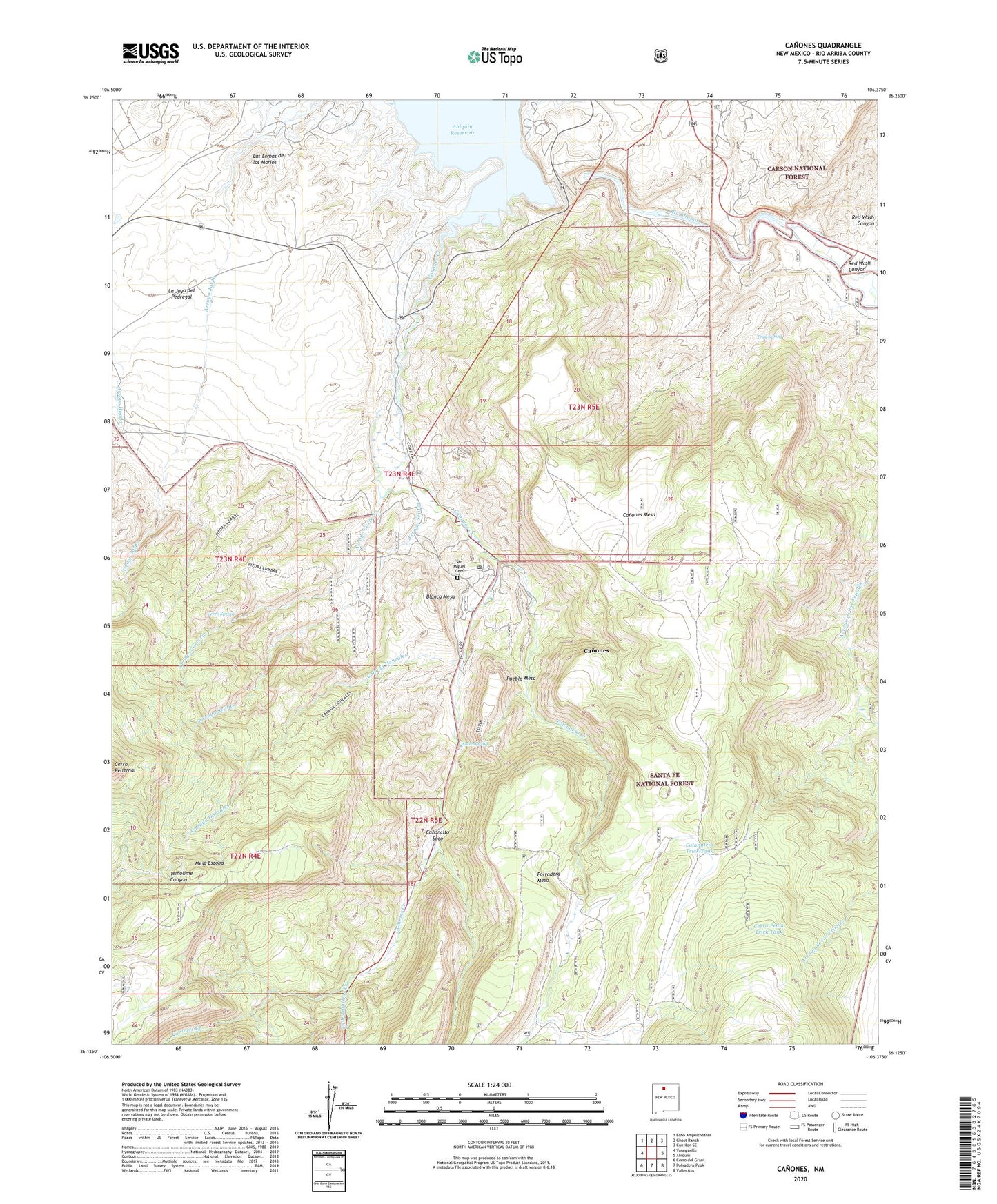
Canones New Mexico US Topo Map
Couldn't load pickup availability
Also explore the Canones Forest Service Topo of this same quad for updated USFS data
2023 topographic map quadrangle Canones in the state of New Mexico. Scale: 1:24000. Based on the newly updated USGS 7.5' US Topo map series, this map is in the following counties: Rio Arriba. The map contains contour data, water features, and other items you are used to seeing on USGS maps, but also has updated roads and other features. This is the next generation of topographic maps. Printed on high-quality waterproof paper with UV fade-resistant inks.
Quads adjacent to this one:
West: Youngsville
Northwest: Echo Amphitheater
North: Ghost Ranch
Northeast: Canjilon SE
East: Abiquiu
Southeast: Vallecitos
South: Polvadera Peak
Southwest: Cerro del Grant
This map covers the same area as the classic USGS quad with code o36106b4.
Contains the following named places: Abiquiu Dam, Agua Condida Trail, Arroyo Carreras, Arroyo Sejitas, Barranca Mesa Trick Tank, Blanca Mesa, Canada de Gonzales, Canada de Ojitos, Canoncito Seco, Canones, Canones Census Designated Place, Canones Creek, Canones Grade School, Canones Mesa, Canones Post Office, Capilla de San Miguel, Cerro Pelon Tank, Cerro Pelon Trick Tank, Cerro Spring, Chihuahuenos Creek, Colanutria Trick Tank, Colorado Plateau Historical Marker, Escoba Trick Tank, Juan Bautista Valdez Grant, La Joya del Pedregal, Las Lomas de los Marios, Lower Canones, Mesa Escoba, North Sundown Tank, Polvadera Creek, Polvadera Tank, Pueblo Mesa, Red Wash Canyon, Salazar Ranch, San Miguel Cemetery, Sundown Tank, Temoline Trick Tank, Trail Spring, Wade Spring, West Colanutria Tank, ZIP Code: 87516