MyTopo
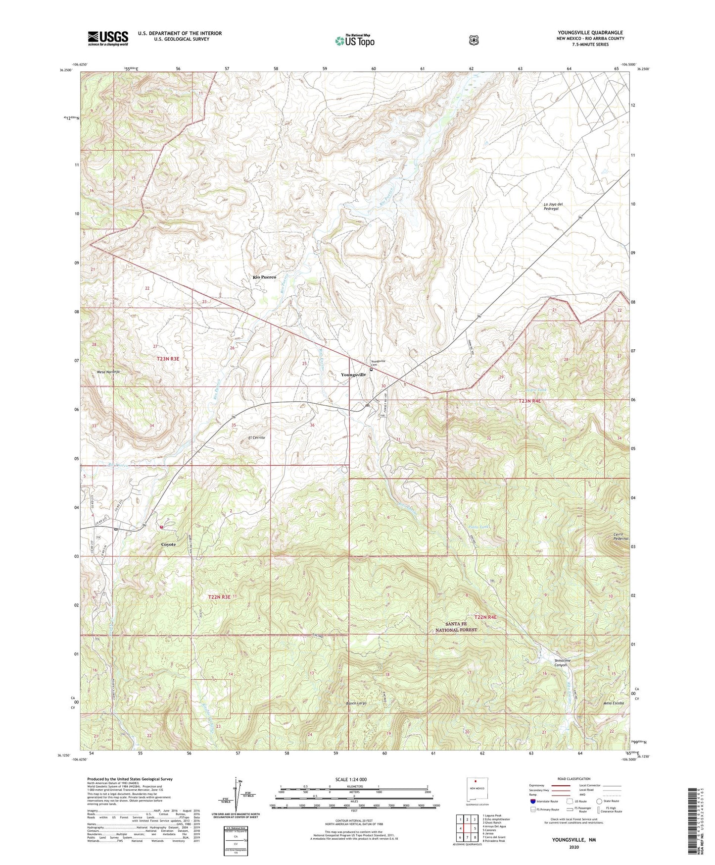
Youngsville New Mexico US Topo Map
Couldn't load pickup availability
Also explore the Youngsville Forest Service Topo of this same quad for updated USFS data
2023 topographic map quadrangle Youngsville in the state of New Mexico. Scale: 1:24000. Based on the newly updated USGS 7.5' US Topo map series, this map is in the following counties: Rio Arriba. The map contains contour data, water features, and other items you are used to seeing on USGS maps, but also has updated roads and other features. This is the next generation of topographic maps. Printed on high-quality waterproof paper with UV fade-resistant inks.
Quads adjacent to this one:
West: Arroyo Del Agua
Northwest: Laguna Peak
North: Echo Amphitheater
Northeast: Ghost Ranch
East: Canones
Southeast: Polvadera Peak
South: Cerro del Grant
Southwest: Jarosa
This map covers the same area as the classic USGS quad with code o36106b5.
Contains the following named places: Arroyo Hondo, Banco Largo, C Serrano Cabin, Cedro Tank, Cerro Pedernal, Coyote, Coyote Census Designated Place, Coyote Creek, Coyote Post Office, Coyote Volunteer Fire Department, E Serrano Cabin, El Cerrito, El Rito, Encino Corral, Encino Trail, La Jolla Trick Tank, Mesa Naranja, Pedernal Trick Tank, Pinta Tank, Rio Puerco, Rito de las Sillas, Rito Encino, Temolime Canyon, Youngsville, Youngsville Cemetery, Youngsville Census Designated Place, Youngsville Post Office, Youngsville Prospects, ZIP Code: 87064