MyTopo
Polvadera Peak New Mexico US Topo Map
Couldn't load pickup availability
Also explore the Polvadera Peak Forest Service Topo of this same quad for updated USFS data
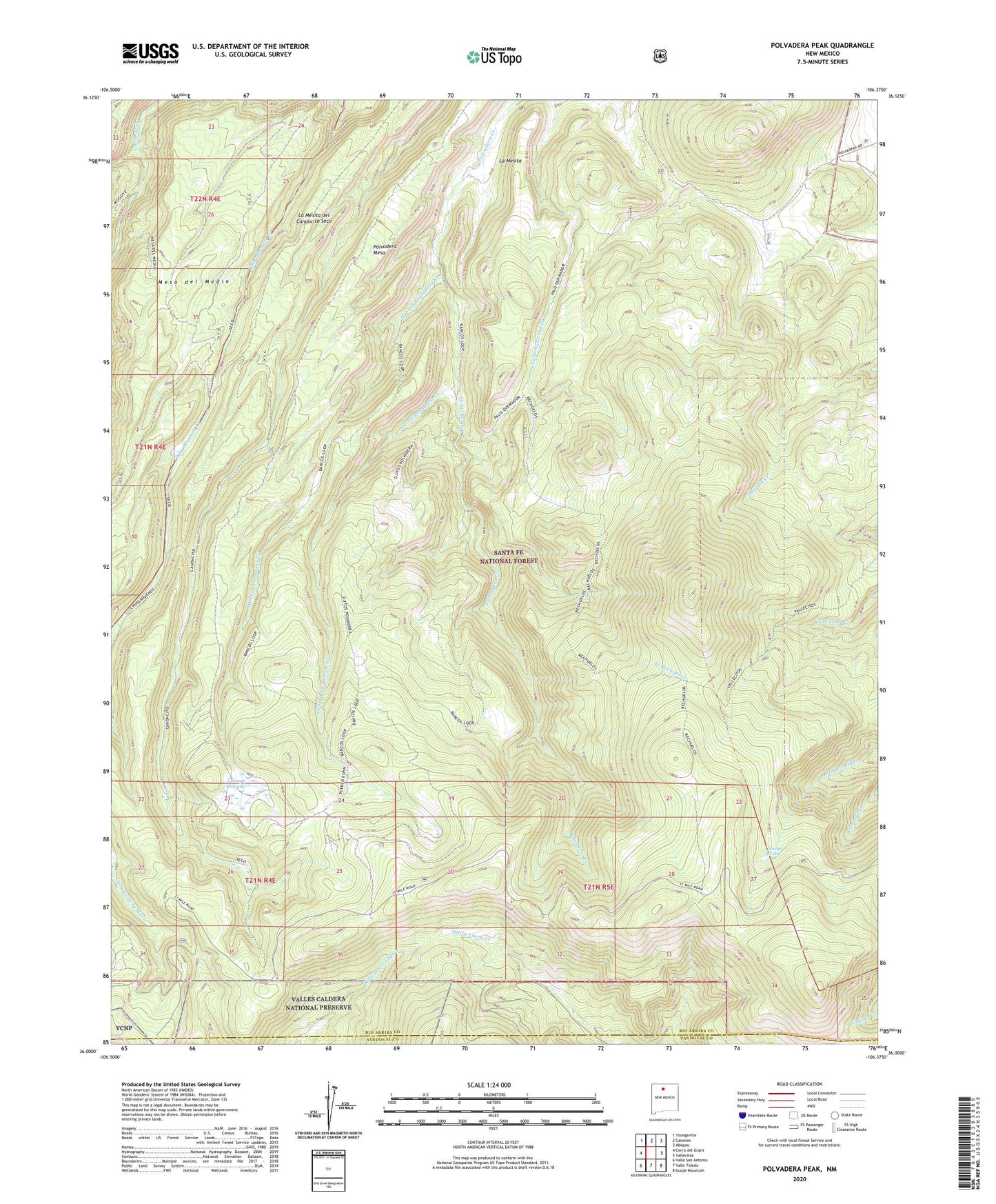
2023 topographic map quadrangle Polvadera Peak in the state of New Mexico. Scale: 1:24000. Based on the newly updated USGS 7.5' US Topo map series, this map is in the following counties: Rio Arriba, Sandoval. The map contains contour data, water features, and other items you are used to seeing on USGS maps, but also has updated roads and other features. This is the next generation of topographic maps. Printed on high-quality waterproof paper with UV fade-resistant inks.
Quads adjacent to this one:
West: Cerro del Grant
Northwest: Youngsville
North: Canones
Northeast: Abiquiu
East: Vallecitos
Southeast: Guaje Mountain
South: Valle Toledo
Southwest: Valle San Antonio
This map covers the same area as the classic USGS quad with code o36106a4.
Contains the following named places: Bancos Loop, Cerrito Chato, Cerro Pelon, Chicoma Mountain, Cienega del Oso, Cienega Redonda, East Fork Polvadera Creek, El Lagunito Palo Quemador, El Rechuelos, Highline Trail, La Mesa del Pedregosa, La Mesita, La Mesita del Canoncito Seco, La Terrera, Ojitas Polvadera Trail, Polvadera Grant, Polvadera Mesa, Polvadera Peak, Polvadera Sawmill Camp, Puerco Espin Trail, Rechuelos Trail, Road Mesa Trick Tank, South Fork Polvadera Creek, Vallecitos Trail, West Fork Polvadera Creek