MyTopo
Cerro del Grant New Mexico US Topo Map
Couldn't load pickup availability
Also explore the Cerro del Grant Forest Service Topo of this same quad for updated USFS data
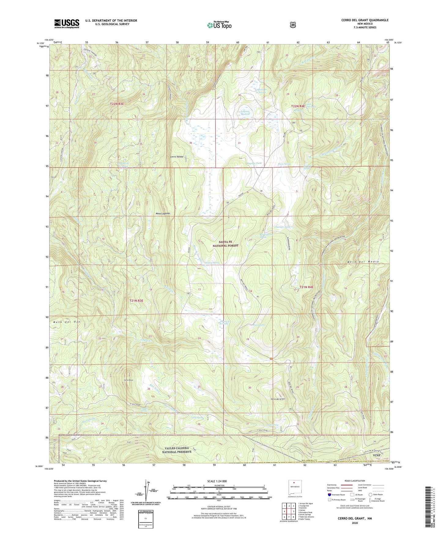
2023 topographic map quadrangle Cerro del Grant in the state of New Mexico. Scale: 1:24000. Based on the newly updated USGS 7.5' US Topo map series, this map is in the following counties: Rio Arriba, Sandoval. The map contains contour data, water features, and other items you are used to seeing on USGS maps, but also has updated roads and other features. This is the next generation of topographic maps. Printed on high-quality waterproof paper with UV fade-resistant inks.
Quads adjacent to this one:
West: Jarosa
Northwest: Arroyo Del Agua
North: Youngsville
Northeast: Canones
East: Polvadera Peak
Southeast: Valle Toledo
South: Valle San Antonio
Southwest: Seven Springs
This map covers the same area as the classic USGS quad with code o36106a5.
Contains the following named places: Barrancones Creek, Barranquenos Spring, Canada de la Mora, Canon del Coyote, Capulin Creek, Cebolla Spring, Cerro del Grant, Cerro Pavo, Cerro Pelon, Cerro Valdez, Champe Tank, Encino Lookout, Flavjo Spring, Grant Spring, La Grulla Plateau, La Grulla Ranch, La Jara Spring, Laguna de la Grulla, Laguna de la Sierra, Laguna de los Pinos, Laguna Madrid, Leche Spring, Madrid Spring, Magogo Tank, Mesa del Medio, Mesa del Ojo, Mesa Lagunas, Ojito Palo Duro, Pavo Spring, Rey, Rito Pelon, Rito Seco, Upper Coyote Creek Sawmill, Valle de la Grulla