MyTopo
Ghost Ranch New Mexico US Topo Map
Couldn't load pickup availability
Also explore the Ghost Ranch Forest Service Topo of this same quad for updated USFS data
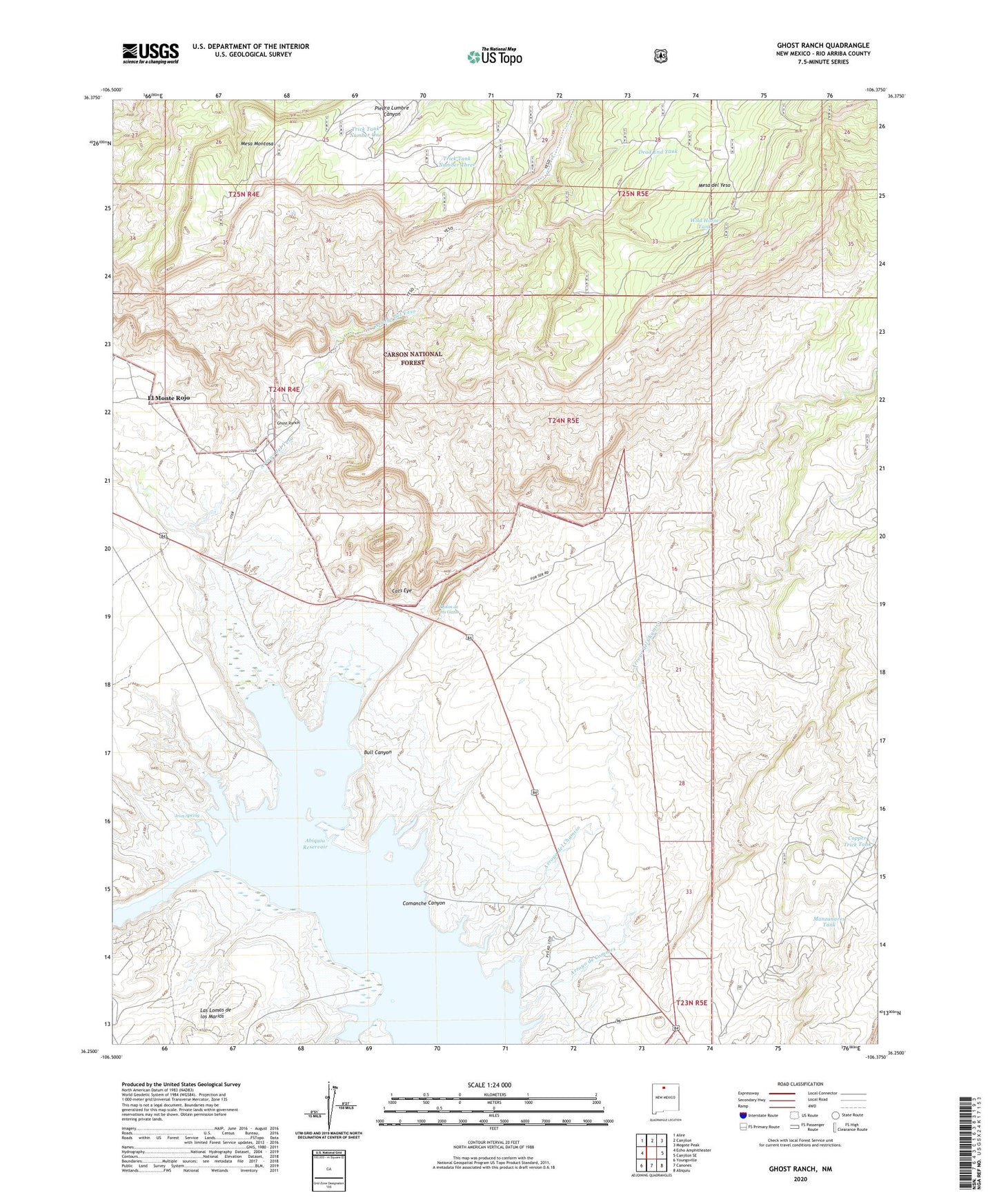
2023 topographic map quadrangle Ghost Ranch in the state of New Mexico. Scale: 1:24000. Based on the newly updated USGS 7.5' US Topo map series, this map is in the following counties: Rio Arriba. The map contains contour data, water features, and other items you are used to seeing on USGS maps, but also has updated roads and other features. This is the next generation of topographic maps. Printed on high-quality waterproof paper with UV fade-resistant inks.
Quads adjacent to this one:
West: Echo Amphitheater
Northwest: Alire
North: Canjilon
Northeast: Mogote Peak
East: Canjilon SE
Southeast: Abiquiu
South: Canones
Southwest: Youngsville
This map covers the same area as the classic USGS quad with code o36106c4.
Contains the following named places: Abiquiu Reservoir, Arroyo de Comales, Arroyo del Chamiso, Arroyo del Yeso, Arroyo Jaspe, Bull Canyon, Canjilon Creek, Cats Eye, CCC Camp, Comanche Canyon, Copper Trick Tank, Dead End Tank, El Monte Rojo, Florence Hawley Ellis Museum of Anthropology, Ghost Ranch, Ghost Ranch Strip Airport, Horny Toad Mine, Iron Spring, Llano Blanco, Llano Piedra Lumbre, Manzanares Tank, Mesa del Yeso, Ojitos de los Gatos, Piedra Lumbre Grant, Rio Chama Valley Gravels, Ruth Hall Museum of Paleontology, Six- 13- S Ext., Trick Tank Number One, Trick Tank Number Three, Wild Horse Tank, ZIP Code: 87510