MyTopo
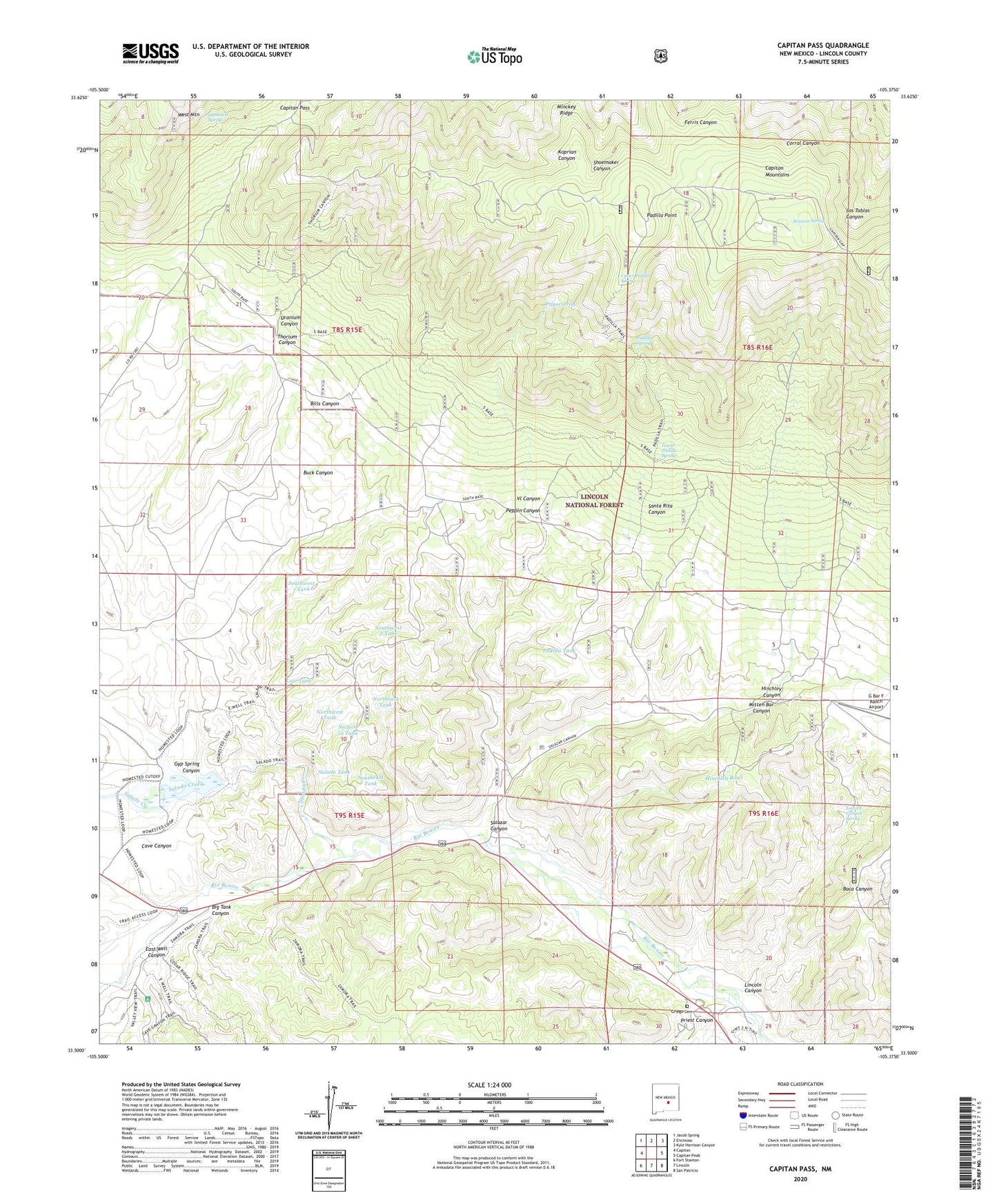
Capitan Pass New Mexico US Topo Map
Couldn't load pickup availability
2020 topographic map quadrangle Capitan Pass in the state of New Mexico. Scale: 1:24000. Based on the newly updated USGS 7.5' US Topo map series, this map is in the following counties: Lincoln. The map contains contour data, water features, and other items you are used to seeing on USGS maps, but also has updated roads and other features. This is the next generation of topographic maps. Printed on high-quality waterproof paper with UV fade-resistant inks.
Quads adjacent to this one:
West: Capitan
Northwest: Jacob Spring
North: Encinoso
Northeast: Kyle Harrison Canyon
East: Capitan Peak
Southeast: San Patricio
South: Lincoln
Southwest: Fort Stanton
Contains the following named places: 10192 Water Well, Abo, Barlejon Number Two, Barry Prospect, Base Trail, Bear Trick Tank, Big Tank Canyon, Bills Canyon, Buck Canyon, Capitan Pass, Cave Canyon, Double Crossing, Drunzer Prospect, East Well Canyon, G Bar F Ranch Airport, Griego Cemetery, Gyp Spring Canyon, Hammett Spring, Hinchley Bowl, Hinchley Canyon, Hinchley Ranch, Hopeful Claims Number 1-19, King Prospect, Lincoln Canyon, Lincoln Canyon Spring, Lost Tank, Lower Padilla Spring, Mitten Bar Canyon, Monzo Claims, Northeast Tank, Northwest Tank, Oso, Padilla Point, Padilla Ranch, Padilla Spring, Padilla Tank, Padilla Trail, Padilla Trick Tank, Peppin Canyon, Peppin Spring, Pinie Claims, Priest Canyon, Salado Creek, Salado Tank, Salazar Canyon, Salazar Canyon Pit, Santa Rita Canyon, Section 10 Tank, Silverstone Claim, Southeast Tank, Southwest 1 Tank, Southwest 2 Tank, Summit Spring, Summit Trail, Thorium Canyon, Upper Padilla Spring, Upper Rio Hondo Site One Dam, Uranium Canyon, Vl Canyon, Wee Three Number 1 Mine, Wee Three Number 2 Mine, Yellow Hand