MyTopo
Borrego Pass New Mexico US Topo Map
Couldn't load pickup availability
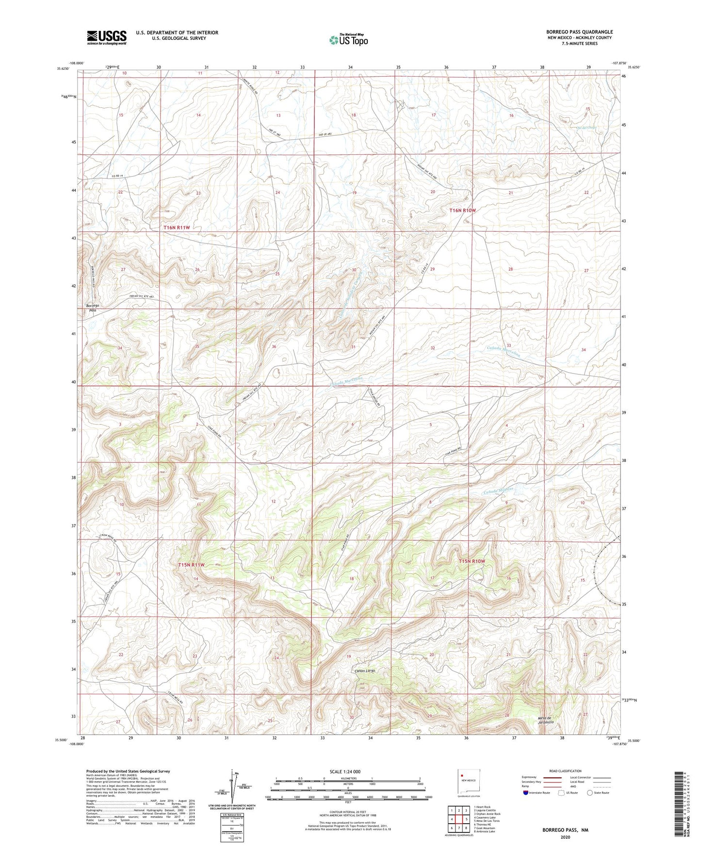
2023 topographic map quadrangle Borrego Pass in the state of New Mexico. Scale: 1:24000. Based on the newly updated USGS 7.5' US Topo map series, this map is in the following counties: McKinley. The map contains contour data, water features, and other items you are used to seeing on USGS maps, but also has updated roads and other features. This is the next generation of topographic maps. Printed on high-quality waterproof paper with UV fade-resistant inks.
Quads adjacent to this one:
West: Casamero Lake
Northwest: Heart Rock
North: Laguna Castillo
Northeast: Orphan Annie Rock
East: Mesa De Los Toros
Southeast: Ambrosia Lake
South: Goat Mountain
Southwest: Thoreau NE
This map covers the same area as the classic USGS quad with code o35107e8.
Contains the following named places: 15K-338 Water Well, 15T-537 Water Well, 16T-561A Water Well, 223-18 Water Well, 80-1 Water Well, Albers Ranch, Barbara J HZ Mine, Borrego Pass, Borrego Pass Trading Post, Canon de Saladeta Canyon, Hall, Holly Mine, Mesa de Jaramillo, Mesa Top Mine, Number 4 Moe Mine, Ojo del Chopo, Tiejen Mine