MyTopo
Cerro Alesna New Mexico US Topo Map
Couldn't load pickup availability
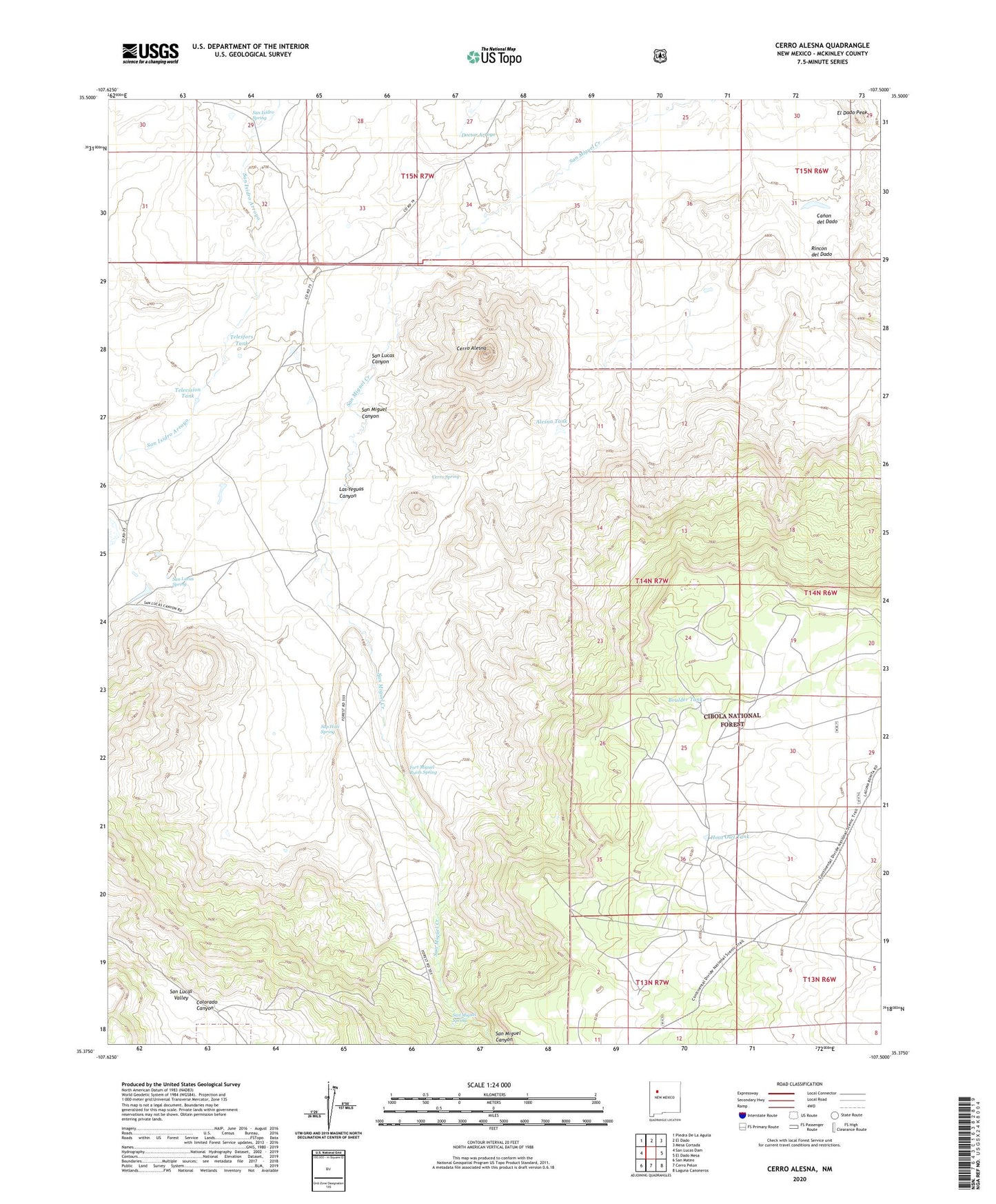
2020 topographic map quadrangle Cerro Alesna in the state of New Mexico. Scale: 1:24000. Based on the newly updated USGS 7.5' US Topo map series, this map is in the following counties: McKinley. The map contains contour data, water features, and other items you are used to seeing on USGS maps, but also has updated roads and other features. This is the next generation of topographic maps. Printed on high-quality waterproof paper with UV fade-resistant inks.
Quads adjacent to this one:
West: San Lucas Dam
Northwest: Piedra De La Aguila
North: El Dado
Northeast: Mesa Cortada
East: El Dado Mesa
Southeast: Laguna Canoneros
South: Cerro Pelon
Southwest: San Mateo
Contains the following named places: Alesna Tank, Bartolome Fernandez Grant, Boulder Tank, Cerro Alesna, Cerro Spring, Colorado Canyon, El Dado Peak, Fort Miguel Ruins Spring, Hoot Owl Tank, Las Yeguas Canyon, Los Barreales Lake, Rincon del Dado, San Isidro Spring, San Lucas Canyon, San Lucas Spring, San Lucas Valley, San Miguel Canyon, San Miguel Ranch, San Miguel Spring, Sap Hole Spring, Telesfors Tank, Television Tank