MyTopo
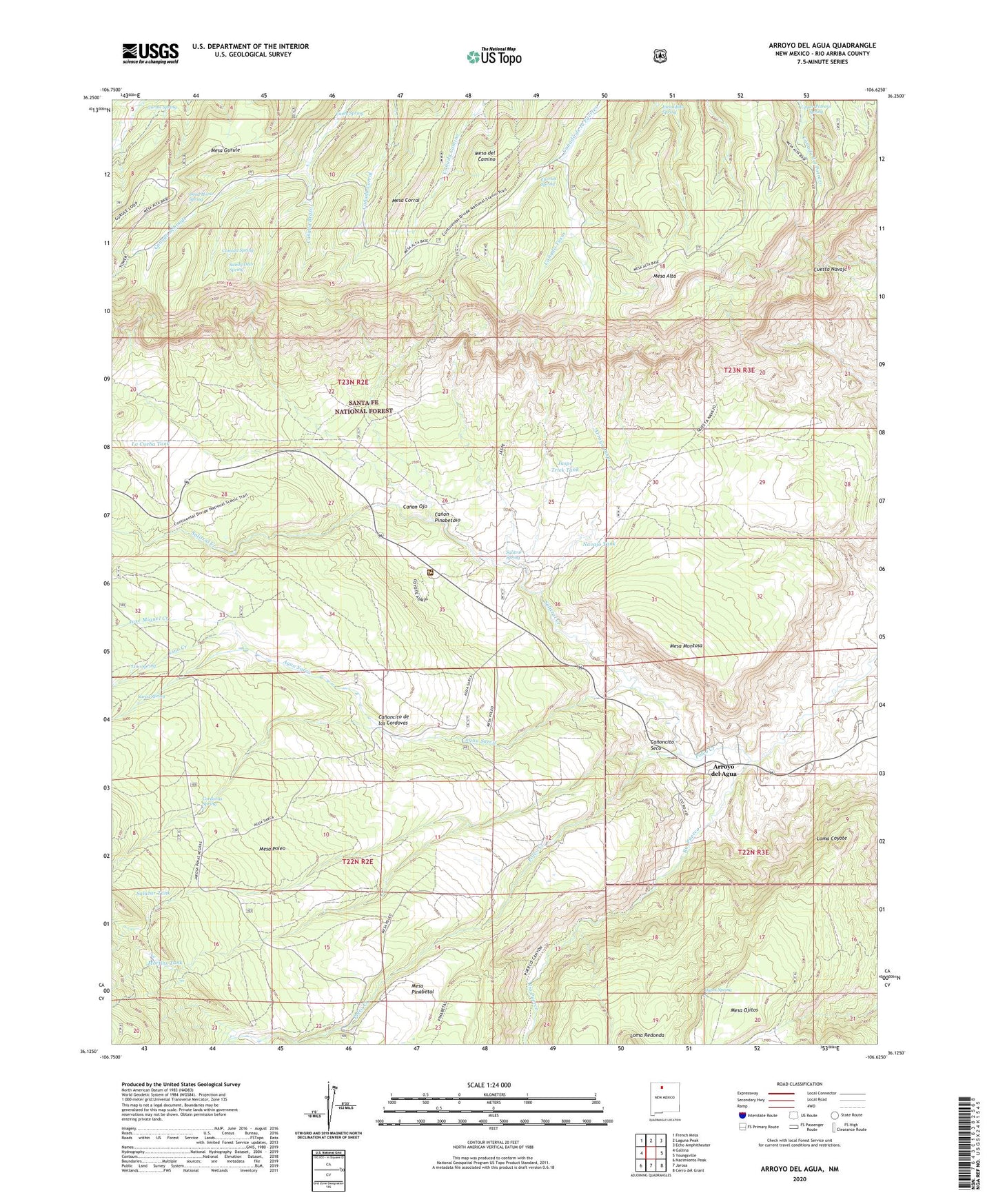
Arroyo Del Agua New Mexico US Topo Map
Couldn't load pickup availability
Also explore the Arroyo Del Agua Forest Service Topo of this same quad for updated USFS data
2023 topographic map quadrangle Arroyo Del Agua in the state of New Mexico. Scale: 1:24000. Based on the newly updated USGS 7.5' US Topo map series, this map is in the following counties: Rio Arriba. The map contains contour data, water features, and other items you are used to seeing on USGS maps, but also has updated roads and other features. This is the next generation of topographic maps. Printed on high-quality waterproof paper with UV fade-resistant inks.
Quads adjacent to this one:
West: Gallina
Northwest: French Mesa
North: Laguna Peak
Northeast: Echo Amphitheater
East: Youngsville
Southeast: Cerro del Grant
South: Jarosa
Southwest: Nacimiento Peak
This map covers the same area as the classic USGS quad with code o36106b6.
Contains the following named places: Agua Sarca, Arroyo del Agua, Arroyo Jaspe, Canada Brazo, Canada Spring, Canada Tusas, Canon Ojo, Canon Pinabetoso, Canoncito de los Cordovas, Canoncito Seco, Casey Spring, Cordovas Spring, Coyote Ranger District, Coyote Ranger Station, Cuesta Navajo, Dead Horse Spring, Escondido Spring, Fuertes Spring, Gurule Spring, Jaramillo-Montoya, Jaspe Trick Tank, Jose Miguel Creek, La Cueba Tank, Lino Creek, Lino Spring, Loma Coyote, Mesa Alta, Mesa Alta Wildlife Trick Tank, Mesa Corral, Mesa del Camino, Mesa Montosa, Mesa Ojitos, Mesa Pinabetal School, Mesa Poleo, Mesa Poleo School, Morfins Tank, Navajo Tank, Navajo Trick Tank, Ojitos Spring, Ojo Corral, Poleo Creek, Resurrection, Salazar Tank, Salitral Corral, Salitral Creek, Salitral Spring, Sandy Deer Spring, Santa Teresa, Santa Teresa Church, Sarca Spring, South Salitral Trick Tank, Upper Potrero Spring, West Trick Tank, ZIP Code: 87012