MyTopo
Dwyer New Mexico US Topo Map
Couldn't load pickup availability
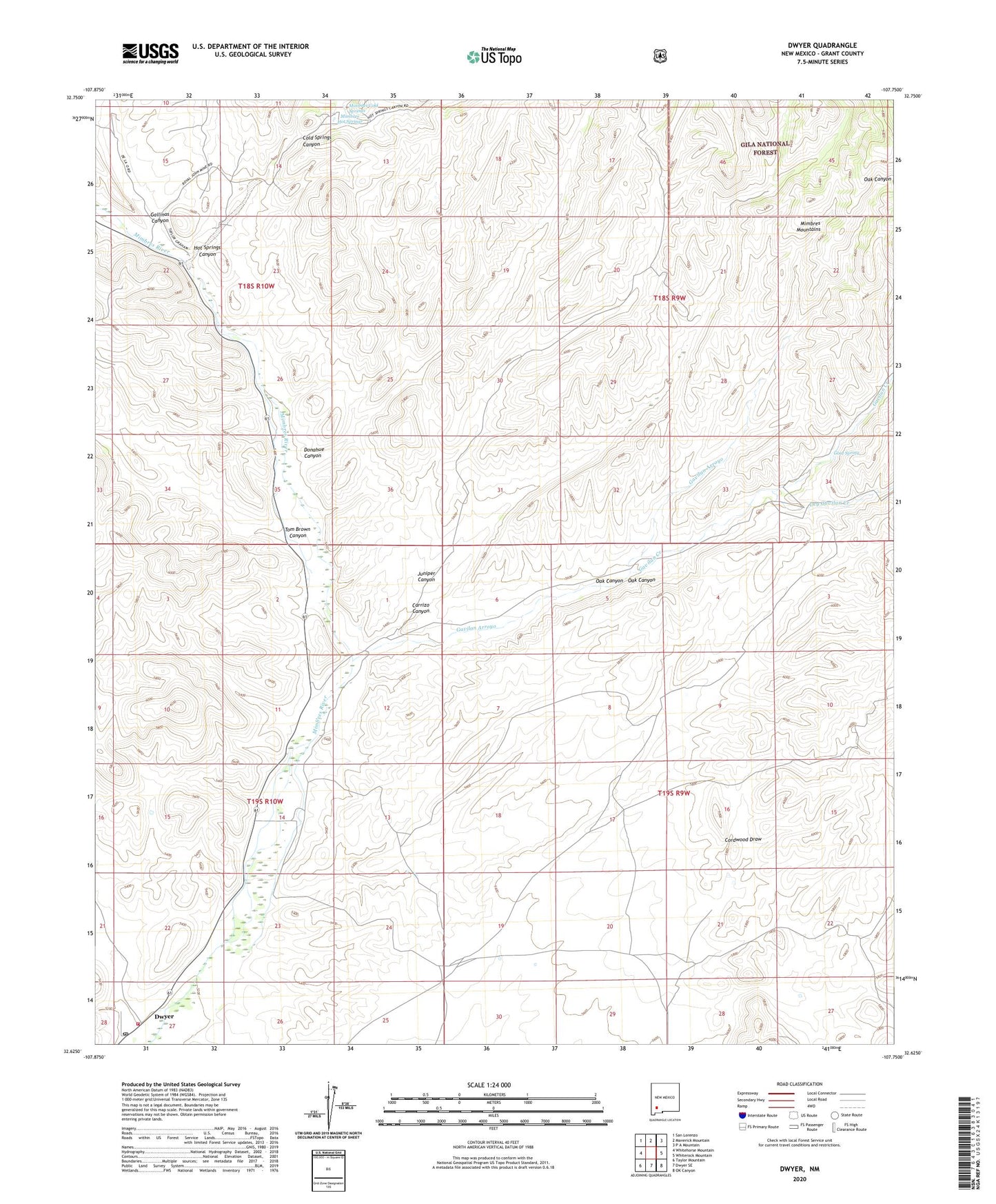
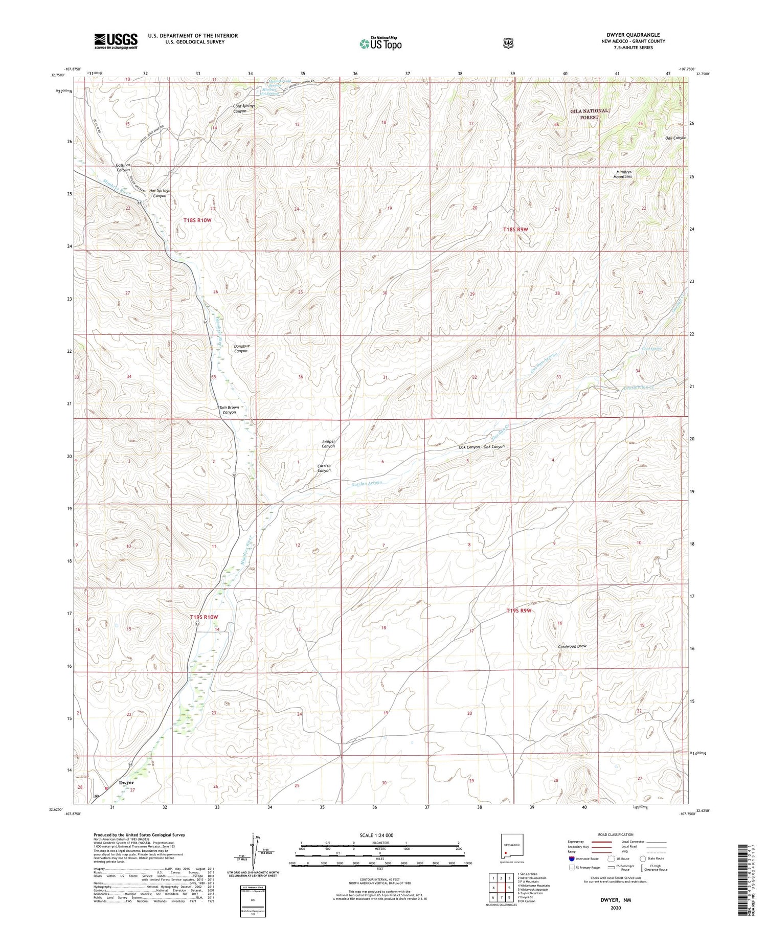
2020 topographic map quadrangle Dwyer in the state of New Mexico. Scale: 1:24000. Based on the newly updated USGS 7.5' US Topo map series, this map is in the following counties: Grant. The map contains contour data, water features, and other items you are used to seeing on USGS maps, but also has updated roads and other features. This is the next generation of topographic maps. Printed on high-quality waterproof paper with UV fade-resistant inks.
Quads adjacent to this one:
West: Whitehorse Mountain
Northwest: San Lorenzo
North: Maverick Mountain
Northeast: P A Mountain
East: Whiterock Mountain
Southeast: OK Canyon
South: Dwyer SE
Southwest: Taylor Mountain
Contains the following named places: 00267 Water Well, 00271 Water Well, 00272 Water Well, 00273 Water Well, 00290 Water Well, 00291 Water Well, 00304 Water Well, 00308 Water Well, 00310 Water Well, 00313 Water Well, 00315 Water Well, 00553 Water Well, 00555 Water Well, 00559 Water Well, 00570 Water Well, 00571 Water Well, 00576 Water Well, Carrizo Canyon, Carrizo Well, Cold Springs Canyon, Donahue Canyon, Dry Gavilan Creek, Dwyer, Dwyer Post Office, Dwyer Reservoir, Eby Ranch, Faywood Post Office, G 266 Water Well, G 269 Water Well, G 556 Water Well, Gallinas Canyon, Gavilan Arroyo, Gavilan Creek, Goat Spring, Hot Springs Canyon, Juniper Canyon, Lower Mimbres Volunteer Fire Department, Macho Creek, Maria J Trujillo and Juan House, Mimbres Cold Springs, Mimbres Hot Springs, Montoya Site, NAN Ranch, Oak Canyon, Parra Tank, Ramon Baca House Historic Site, San Jose, Soliz-Baca House, Swartz, Tom Brown Canyon, Tom Eby Storage Building Historic Site, Trinidad Andazola House Historic Site, Upton Site, Y Bar Nan Ranch