MyTopo
Whitehorse Mountain New Mexico US Topo Map
Couldn't load pickup availability
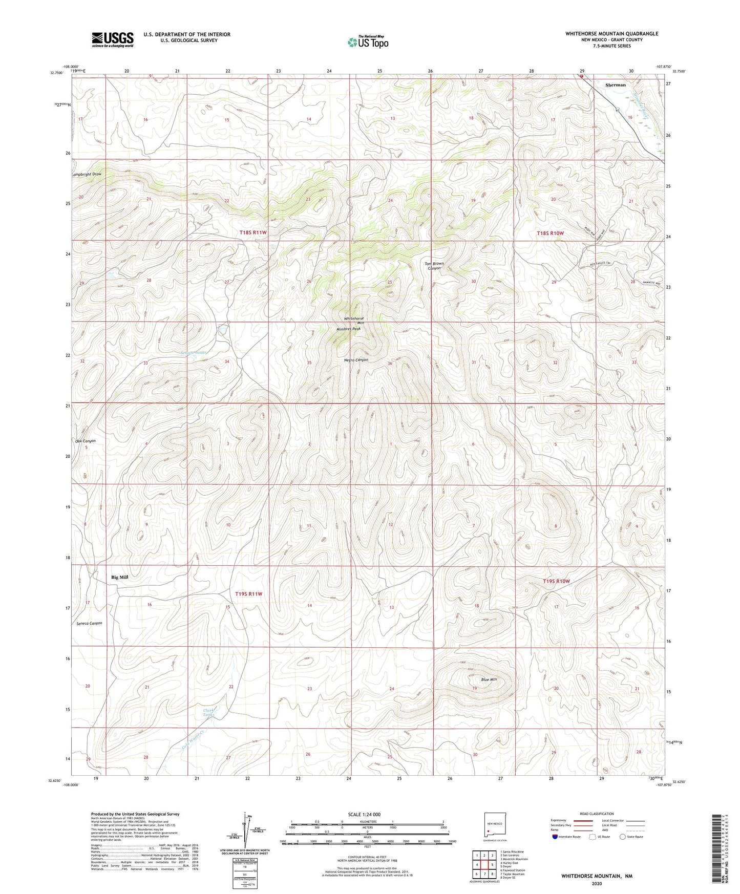
2023 topographic map quadrangle Whitehorse Mountain in the state of New Mexico. Scale: 1:24000. Based on the newly updated USGS 7.5' US Topo map series, this map is in the following counties: Grant. The map contains contour data, water features, and other items you are used to seeing on USGS maps, but also has updated roads and other features. This is the next generation of topographic maps. Printed on high-quality waterproof paper with UV fade-resistant inks.
Quads adjacent to this one:
West: Hurley East
Northwest: Santa Rita Mine
North: San Lorenzo
Northeast: Maverick Mountain
East: Dwyer
Southeast: Dwyer SE
South: Taylor Mountain
Southwest: Faywood Station
This map covers the same area as the classic USGS quad with code o32107f8.
Contains the following named places: Bayard-Santa Rita Division, Big Mill, Blue Mountain, Clark Tanks, Lower Mimbres Volunteer Fire Department, Mimbres Peak, Oak Canyon, Seneca Canyon, Seneca Tanks, Sherman, Sherman Post Office, Whitehorse Mountain