MyTopo
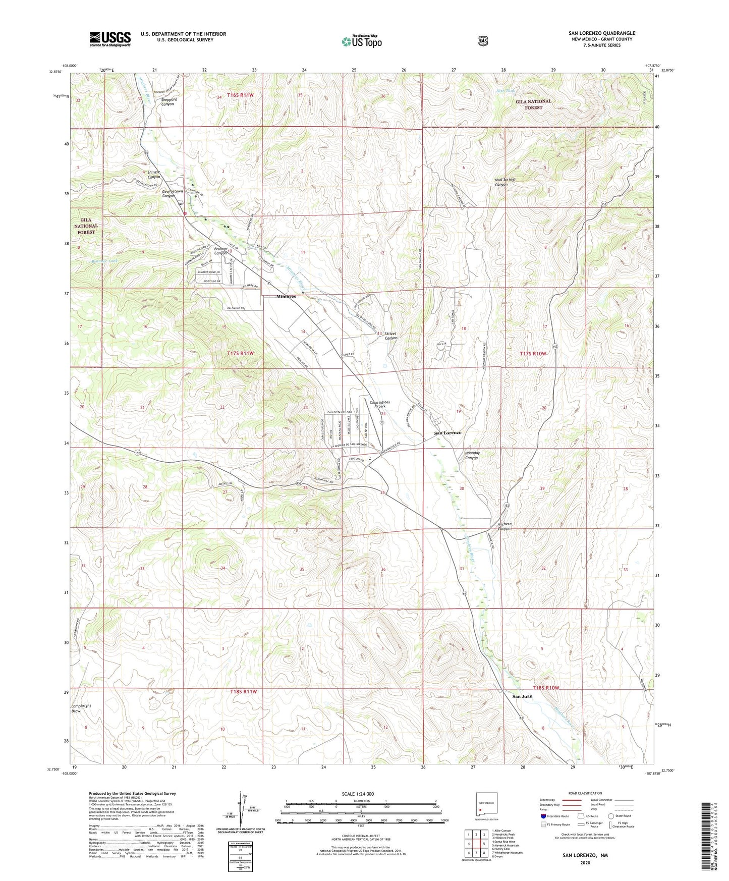
San Lorenzo New Mexico US Topo Map
Couldn't load pickup availability
Also explore the San Lorenzo Forest Service Topo of this same quad for updated USFS data
2023 topographic map quadrangle San Lorenzo in the state of New Mexico. Scale: 1:24000. Based on the newly updated USGS 7.5' US Topo map series, this map is in the following counties: Grant. The map contains contour data, water features, and other items you are used to seeing on USGS maps, but also has updated roads and other features. This is the next generation of topographic maps. Printed on high-quality waterproof paper with UV fade-resistant inks.
Quads adjacent to this one:
West: Santa Rita Mine
Northwest: Allie Canyon
North: Hendricks Peak
Northeast: Hillsboro Peak
East: Maverick Mountain
Southeast: Dwyer
South: Whitehorse Mountain
Southwest: Hurley East
This map covers the same area as the classic USGS quad with code o32107g8.
Contains the following named places: 00017 Water Well, 00028 Water Well, 00031 Water Well, 00042 Water Well, 00045 Water Well, 00048 Water Well, 00053 Water Well, 00056 Water Well, 00060 Water Well, 00064 Water Well, 00071 Water Well, 00073 Water Well, 00078 Water Well, 00080 Water Well, 00093 Water Well, 00096 Water Well, 00101 Water Well, 00276 Water Well, 00285 Water Well, 00286 Water Well, 00320 Water Well, 00321 Water Well, 01036 Water Well, 01069 Water Well, 10020 Water Well, 10167 Water Well, 10168 Water Well, 10169 Water Well, 10171 Water Well, 10172 Water Well, 10173 Water Well, 88041, Acklin Store Historic Site, Ancheta Canyon, Antonio Torres House, Beth Tank, Brunner Canyon, Brunner Tank, Casas Adobes, Casas Adobes Airpark, Casas Adobes Census Designated Place, Doctor Granville Wood House Historic Site, Father Roger Aull House and Chapel, G 77 Water Well, Georgetown Canyon, Janss Historic Site, Jesus Valencia House, Luciana B Grijalva House Historic Site, Mattocks Site, Menard-Galaz House, Mimbres, Mimbres Census Designated Place, Mimbres Post Office, Mimbres School, Mimbres Valley Community Church, Mimbres Valley Emergency Medical Services, Mimbres Weather Station, Mud Springs Canyon, Noonday Canyon, Otto Huechling House Historic Site, Quien Sabe Canyon, Reeds Peak Lookout Tower, Rio Mimbres Baptist Church, Rose Mine, San Juan, San Juan Historic District, San Lorenzo, San Lorenzo Catholic Church, San Lorenzo Census Designated Place, Sheppard Canyon, Shingle Canyon, Stitzel Canyon, Upper Mimbres Volunteer Fire Department Station 1, Wheaton-Smith Site, William Redding House