MyTopo
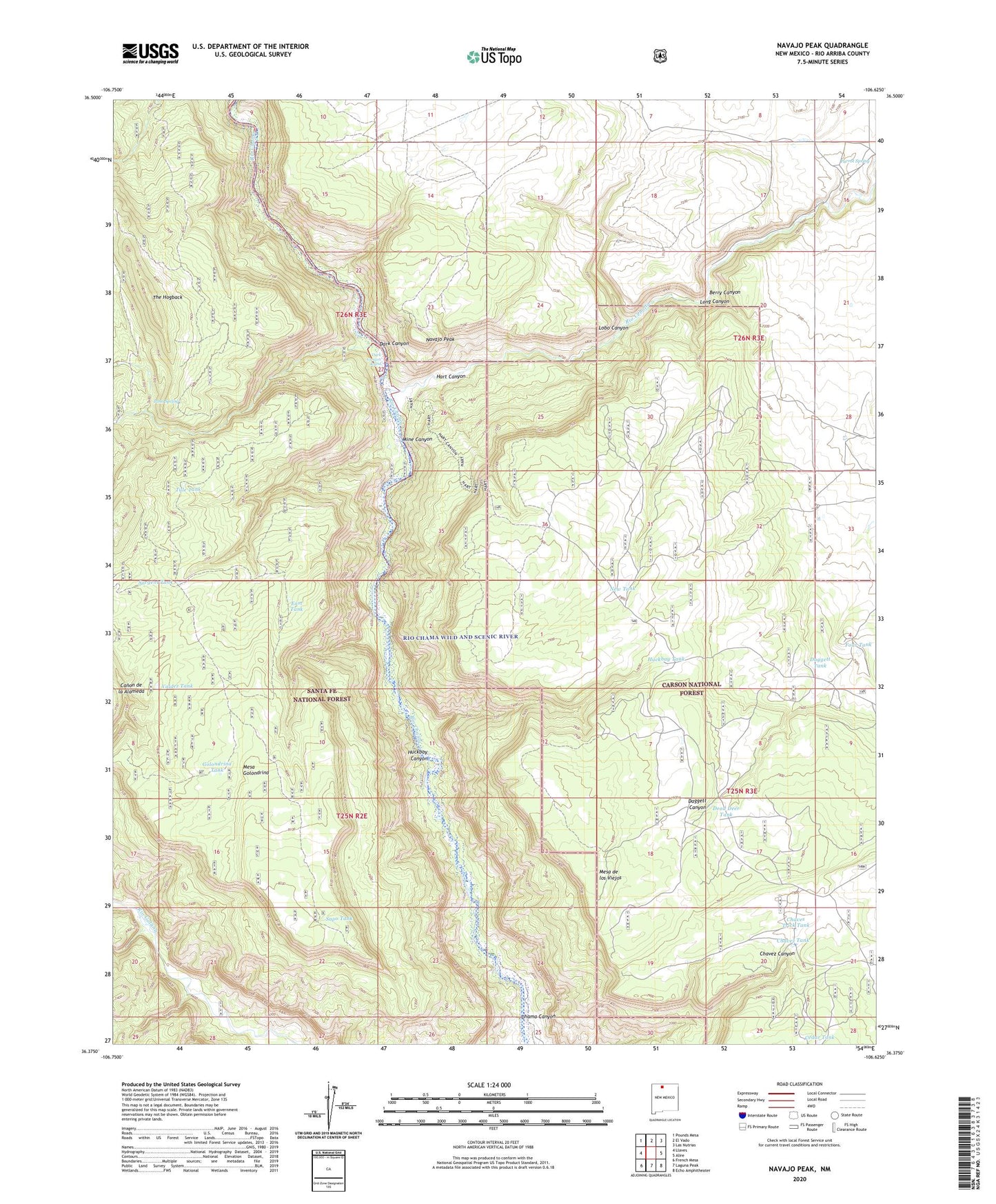
Navajo Peak New Mexico US Topo Map
Couldn't load pickup availability
Also explore the Navajo Peak Forest Service Topo of this same quad for updated USFS data
2023 topographic map quadrangle Navajo Peak in the state of New Mexico. Scale: 1:24000. Based on the newly updated USGS 7.5' US Topo map series, this map is in the following counties: Rio Arriba. The map contains contour data, water features, and other items you are used to seeing on USGS maps, but also has updated roads and other features. This is the next generation of topographic maps. Printed on high-quality waterproof paper with UV fade-resistant inks.
Quads adjacent to this one:
West: Llaves
Northwest: Pounds Mesa
North: El Vado
Northeast: Las Nutrias
East: Alire
Southeast: Echo Amphitheater
South: Laguna Peak
Southwest: French Mesa
This map covers the same area as the classic USGS quad with code o36106d6.
Contains the following named places: Abbey of Christ in the Desert Cemetery, Berry Canyon, Cedar Tank, Chaves Trick Tank, Chavez Tank, Daggett Tank, Dark Canyon, Dawson, Dead Deer Tank, East Tank, Four Tank, Golondrina Tank, Hart Canyon, Hart Trail, Huckbay Canyon, Huckbay Tank, Juan Gallegos Ranch, Lobo Canyon, Long Canyon, Mesa Golondrina, Mine Canyon, Monastery of Christ in the Desert, Navajo Peak, New Tank, North Tank, North Trick Tank, Parrot Spring, Peacock, Poso Spring, Rio Cebolla, Rio Chama Wild and Scenic River, Rio Chama Wilderness Study Area, Sapo Tank, Sargent Tank, The Hogback, Tule Tank, Valdez Tank, West Tank, White Place