MyTopo
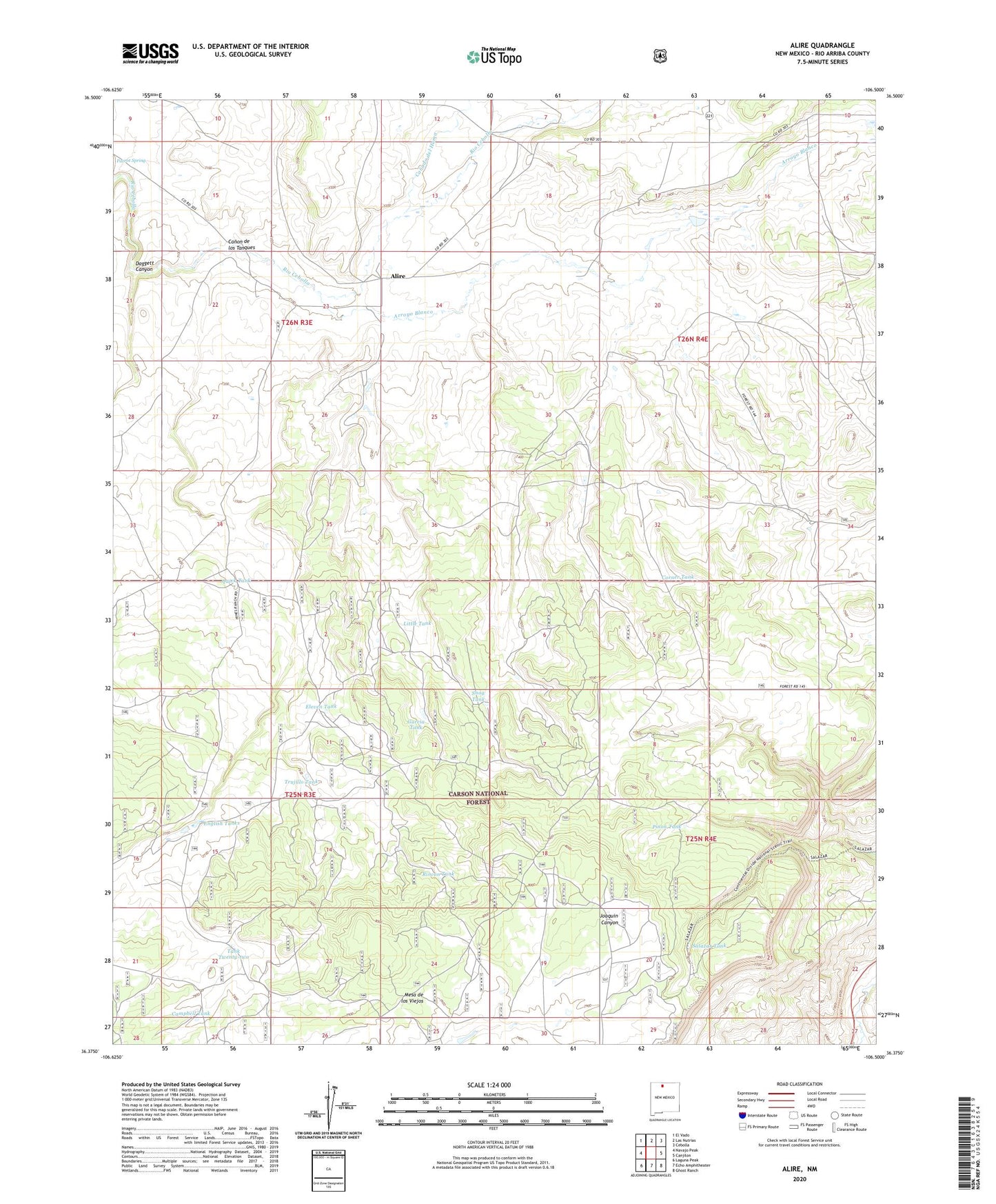
Alire New Mexico US Topo Map
Couldn't load pickup availability
Also explore the Alire Forest Service Topo of this same quad for updated USFS data
2023 topographic map quadrangle Alire in the state of New Mexico. Scale: 1:24000. Based on the newly updated USGS 7.5' US Topo map series, this map is in the following counties: Rio Arriba. The map contains contour data, water features, and other items you are used to seeing on USGS maps, but also has updated roads and other features. This is the next generation of topographic maps. Printed on high-quality waterproof paper with UV fade-resistant inks.
Quads adjacent to this one:
West: Navajo Peak
Northwest: El Vado
North: Las Nutrias
Northeast: Cebolla
East: Canjilon
Southeast: Ghost Ranch
South: Echo Amphitheater
Southwest: Laguna Peak
This map covers the same area as the classic USGS quad with code o36106d5.
Contains the following named places: Alire, Alire Post Office, Arroyo Blanco, Baker, Berryman Ranch, Brand Ranch, Campbell Tank, Canada del Humo, Canon de los Tanques, Corner Tank, Daggett Canyon, Eleven Tank, English Tanks, Garcia Tank, Hinds Tank, Hines Ranch, Iron Spring, Little Tank, Pinon Tank, Pinon Well, Quick Tank, Rincon Tank, Salazar Tank, Snag Tank, Tank Twenty-two, Trujillo Tank