MyTopo
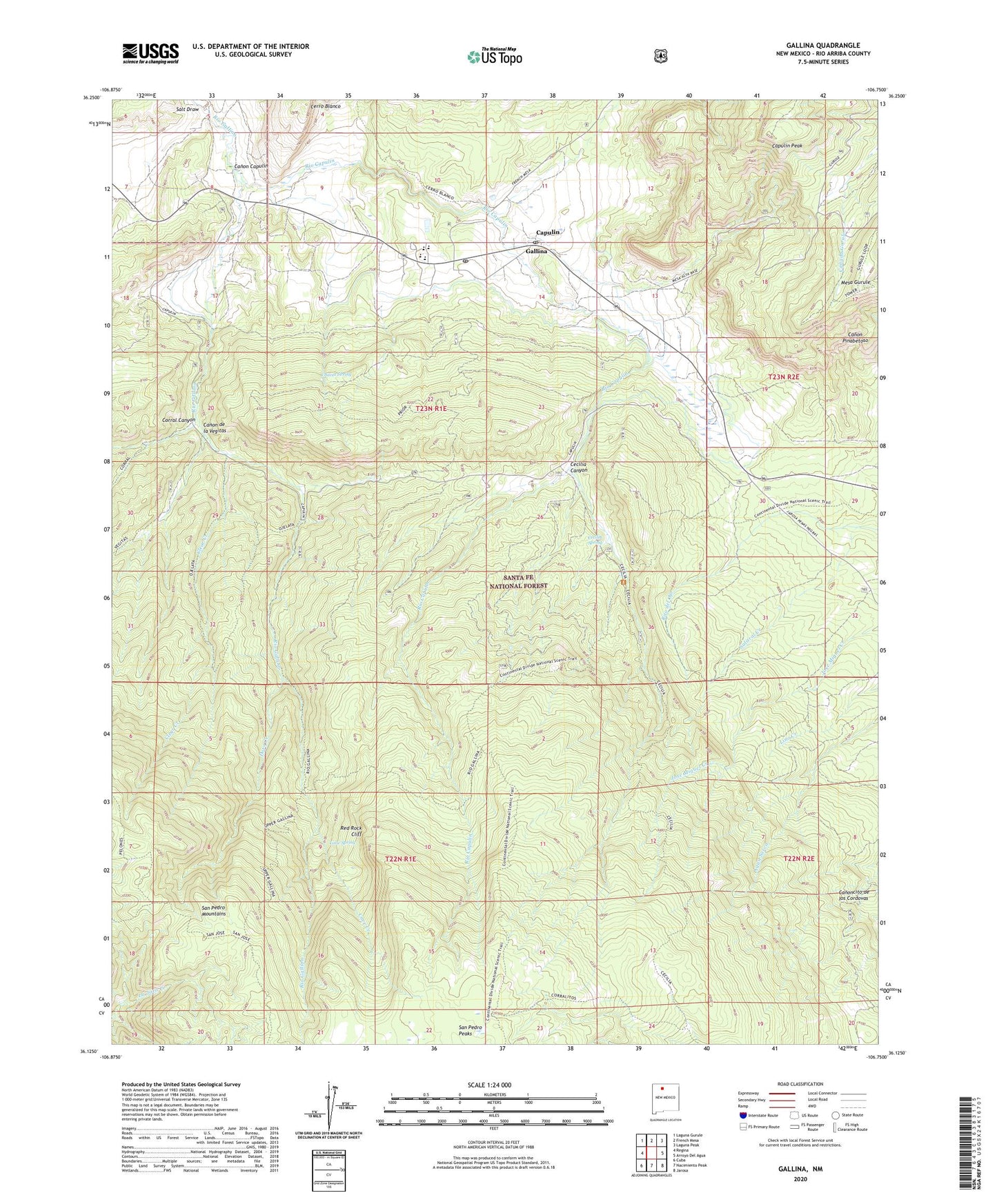
Gallina New Mexico US Topo Map
Couldn't load pickup availability
Also explore the Gallina Forest Service Topo of this same quad for updated USFS data
2023 topographic map quadrangle Gallina in the state of New Mexico. Scale: 1:24000. Based on the newly updated USGS 7.5' US Topo map series, this map is in the following counties: Rio Arriba. The map contains contour data, water features, and other items you are used to seeing on USGS maps, but also has updated roads and other features. This is the next generation of topographic maps. Printed on high-quality waterproof paper with UV fade-resistant inks.
Quads adjacent to this one:
West: Regina
Northwest: Laguna Gurule
North: French Mesa
Northeast: Laguna Peak
East: Arroyo Del Agua
Southeast: Jarosa
South: Nacimiento Peak
Southwest: Cuba
This map covers the same area as the classic USGS quad with code o36106b7.
Contains the following named places: Austin Ranch, Canon Capulin, Canon de la Vegitas, Capulin, Capulin Peak, Capulin Post Office, Capulin School, Cave Creek, Cecilia Canyon, Cecilia Spring, Chavez SPring, Clear Creek, Corral Canyon, Coyote Division, Dove Creek, Gallina, Gallina Census Designated Place, Gallina Plaza, Gallina Post Office, Lime Spring, Mesa Gurule, Red Rock Cliff, Rio Capulin, Rito del Ojo, River Trail, Salt Draw, San Jose Trail, San Pedro Mountain Trail, San Pedro Parks Trail, Santo Nino Church, TJBD 1, Upper Gallina River Trail, Wild Blue