MyTopo
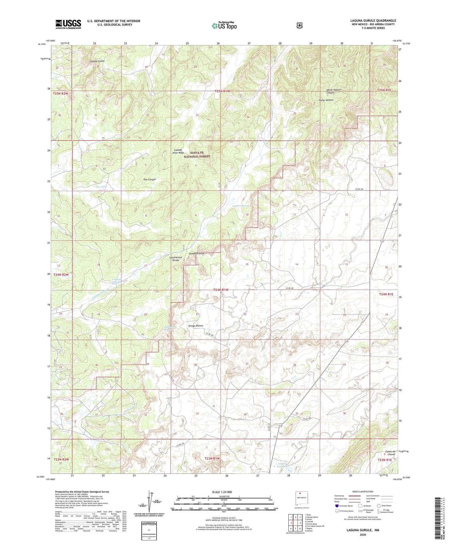
Laguna Gurule New Mexico US Topo Map
Couldn't load pickup availability
Also explore the Laguna Gurule Forest Service Topo of this same quad for updated USFS data
2023 topographic map quadrangle Laguna Gurule in the state of New Mexico. Scale: 1:24000. Based on the newly updated USGS 7.5' US Topo map series, this map is in the following counties: Rio Arriba. The map contains contour data, water features, and other items you are used to seeing on USGS maps, but also has updated roads and other features. This is the next generation of topographic maps. Printed on high-quality waterproof paper with UV fade-resistant inks.
Quads adjacent to this one:
West: Lindrith
Northwest: Ojito
North: Canada Ojitos
Northeast: Llaves
East: French Mesa
Southeast: Gallina
South: Regina
Southwest: Five Lakes Canyon NE
This map covers the same area as the classic USGS quad with code o36106c8.
Contains the following named places: Arroyo Blanco, Hooten, Horse Heaven, Laguna Colorada, Laguna Gurule, Laguna Jacquez, Lee Tank, Nelson Wells, Oso Tank, Questecita Blanca, ZIP Code: 87046