MyTopo
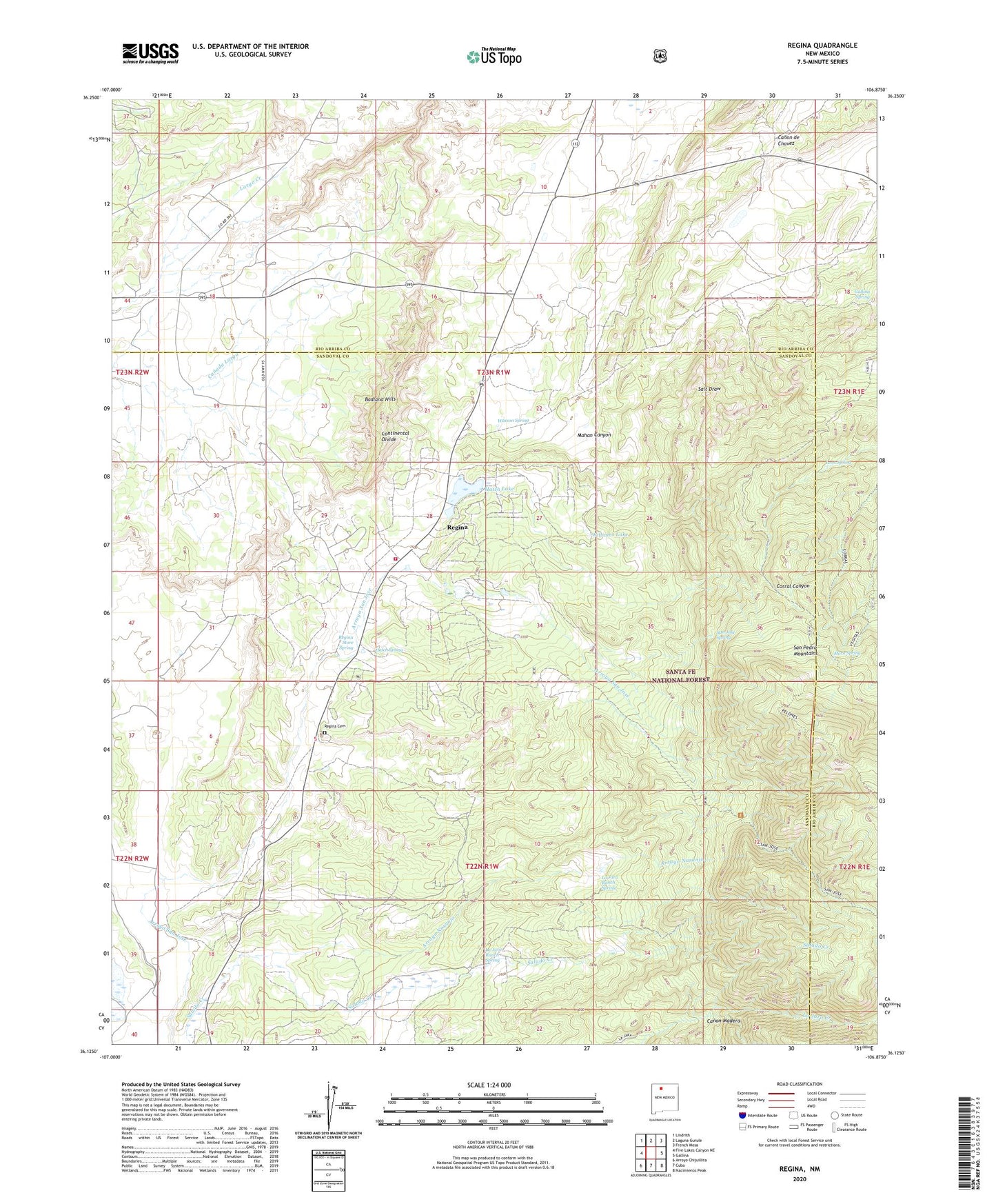
Regina New Mexico US Topo Map
Couldn't load pickup availability
Also explore the Regina Forest Service Topo of this same quad for updated USFS data
2023 topographic map quadrangle Regina in the state of New Mexico. Scale: 1:24000. Based on the newly updated USGS 7.5' US Topo map series, this map is in the following counties: Sandoval, Rio Arriba. The map contains contour data, water features, and other items you are used to seeing on USGS maps, but also has updated roads and other features. This is the next generation of topographic maps. Printed on high-quality waterproof paper with UV fade-resistant inks.
Quads adjacent to this one:
West: Five Lakes Canyon NE
Northwest: Lindrith
North: Laguna Gurule
Northeast: French Mesa
East: Gallina
Southeast: Nacimiento Peak
South: Cuba
Southwest: Arroyo Chijuillita
This map covers the same area as the classic USGS quad with code o36106b8.
Contains the following named places: American Mine, Amick Prospect, Arroyo Mine, Arroyo Naranjo, Canon Madera, Conqueror Mine, Conqueror Number Nine Mine, Gallina Spring, Hatch Lake, Hatch Reservoir Dam, Hatch Spring, La Jara Ranch Spring, Leon Spring, Mahan Canyon, Mora Spring, Regina, Regina Cemetery, Regina Census Designated Place, Regina Post Office, Regina Store Spring, Regina Volunteer Fire Department, Regina Weather Station, San Jose Creek, San Jose Lakes, San Jose Spring, Sla-Tex Venture Mine, W J Jack Lease, Wasson Spring, Whiteflo, Williams Lake, ZIP Code: 87027