MyTopo
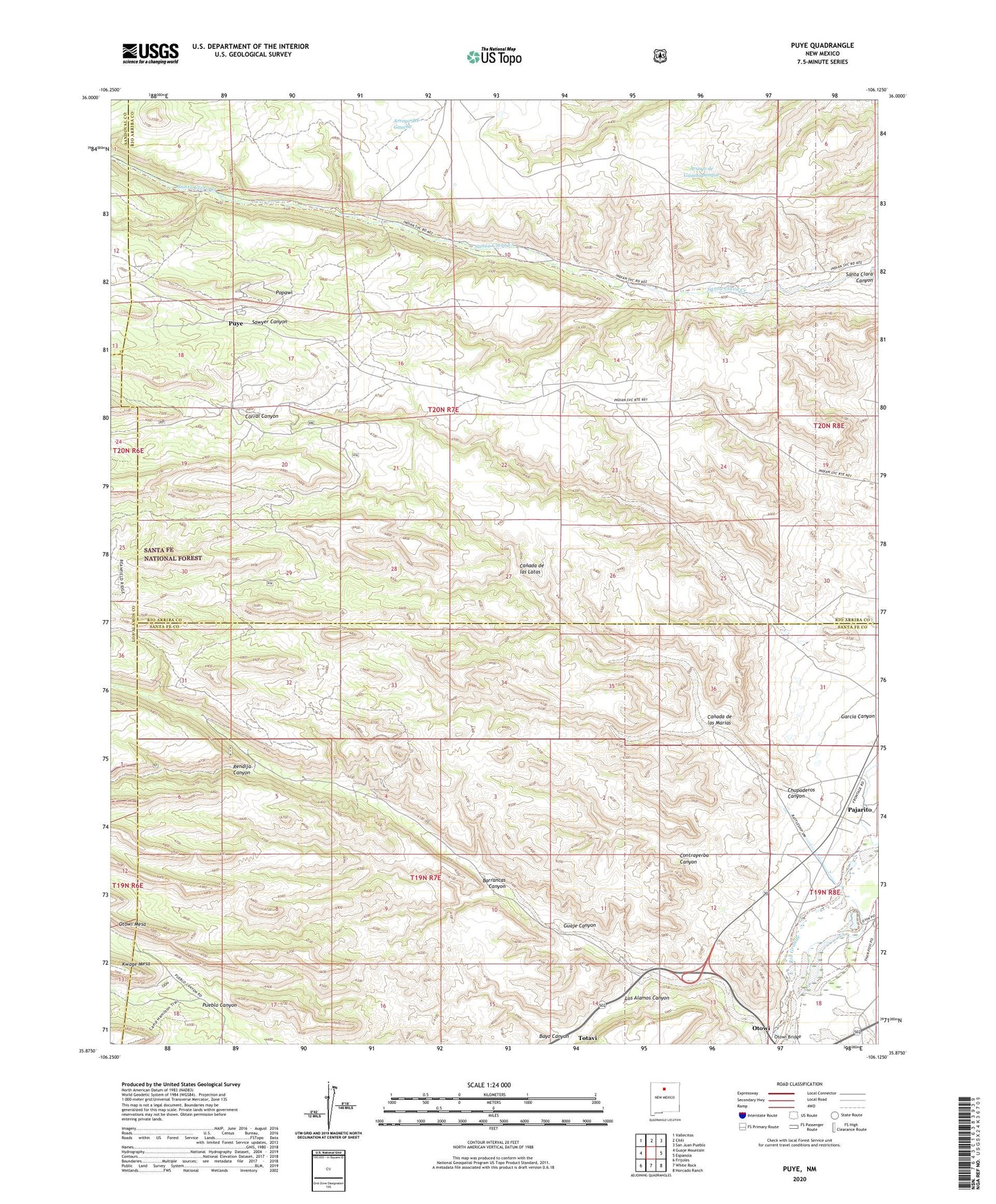
Puye New Mexico US Topo Map
Couldn't load pickup availability
Also explore the Puye Forest Service Topo of this same quad for updated USFS data
2023 topographic map quadrangle Puye in the state of New Mexico. Scale: 1:24000. Based on the newly updated USGS 7.5' US Topo map series, this map is in the following counties: Santa Fe, Rio Arriba, Los Alamos, Sandoval. The map contains contour data, water features, and other items you are used to seeing on USGS maps, but also has updated roads and other features. This is the next generation of topographic maps. Printed on high-quality waterproof paper with UV fade-resistant inks.
Quads adjacent to this one:
West: Guaje Mountain
Northwest: Vallecitos
North: Chili
Northeast: San Juan Pueblo
East: Espanola
Southeast: Horcado Ranch
South: White Rock
Southwest: Frijoles
This map covers the same area as the classic USGS quad with code o35106h2.
Contains the following named places: 10159 Water Well, Barrancas Canyon, Bayo Canyon, Canada de las Latas, Canada de las Marias, Chupaderos Canyon, Contrayerba Canyon, Copar Mine, Copar Pumice Mine, Corral Canyon, Garcia Canyon, General Pumice Mine, Guaje Canyon, Guaye Trick Tank, LA 6 Water Well, Los Alamos Canyon, Otowi, Otowi Post Office, Otowi Ruins, Pajarito, Popawi, Pumice Mine Pump, Puye, Puye Cliff Dwellings, Puye Cliff Dwellings National Historic Landmark, Puye Ruins Historical Marker, RC-17901 Water Well, Rendija Canyon, San Ildefonso Pueblo, Santa Clara Pueblo, Santa Clara Pueblo Division, Santa Clara Pumice Pit 3, Sawyer Canyon, Totavi, White Eagle Pumice Mine