MyTopo
Laguna Peak New Mexico US Topo Map
Couldn't load pickup availability
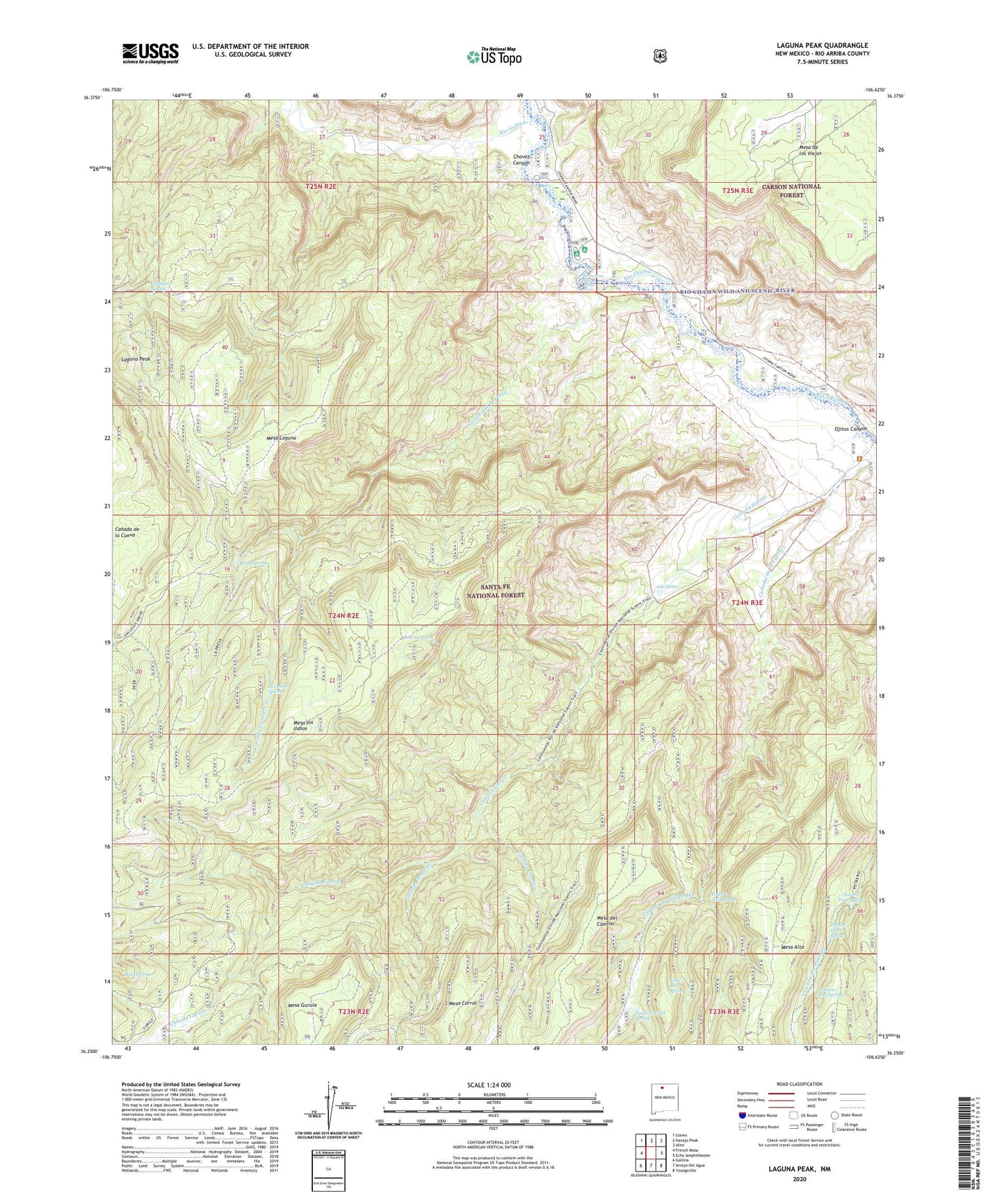
2020 topographic map quadrangle Laguna Peak in the state of New Mexico. Scale: 1:24000. Based on the newly updated USGS 7.5' US Topo map series, this map is in the following counties: Rio Arriba. The map contains contour data, water features, and other items you are used to seeing on USGS maps, but also has updated roads and other features. This is the next generation of topographic maps. Printed on high-quality waterproof paper with UV fade-resistant inks.
Quads adjacent to this one:
West: French Mesa
Northwest: Llaves
North: Navajo Peak
Northeast: Alire
East: Echo Amphitheater
Southeast: Youngsville
South: Arroyo Del Agua
Southwest: Gallina
Contains the following named places: Bear Spring, Canada Camino, Canada Corral, Canada de la Fuertes, Canada de la Presa, Canada Gurule, Canada Schmidt, Canon de Chama Grant, Chama River Canyon Wilderness, Chavez Canyon, Gallegos Spring, Gallina Bench Ranch, Laguna Peak, Little Bear Spring, Los Indios Spring, Los Ojitos, Lower Fuertes Spring, Mesa de los Viejos, Mesa Laguna, Mesa los Indios, Ojitos Canyon, Ojitos Trail, Potrero Four Spring, Potrero One Spring, Potrero Three Spring, Potrero Two Spring, Presa Spring, Rincon Spring, Rio Gallina, Wild Blue Mine