
MyTopo
Ramah New Mexico US Topo Map
Couldn't load pickup availability
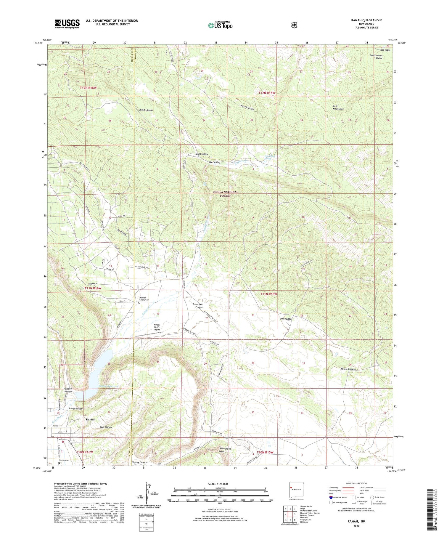
2020 topographic map quadrangle Ramah in the state of New Mexico. Scale: 1:24000. Based on the newly updated USGS 7.5' US Topo map series, this map is in the following counties: Cibola, McKinley. The map contains contour data, water features, and other items you are used to seeing on USGS maps, but also has updated roads and other features. This is the next generation of topographic maps. Printed on high-quality waterproof paper with UV fade-resistant inks.
Quads adjacent to this one:
West: Burned Timber Canyon
Northwest: Upper Nutria
North: Page
Northeast: Cottonwood Canyon
East: Kettner Canyon
Southeast: El Morro
South: Togeye Lake
Southwest: Pescado
Contains the following named places: Ashcroft-Merrill Historic District, Burnt Mill Canyon, Clawson Homestead, Clo-Chew-Tah Ranch, Coal Hollow, Dan Valley, Dan Valley Spring, Dent Ranch, Harris Valley, Mormon Colony Cemetery, Mystic Bluffs Airport, Oak Hollow, Old Bond Ranch, Pasture Hollow, Pipkin Canyon, Ramah, Ramah Cemetery, Ramah Elementary School, Ramah High School, Ramah Post Office, Ramah Reservoir, Ramah Reservoir Dam, Ramah Volunteer Fire and Rescue, Ramah Weather Station, San Lorenzo Church, The Falls, Timberlake, Timberlake Census Designated Place, Voght Ranch House Historic Site, Wild Sheep Mesa


