MyTopo
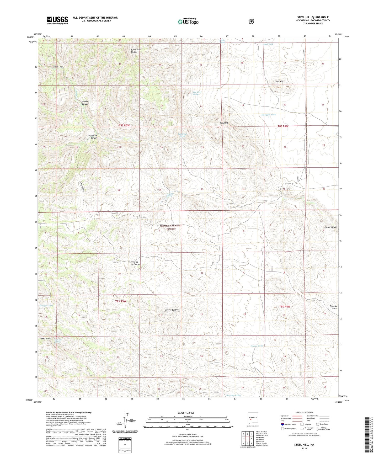
Steel Hill New Mexico US Topo Map
Couldn't load pickup availability
Also explore the Steel Hill Forest Service Topo of this same quad for updated USFS data
2023 topographic map quadrangle Steel Hill in the state of New Mexico. Scale: 1:24000. Based on the newly updated USGS 7.5' US Topo map series, this map is in the following counties: Socorro. The map contains contour data, water features, and other items you are used to seeing on USGS maps, but also has updated roads and other features. This is the next generation of topographic maps. Printed on high-quality waterproof paper with UV fade-resistant inks.
Quads adjacent to this one:
West: Vicks Peak
Northwest: Blue Mountain
North: San Juan Peak
Northeast: Hickman Ranch
East: Black Hill
Southeast: Romero Canyon
South: Sierra Fijardo
Southwest: Monticello
This map covers the same area as the classic USGS quad with code o33107e3.
Contains the following named places: Bell Hill, Cedar Tank, Cerra de las Cabras, Cuervo Tank, Cuervo Windmill, Humpfer Tank, Indian Creek, La Cabra Windmill, Milligan Tank, Nogal Canyon Ranch, Nogalita Spring, Pankey, Panky Mine, Pine Tree Spring, Rabbit Eye Spring, Rincon Windmill, Roberts Canyon, San Jose Cabin, San Jose Spring, Springtime Canyon, Steel Hill, Steel Tank