MyTopo
Victorio Park New Mexico US Topo Map
Couldn't load pickup availability
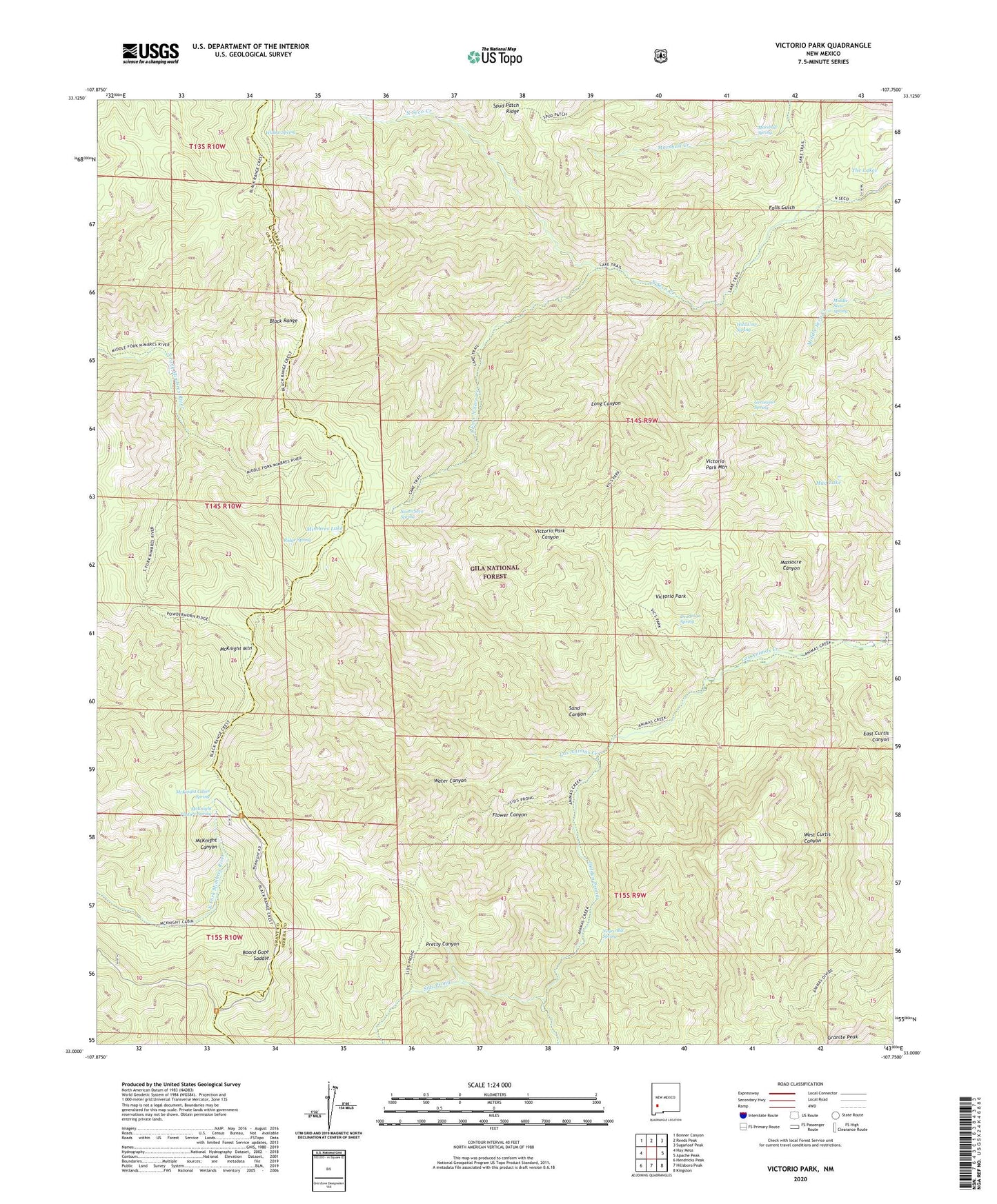
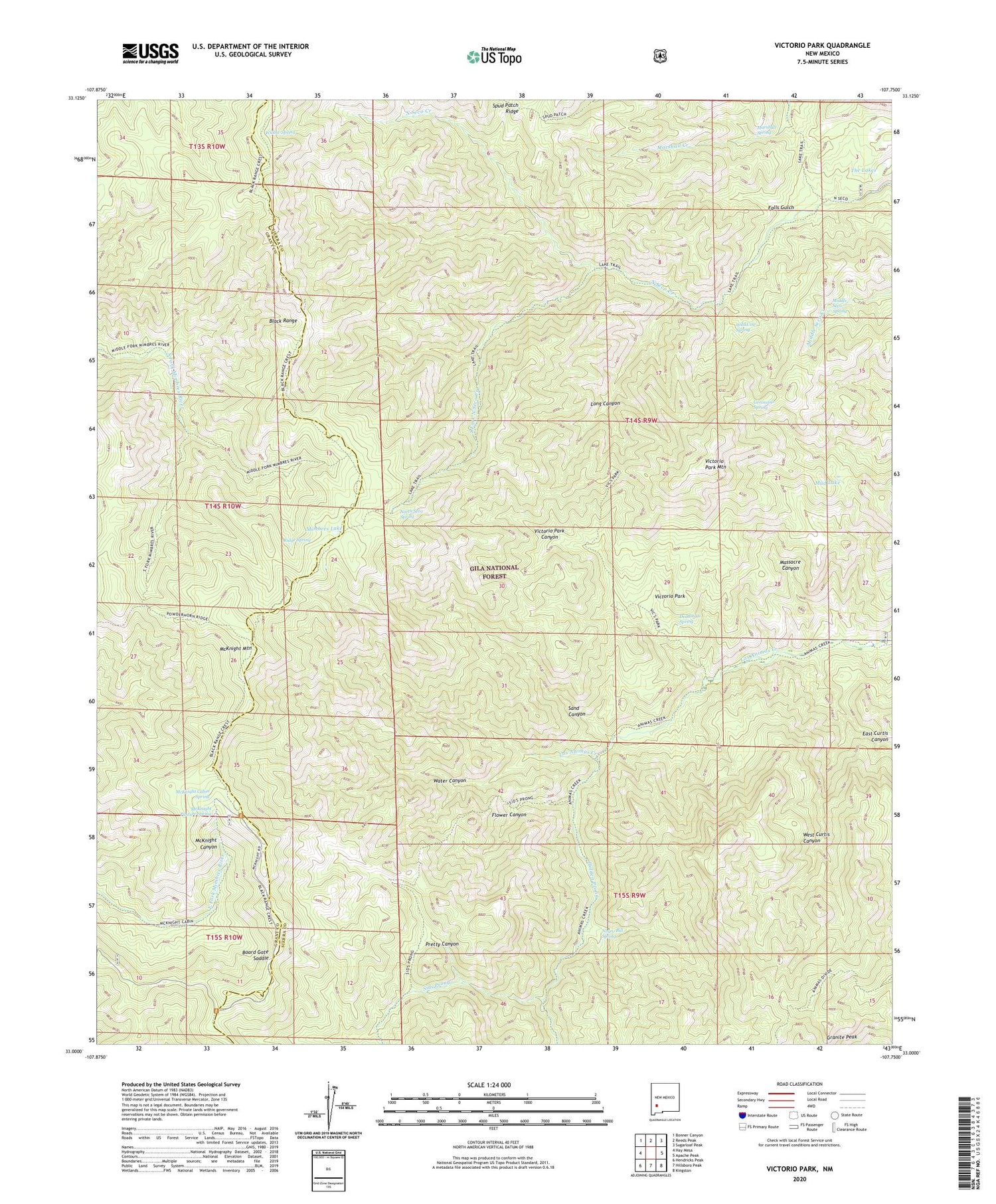
2020 topographic map quadrangle Victorio Park in the state of New Mexico. Scale: 1:24000. Based on the newly updated USGS 7.5' US Topo map series, this map is in the following counties: Sierra, Grant. The map contains contour data, water features, and other items you are used to seeing on USGS maps, but also has updated roads and other features. This is the next generation of topographic maps. Printed on high-quality waterproof paper with UV fade-resistant inks.
Quads adjacent to this one:
West: Hay Mesa
Northwest: Bonner Canyon
North: Reeds Peak
Northeast: Sugarloaf Peak
East: Apache Peak
Southeast: Kingston
South: Hillsboro Peak
Southwest: Hendricks Peak
Contains the following named places: Board Gate Saddle, Deadman Spring, East Curtis Canyon, Falls Gulch, Flower Canyon, Geronimo Spring, Gooseberry, Granite Peak, Holden Prong, Kelsey Place, Long Canyon, Marshall Spring, Massacre Canyon, McKnight Cabin Spring, McKnight Fire Cabin, McKnight Mountain, McKnight Pasture Spring, Middle Seco Spring, Mimbres Lake, Mud Lake, Murphy Place, Negro Bill Spring, North Seco Spring, Pretty Canyon, Ridge Spring, Sand Canyon, Sawmill Windmill, Sids Prong, South Fork North Seco Creek, The Lakes, Victorio Park, Victorio Park Canyon, Victorio Park Mountain, Water Canyon, West Curtis Canyon, Wild Cow Spring, Willow Spring