MyTopo
Arkport New York US Topo Map
Couldn't load pickup availability
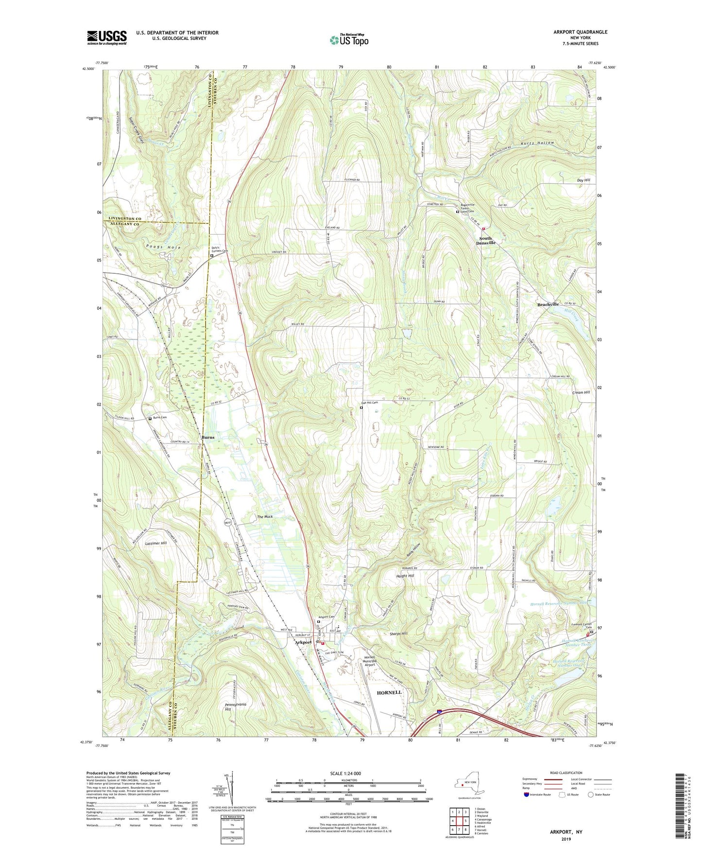
2023 topographic map quadrangle Arkport in the state of New York. Scale: 1:24000. Based on the newly updated USGS 7.5' US Topo map series, this map is in the following counties: Steuben, Allegany, Livingston. The map contains contour data, water features, and other items you are used to seeing on USGS maps, but also has updated roads and other features. This is the next generation of topographic maps. Printed on high-quality waterproof paper with UV fade-resistant inks.
Quads adjacent to this one:
West: Canaseraga
Northwest: Ossian
North: Dansville
Northeast: Wayland
East: Haskinville
Southeast: Canisteo
South: Hornell
Southwest: Alfred
This map covers the same area as the classic USGS quad with code o42077d6.
Contains the following named places: Arkport, Arkport Cemetery, Arkport Central School, Arkport Dam, Arkport Fire Department, Arkport Post Office, Arkport United Methodist Church, Beachville, Bishopville United Methodist Church, Blueberry Hill Farm, Burns, Burns Cemetery, Day Hill, Dotys Corners, Doty's Corners Cemetery, First Methodist Protestant Church, First Presbyterian Church, Fremont, Fremont Center Cemetery, Fremont Volunteer Fire Department 1, Haight Hill, Harding School, Hornell Church of Christ, Hornell Municipal Airport, Hornell Reservoir Number One, Hornell Reservoir Number Three, Jenkins Farm, Kurtz Hollow, Lattimer Hill, Lime Kiln Creek, Lismore Dairy, Marcus Farms, Meadows Mobile Home Park, Mill Creek, Moraine Park, Oak Hill Cemetery, Pennsylvania Hill, Pine Knoll Mobile Home Park, Pine Wood Camp, Poags Hole, Reedy Hollow, Rogersville Forest Lawn Cemetery, Sharps Hill, South Dansville, South Dansville United Methodist Church, South Dansville Volunteer Fire Company Station 1, Sugar Creek, Sugar Creek Glen, The Muck, Town of Dansville, Village of Arkport, ZIP Code: 14807