MyTopo
Edwardsville New York US Topo Map
Couldn't load pickup availability
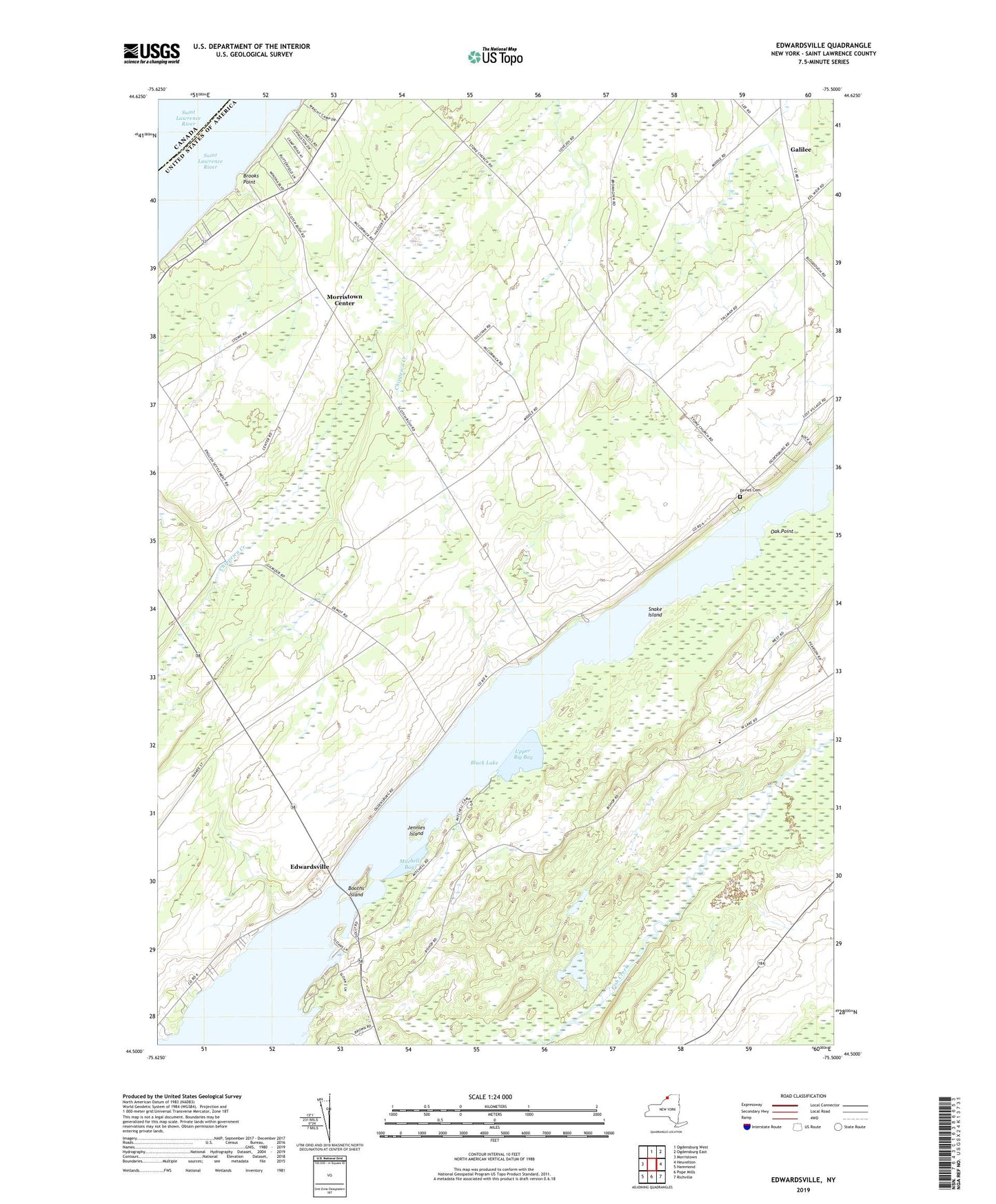
2023 topographic map quadrangle Edwardsville in the state of New York. Scale: 1:24000. Based on the newly updated USGS 7.5' US Topo map series, this map is in the following counties: St. Lawrence. The map contains contour data, water features, and other items you are used to seeing on USGS maps, but also has updated roads and other features. This is the next generation of topographic maps. Printed on high-quality waterproof paper with UV fade-resistant inks.
Quads adjacent to this one:
West: Morristown
North: Ogdensburg West
Northeast: Ogdensburg East
East: Heuvelton
Southeast: Richville
South: Pope Mills
Southwest: Hammond
This map covers the same area as the classic USGS quad with code o44075e5.
Contains the following named places: Beggs Dairy Farms, Black Lake, Booths Island, Brooks Point, Catamaran Shoal, Davies Cemetery, Edwardsville, Galilee, Galilee Farms, Jennies Island, Longs Corners, Mitchell Bay, Morristown Center, Oak Point, School Number 10, School Number 11, School Number 15, School Number 18, School Number 3, School Number 6, School Number 7, School Number 8, School Number 9, Scotch Bush Grange, Snake Island, Stone Church, Upper Big Bay, Wilson Dairy