MyTopo
Moffitsville New York US Topo Map
Couldn't load pickup availability
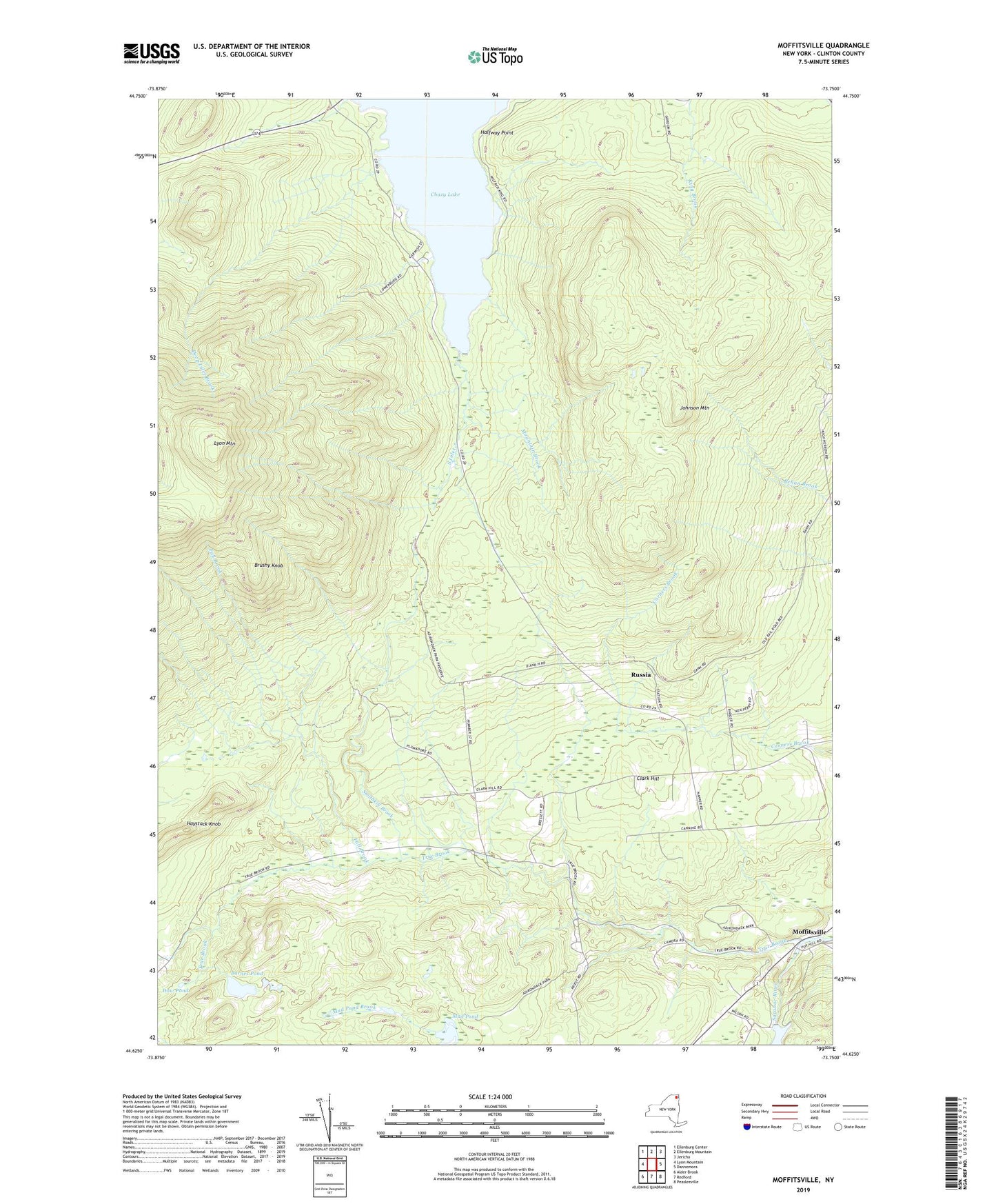
2023 topographic map quadrangle Moffitsville in the state of New York. Scale: 1:24000. Based on the newly updated USGS 7.5' US Topo map series, this map is in the following counties: Clinton. The map contains contour data, water features, and other items you are used to seeing on USGS maps, but also has updated roads and other features. This is the next generation of topographic maps. Printed on high-quality waterproof paper with UV fade-resistant inks.
Quads adjacent to this one:
West: Lyon Mountain
Northwest: Ellenburg Center
North: Ellenburg Mountain
Northeast: Jericho
East: Dannemora
Southeast: Peasleeville
South: Redford
Southwest: Alder Brook
This map covers the same area as the classic USGS quad with code o44073f7.
Contains the following named places: Barnes Pond, Brushy Knob, Chazy Lake, Clark Hill, Deep Inlet Brook, Dow Pond, Fall Brook, Halfway Point, Haystack Knob, Johnson Mountain, Lyon Mountain, Moffitsville, Mountain Brook, Mud Pond, Russia, Smithkill Brook, South Inlet, Town of Dannemora, Town of Saranac, True Brook, ZIP Code: 12981