MyTopo
Stratford New York US Topo Map
Couldn't load pickup availability
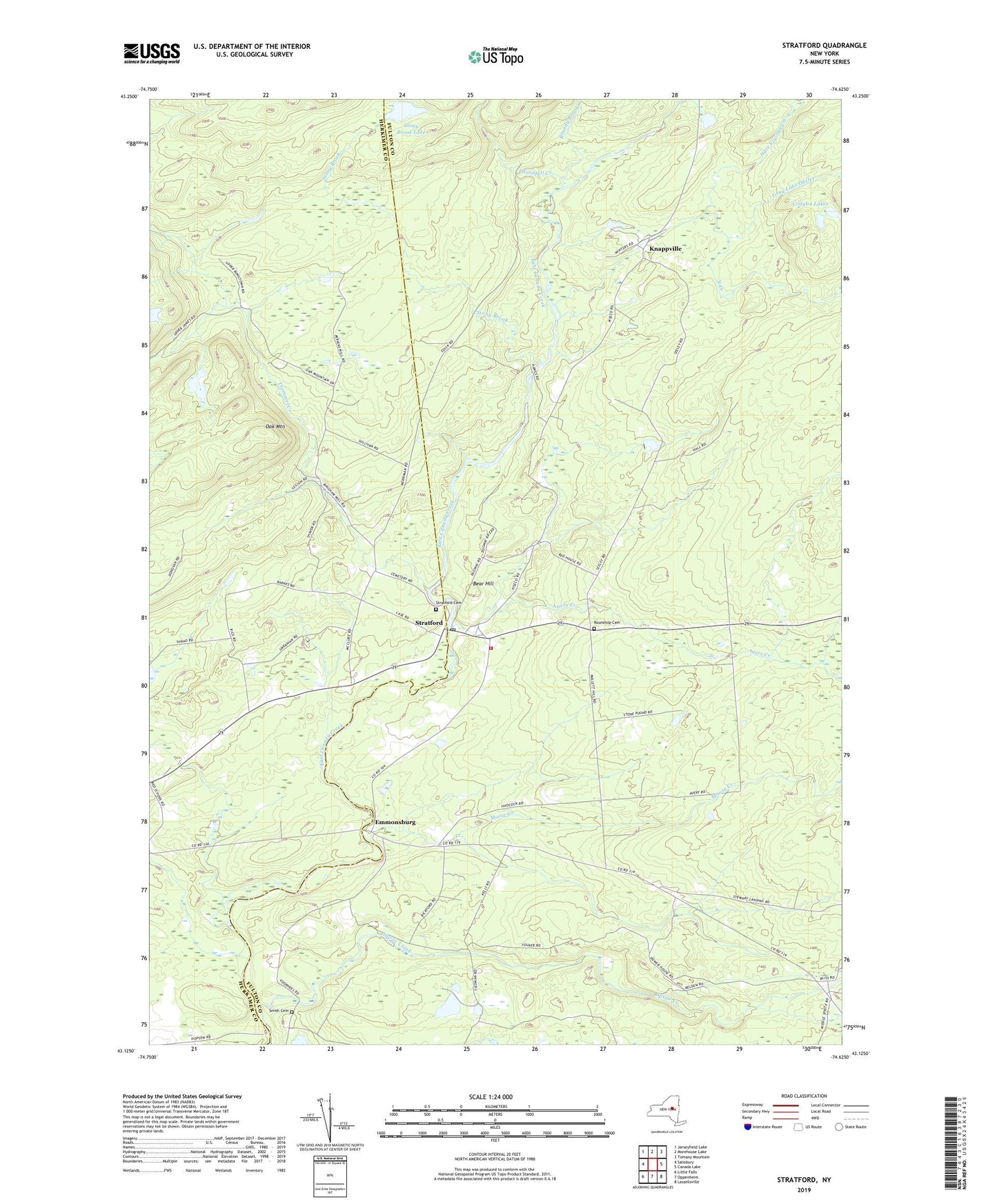
2023 topographic map quadrangle Stratford in the state of New York. Scale: 1:24000. Based on the newly updated USGS 7.5' US Topo map series, this map is in the following counties: Fulton, Herkimer. The map contains contour data, water features, and other items you are used to seeing on USGS maps, but also has updated roads and other features. This is the next generation of topographic maps. Printed on high-quality waterproof paper with UV fade-resistant inks.
Quads adjacent to this one:
West: Salisbury
Northwest: Jerseyfield Lake
North: Morehouse Lake
Northeast: Tomany Mountain
East: Canada Lake
Southeast: Lassellsville
South: Oppenheim
Southwest: Little Falls
This map covers the same area as the classic USGS quad with code o43074b6.
Contains the following named places: Ayers Creek, Bear Hill, Bliss Corner, Brandy Brook, Conglin Lakes, Emmonsburg, Hart Vly Stream, Knapp Reservoir, Knappville, Long Lake Outlet, Moose Creek, North Creek, Oak Mountain, Phipps Brook, Roundtop Cemetery, School Number 16, Smith Cemetery, Sprite Creek, Stony Brook, Stony Brook Lake, Stratford, Stratford Cemetery, Stratford Post Office, Stratford Volunteer Fire Department, Town of Stratford, Trammel Creek, Windfall Creek