MyTopo
Oppenheim New York US Topo Map
Couldn't load pickup availability
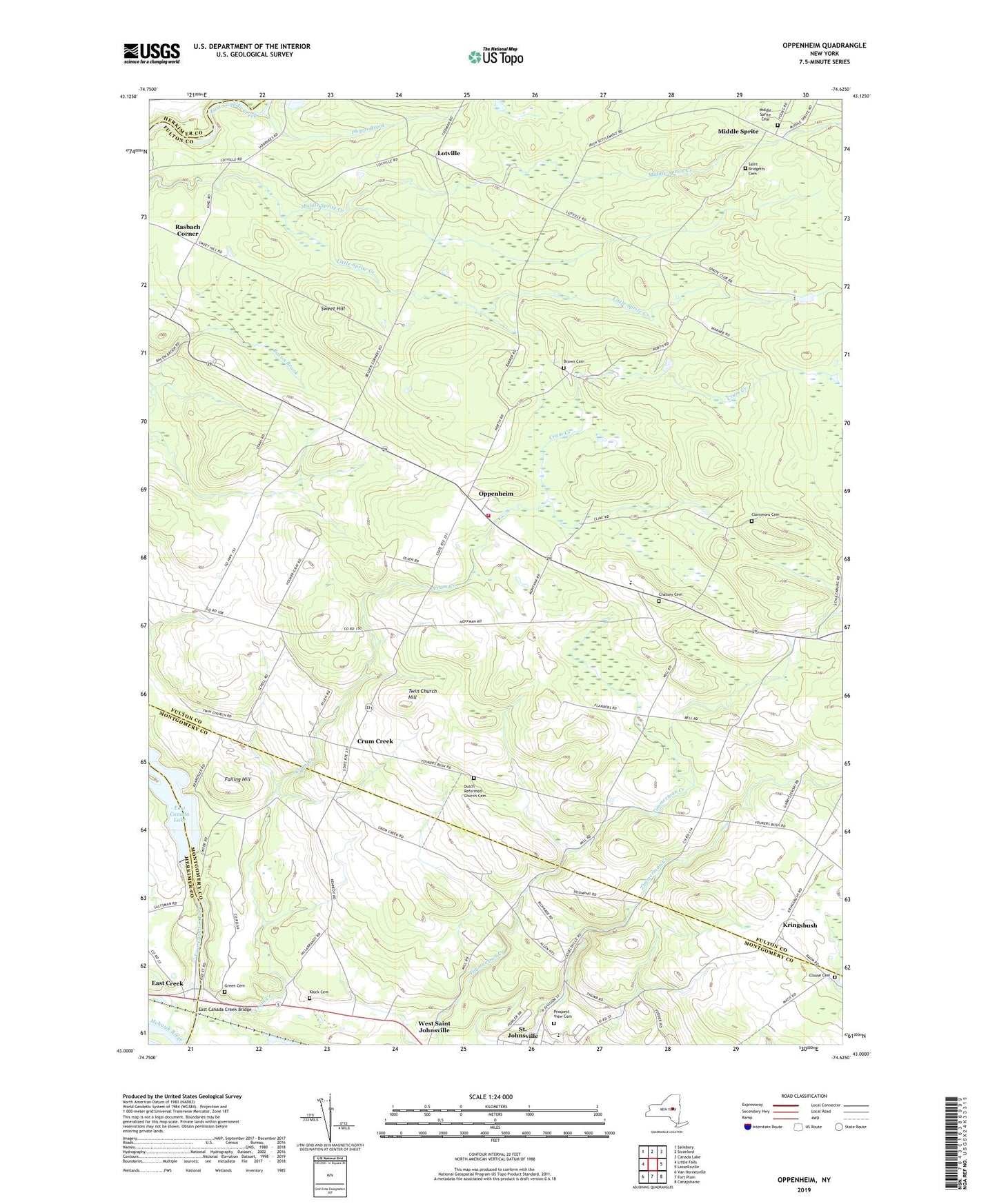
2023 topographic map quadrangle Oppenheim in the state of New York. Scale: 1:24000. Based on the newly updated USGS 7.5' US Topo map series, this map is in the following counties: Fulton, Montgomery, Herkimer. The map contains contour data, water features, and other items you are used to seeing on USGS maps, but also has updated roads and other features. This is the next generation of topographic maps. Printed on high-quality waterproof paper with UV fade-resistant inks.
Quads adjacent to this one:
West: Little Falls
Northwest: Salisbury
North: Stratford
Northeast: Canada Lake
East: Lassellsville
Southeast: Canajoharie
South: Fort Plain
Southwest: Van Hornesville
This map covers the same area as the classic USGS quad with code o43074a6.
Contains the following named places: Bacon Brook School, Beekman School, Brown Cemetery, Chatsey Cemetery, Clemmons Cemetery, Clouse Cemetery, Crum Creek, Crystal Grove Diamond Mine Campground, Damin Farm, Dolgeville Airport, Doxtater Corner, Dutch Reformed Church Cemetery, East Canada Creek Bridge, East Canada Lake, East Creek, Failing Hill, Grace Christian Church, Green Cemetery, Klock Cemetery, Klock Park, Kringsbush, Little Sprite Creek, Lotville, Middle Sprite, Middle Sprite Cemetery, One Cow Farm, Oppenheim, Oppenheim - Ephratah Central School, Oppenheim Volunteer Fire Company 1, Phipps Corners, Prospect View Cemetery, Rain Dance Pond, Rasbach Corner, Saint Bridgetts Cemetery, Saint Johnsville Junior - Senior High School, Saint Johnsville Quarry, School Number 12, School Number 6, School Number 7, School Number 9, Sweet Hill, Town of Oppenheim, Town of Saint Johnsville, Twin Church Hill, Village of Saint Johnsville, Youker Buch School, ZIP Codes: 13329, 13452