MyTopo
Muskellunge Lake New York US Topo Map
Couldn't load pickup availability
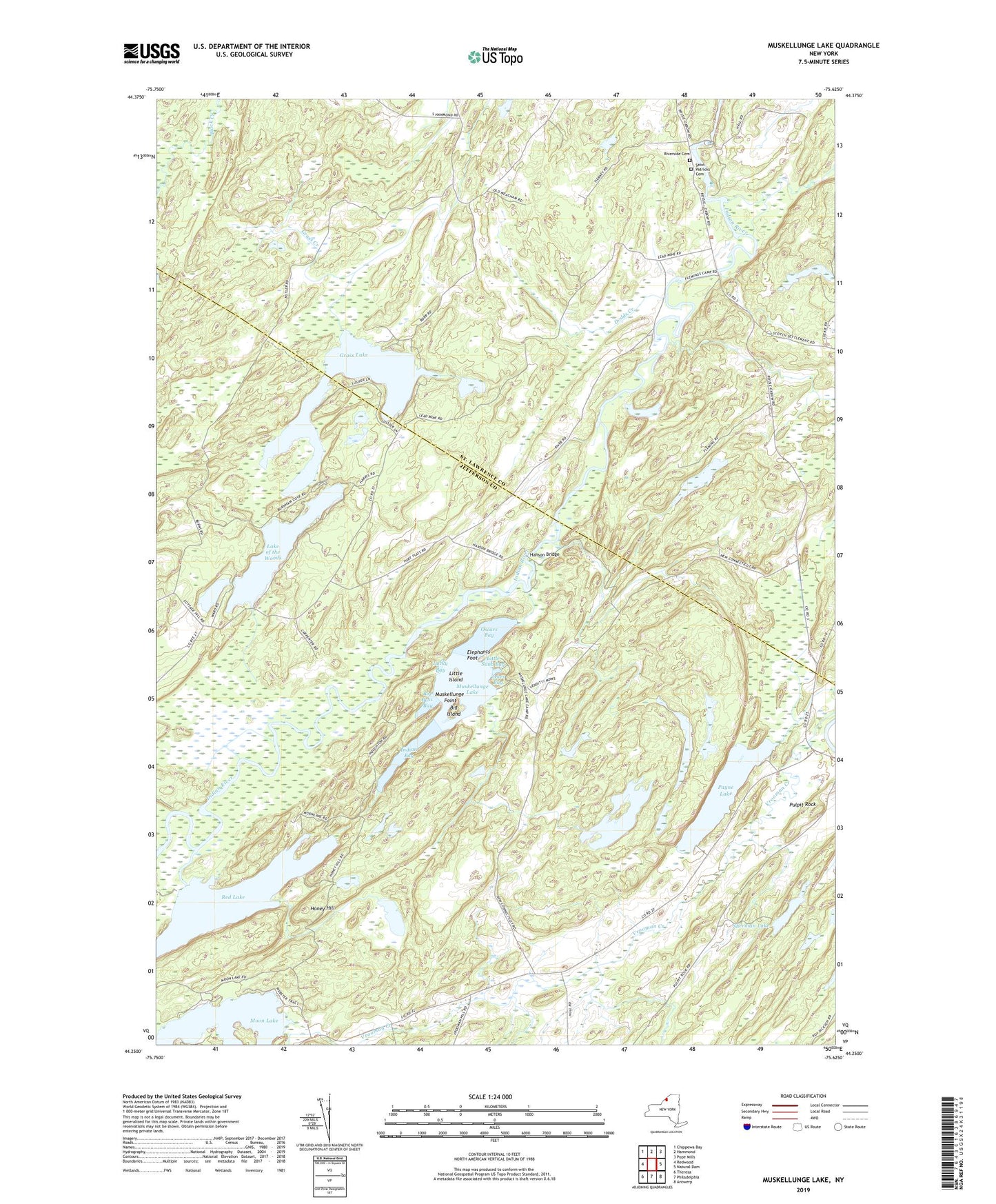
2019 topographic map quadrangle Muskellunge Lake in the state of New York. Scale: 1:24000. Based on the newly updated USGS 7.5' US Topo map series, this map is in the following counties: Jefferson, St. Lawrence. The map contains contour data, water features, and other items you are used to seeing on USGS maps, but also has updated roads and other features. This is the next generation of topographic maps. Printed on high-quality waterproof paper with UV fade-resistant inks.
Quads adjacent to this one:
West: Redwood
Northwest: Chippewa Bay
North: Hammond
Northeast: Pope Mills
East: Natural Dam
Southeast: Antwerp
South: Philadelphia
Southwest: Theresa
Contains the following named places: Bartletts Corner, Big Bass Bay, Big Island, Chapel Corners, Dodds Creek, Elephants Foot, Grass Lake, Hanson Bridge, Honey Hill, Indian Bay, Lake of the Woods, Little Island, Little Sand Bay, Lucky Bay, Moon Lake, Muskellunge Lake, Muskellunge Point, Nelson Corner, Oscars Bay, Oxbow Census Designated Place, Payne Lake, Pulpit Rock, Rapids School, Red Lake, Riverside Cemetery, Robb School, Saint Patricks Cemetery, School Number 17, School Number 19, School Number 4, School Number 6, School Number 8, Sherman Lake, Town of Rossie, Zekes Bay