MyTopo
Tomany Mountain New York US Topo Map
Couldn't load pickup availability
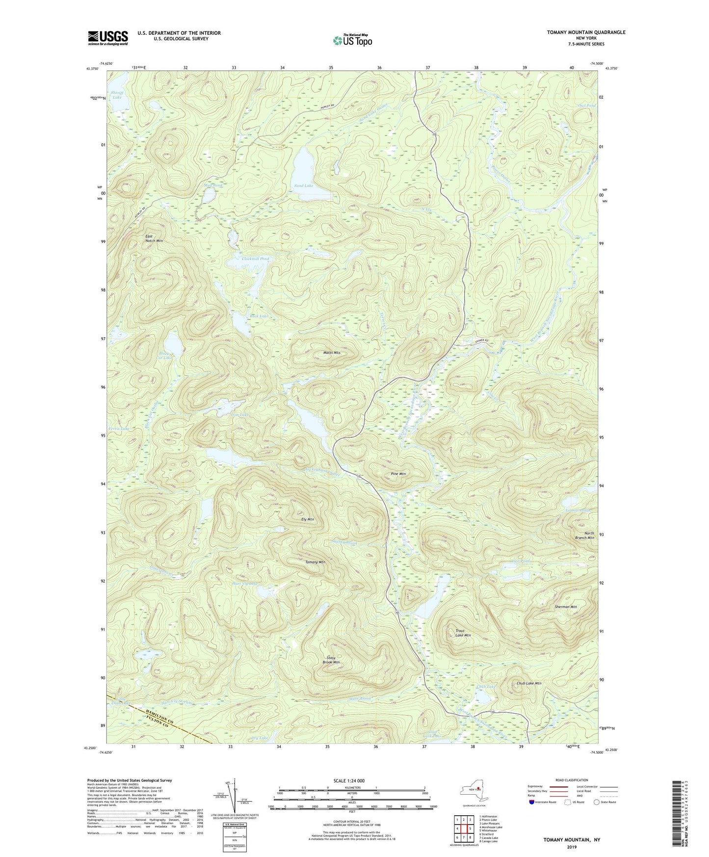
2019 topographic map quadrangle Tomany Mountain in the state of New York. Scale: 1:24000. Based on the newly updated USGS 7.5' US Topo map series, this map is in the following counties: Hamilton, Fulton. The map contains contour data, water features, and other items you are used to seeing on USGS maps, but also has updated roads and other features. This is the next generation of topographic maps. Printed on high-quality waterproof paper with UV fade-resistant inks.
Quads adjacent to this one:
West: Morehouse Lake
Northwest: Hoffmeister
North: Piseco Lake
Northeast: Lake Pleasant
East: Whitehouse
Southeast: Caroga Lake
South: Canada Lake
Southwest: Stratford
Contains the following named places: Averys Place, Black Cat Lake, Chub Lake, Chub Lake Mountain, Clockmill Corners, Clockmill Pond, Cow Creek, Dry Lake, East Notch Mountain, Ely Mountain, Hart Vly Lake, Iron Lake, Jockeybush Lake, Jockeybush Outlet, Kennels Pond, Little Chub Lake, Little Trout Lake, Loomis Ponds, Lost Pond, Matts Mountain, Moose Creek, Mud Pond, North Branch West Branch Sacandaga River, North Vly, Pine Mountain, Piseco Outlet, Rock Lake, Sand Lake, Shaker Place, Shanty Brook, Sheriff Lake, Sherman Mountain, State Brook, State Brook Mountain, Teeter Creek, Tomany Mountain, Trout Lake, Trout Lake Mountain