MyTopo
Creedmoor North Carolina US Topo Map
Couldn't load pickup availability
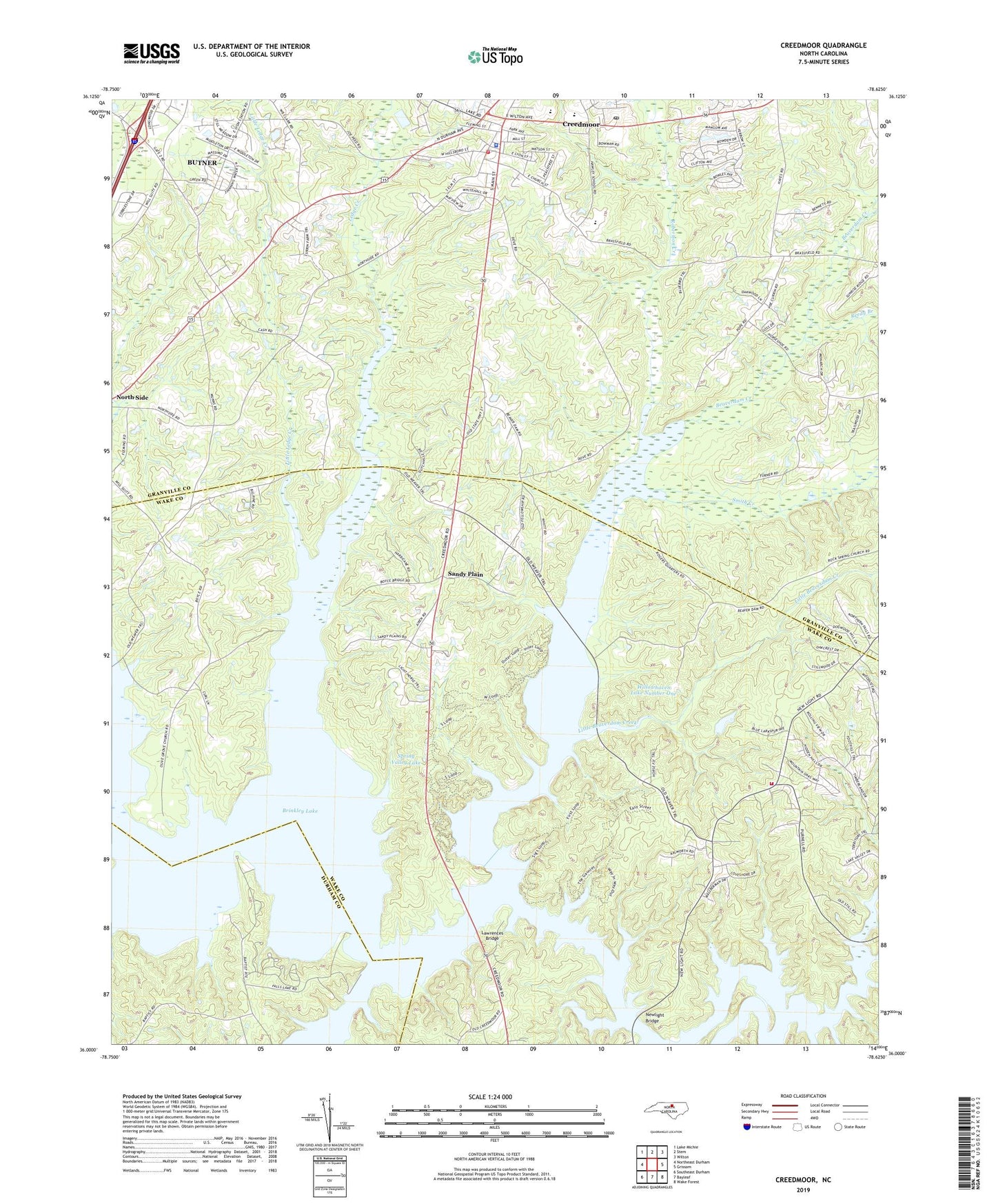
2022 topographic map quadrangle Creedmoor in the state of North Carolina. Scale: 1:24000. Based on the newly updated USGS 7.5' US Topo map series, this map is in the following counties: Granville, Wake, Durham. The map contains contour data, water features, and other items you are used to seeing on USGS maps, but also has updated roads and other features. This is the next generation of topographic maps. Printed on high-quality waterproof paper with UV fade-resistant inks.
Quads adjacent to this one:
West: Northeast Durham
Northwest: Lake Michie
North: Stem
Northeast: Wilton
East: Grissom
Southeast: Wake Forest
South: Bayleaf
Southwest: Southeast Durham
This map covers the same area as the classic USGS quad with code o36078a6.
Contains the following named places: Beaverdam Creek, Boyces Bridge, Brinkley Lake, City of Creedmoor, Creedmoor, Creedmoor Elementary School, Creedmoor Police Department, Creedmoor Post Office, Creedmoor Volunteer Fire Department, Falls Lake State Recreation Area, Fellowship Church, Freewill Church, Granville County Emergency Medical Services Station 2, Hawley School, Lake Hughes Dam, Lawrences Bridge, Ledge Creek, Ledge Rock Church, Lick Creek, Little Beaverdam Creek, Little Ledge Creek, Little Lick Creek, Medlins Store, New Light Church, New Light Creek, New Light School, Newlight Bridge, North Side, O'Briants Store, Olive Grove Church, Perrys Store, Reedy Branch, Reedy Branch School, Robertson Creek, Sandy Plain, Smith Creek, South Granville School, Spring Valley Lake, Stony Hill Rural Fire Department Station 2, Township of New Light, Union Church, Willowhaven Lake Number One, ZIP Code: 27522