MyTopo
Stem North Carolina US Topo Map
Couldn't load pickup availability
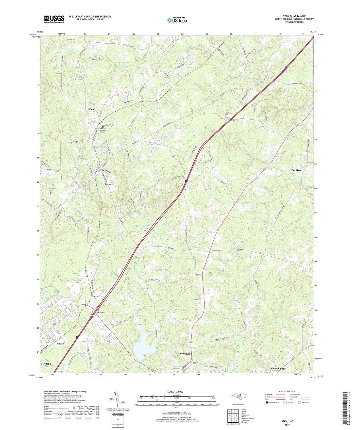
2022 topographic map quadrangle Stem in the state of North Carolina. Scale: 1:24000. Based on the newly updated USGS 7.5' US Topo map series, this map is in the following counties: Granville. The map contains contour data, water features, and other items you are used to seeing on USGS maps, but also has updated roads and other features. This is the next generation of topographic maps. Printed on high-quality waterproof paper with UV fade-resistant inks.
Quads adjacent to this one:
West: Lake Michie
Northwest: Moriah
North: Berea
Northeast: Oxford
East: Wilton
Southeast: Grissom
South: Creedmoor
Southwest: Northeast Durham
This map covers the same area as the classic USGS quad with code o36078b6.
Contains the following named places: Bryant Hill School, Bullock Church, Caldmont Lake, Cash Lake, Cattail Creek, Cedar Creek, Community Memorial Gardens, Concord Church, Gooch Memorial Church, Granville County Emergency Medical Services Station 4, Greenfield Church, Greenfield School, Hester, Holman Creek, Jackson Creek, Johnson Creek, Lake Rogers Dam, Lattice Church, Lyons, Mount Energy, Mount Vernon Church, Murdoch Center, Nye Pond Dam Number One, Nye Pond Number One, Pine Grove Church, Pleasant Grove Church, Providence School, Shoofly, Stem, Stem Fire Department and Emergency Medical Services Station 8, Stem Police Department, Stem Post Office, Stem United Methodist Church, Tallyho Church, Tallyho School, Tar River, Town of Stem, Township of Dutchville, Township of Tally Ho, Veazsys Lake Dam, Winston School, ZIP Code: 27581