MyTopo
Wilton North Carolina US Topo Map
Couldn't load pickup availability
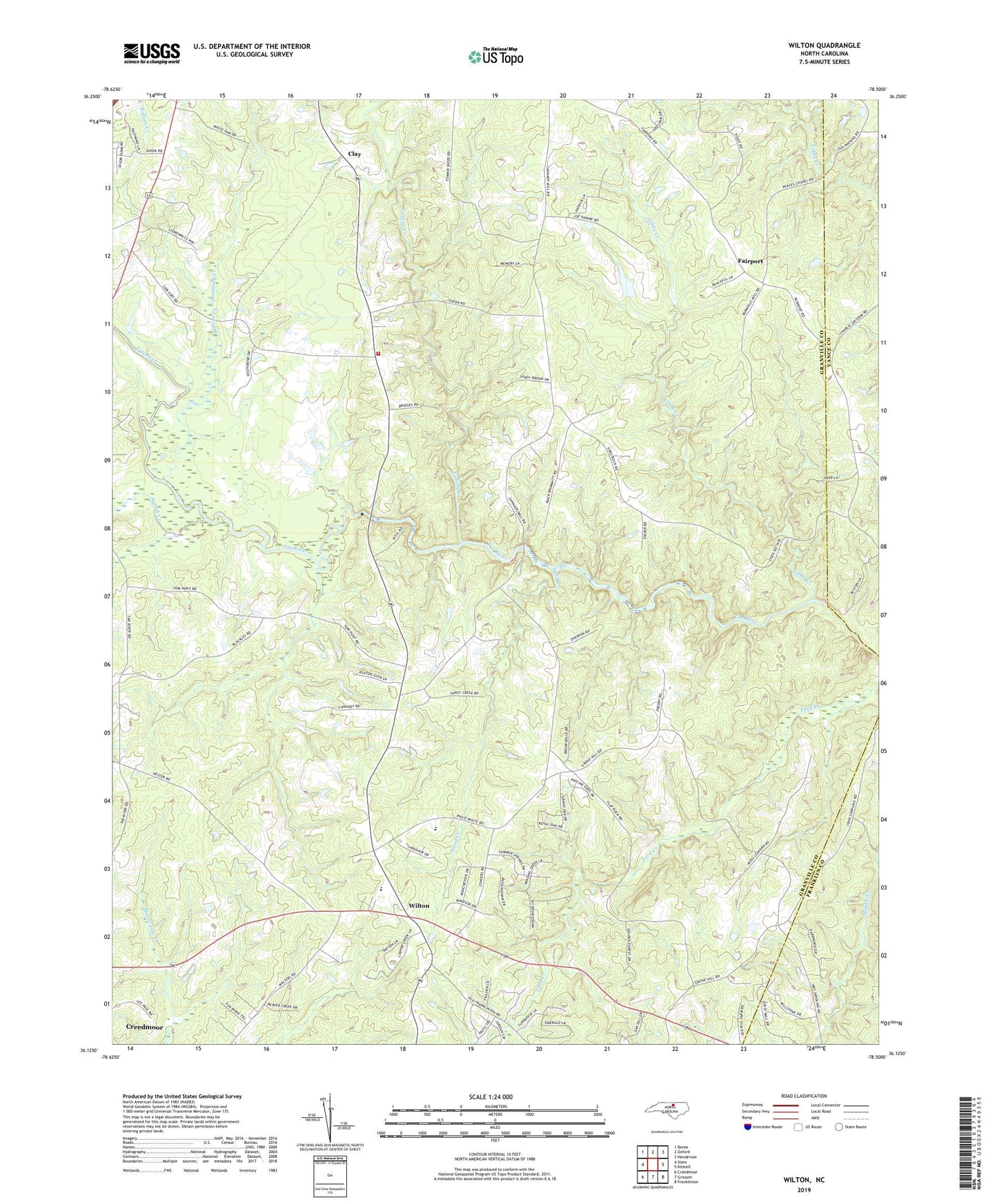
2022 topographic map quadrangle Wilton in the state of North Carolina. Scale: 1:24000. Based on the newly updated USGS 7.5' US Topo map series, this map is in the following counties: Granville, Vance, Franklin. The map contains contour data, water features, and other items you are used to seeing on USGS maps, but also has updated roads and other features. This is the next generation of topographic maps. Printed on high-quality waterproof paper with UV fade-resistant inks.
Quads adjacent to this one:
West: Stem
Northwest: Berea
North: Oxford
Northeast: Henderson
East: Kittrell
Southeast: Franklinton
South: Grissom
Southwest: Creedmoor
This map covers the same area as the classic USGS quad with code o36078b5.
Contains the following named places: Ashburn Hall, Aycock Creek, Banks Church, Banks School, Belton Creek Church, Bethel Church, Bollens Creek, Boulding Creek, Clay, Corinth Church, Corinth Volunteer Fire Department, Fairport, Fishing Creek, Gibbs Creek, Granville County Emergency Medical Services Station 6, Grey Rock Church, Grove Hill Church, Harris Grove Church, Hawkins Chapel Baptist Church, Ilong Church, Joe Hamme Jr Lake, Joe Hamme Jr Lake Dam, Peaces Chapel, Pettiford Church, Pettiford School, Poplar Hill School, Sand Creek, Spurr Creek, Synama Grove Church, Tar River School, Union School, Union Zion Church, Williams Hill Church, Wilton, Wilton Elementary School