MyTopo
Grantham North Carolina US Topo Map
Couldn't load pickup availability
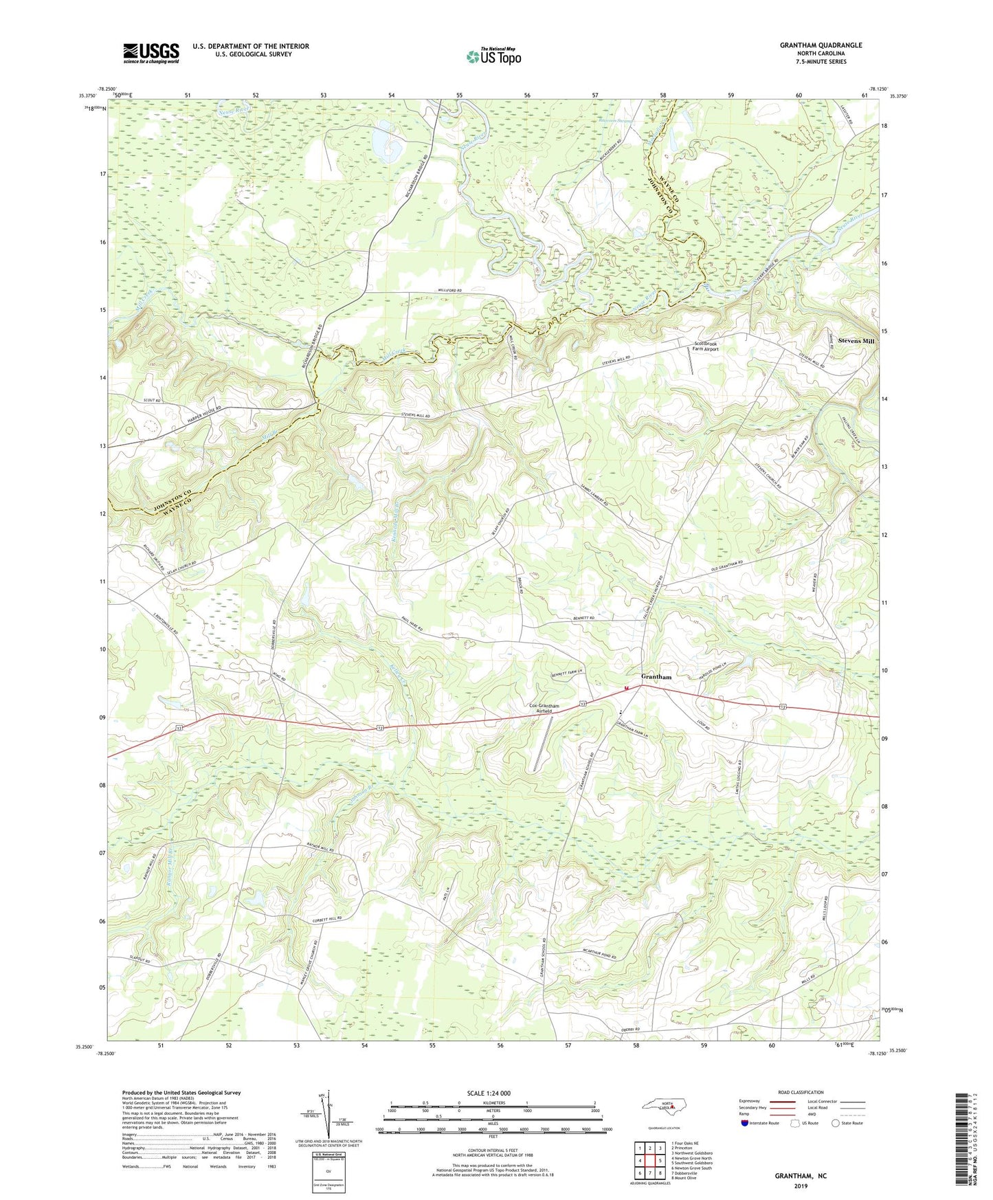
2022 topographic map quadrangle Grantham in the state of North Carolina. Scale: 1:24000. Based on the newly updated USGS 7.5' US Topo map series, this map is in the following counties: Wayne, Johnston. The map contains contour data, water features, and other items you are used to seeing on USGS maps, but also has updated roads and other features. This is the next generation of topographic maps. Printed on high-quality waterproof paper with UV fade-resistant inks.
Quads adjacent to this one:
West: Newton Grove North
Northwest: Four Oaks NE
North: Princeton
Northeast: Northwest Goldsboro
East: Southwest Goldsboro
Southeast: Mount Olive
South: Dobbersville
Southwest: Newton Grove South
This map covers the same area as the classic USGS quad with code o35078c2.
Contains the following named places: Bethany Church, Camp Wacoboc, Cox Mill, Cox-Grantham Airfield, Eureka Church, Falling Creek, Falling Creek Church, Grantham, Grantham Elementary School, Grantham Volunteer Fire Department - Wayne County Station 19, Harrington Mobile Home Park, Johnson Branch, Kelley Creek, Kennedy Mill Branch, Manley Grove Church, Mill Branch, Mill Creek, Moccasin Creek, Piney Grove Church, Pleasant Union Church, Ranyor Mill Branch, Rhodes Church, Riverside Church, Scottbrook Farm Airport, Selah Church, Stevens Chapel, Sylvania Lake Dam, Sylvinia Lake, Township of Grantham, Wayne County Emergency Medical Services Station 3