MyTopo
Newton Grove North North Carolina US Topo Map
Couldn't load pickup availability
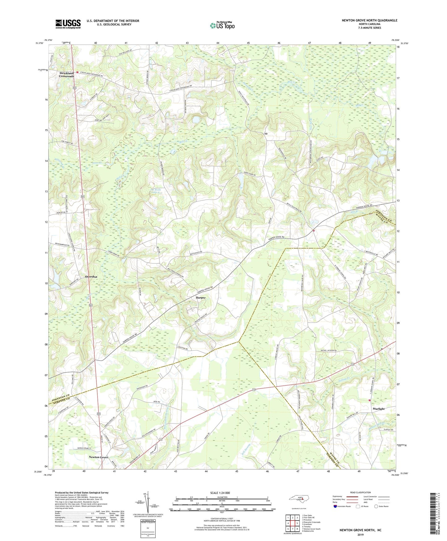
2022 topographic map quadrangle Newton Grove North in the state of North Carolina. Scale: 1:24000. Based on the newly updated USGS 7.5' US Topo map series, this map is in the following counties: Johnston, Wayne, Sampson. The map contains contour data, water features, and other items you are used to seeing on USGS maps, but also has updated roads and other features. This is the next generation of topographic maps. Printed on high-quality waterproof paper with UV fade-resistant inks.
Quads adjacent to this one:
West: Peacocks Crossroads
Northwest: Four Oaks
North: Four Oaks NE
Northeast: Princeton
East: Grantham
Southeast: Dobbersville
South: Newton Grove South
Southwest: Timothy
This map covers the same area as the classic USGS quad with code o35078c3.
Contains the following named places: Antioch Church, Beaverdam Creek, Benson Emergency Medical Services Station 2, Bentonsville Beasley Post Office, Bentonville, Bentonville Battleground, Bentonville Church, Bentonville Fire Department, Blackman Pond, Corinth Church, Ebenezer Church, Flowers Store, Friendly Church, Hannah Creek, Hannah Creek Church, Harper, Hoods Grove Church, J R Wells Lake A, Jordans Chapel, Jordans Chapel Fire Department - Wayne County Station 20, Jordans Store, Langston Store, Mill Creek Church, Our Lady of Guadalupe Church, Overshot, Pauline Church, Rose Pond, Rose Pond Dam, Saint John Church, Saw Pit Branch, Small Chapel, Starlight, Stone Creek, Strickland Crossroads, Strickland Crossroads Fire Department, Thornton Store, Town of Newton Grove, Township of Bentonville, Tuscarora Scout Reservation, Westbrook Grove Church, Whiteoak Branch