MyTopo
Grissom North Carolina US Topo Map
Couldn't load pickup availability
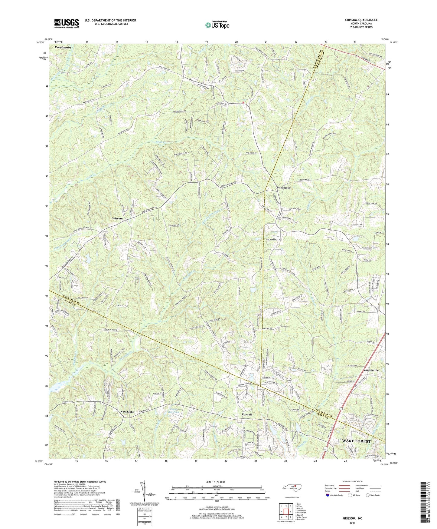
2019 topographic map quadrangle Grissom in the state of North Carolina. Scale: 1:24000. Based on the newly updated USGS 7.5' US Topo map series, this map is in the following counties: Granville, Franklin, Wake. The map contains contour data, water features, and other items you are used to seeing on USGS maps, but also has updated roads and other features. This is the next generation of topographic maps. Printed on high-quality waterproof paper with UV fade-resistant inks.
Quads adjacent to this one:
West: Creedmoor
Northwest: Stem
North: Wilton
Northeast: Kittrell
East: Franklinton
Southeast: Rolesville
South: Wake Forest
Southwest: Bayleaf
Contains the following named places: Bragg School, Brassfield Church, Brassfield School, Brassfield Volunteer Fire Department Station 16, Buckhorn Creek, Calvin Ray Pond, Camp Kanata, Cedar Grove Church, Efland Millpond, Good Hope Baptist Church, Grissom, Kinches Chapel, Kinches School, Maple Springs School, Marys Chapel, Masons Pond Dam, Mill Creek, Mount Carmel Church, New Light, New Rock Spring Church, Pocomoke, Poke Chapel, Popes Chapel, Purnell, Rock Spring Church, Sunrise School, Township of Brassfield, Wake Union Church, Wesley Chapel, West Prong New Light Creek, Woodland Church