MyTopo
Leicester North Carolina US Topo Map
Couldn't load pickup availability
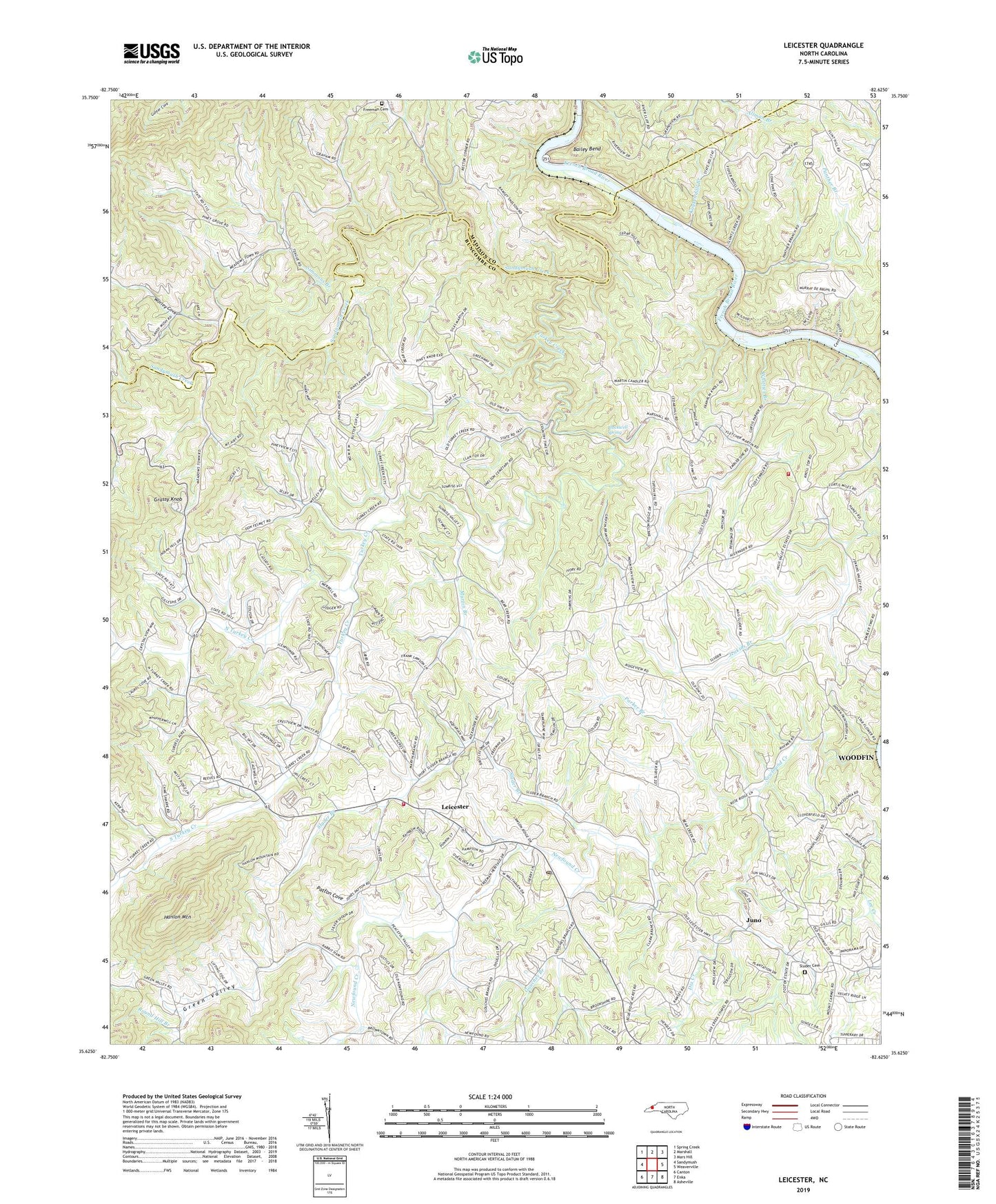
2019 topographic map quadrangle Leicester in the state of North Carolina. Scale: 1:24000. Based on the newly updated USGS 7.5' US Topo map series, this map is in the following counties: Buncombe, Madison. The map contains contour data, water features, and other items you are used to seeing on USGS maps, but also has updated roads and other features. This is the next generation of topographic maps. Printed on high-quality waterproof paper with UV fade-resistant inks.
Quads adjacent to this one:
West: Sandymush
Northwest: Spring Creek
North: Marshall
Northeast: Mars Hill
East: Weaverville
Southeast: Asheville
South: Enka
Southwest: Canton
Contains the following named places: Alexander School, Bailey Bend, Blackwell Spring, Blevin Branch, Brick Church, Cedar Hill Church, Dix Creek, Flat Creek, Flint Hill Church, Freeman Gap Cemetery, French Broad Church, French Broad School, French Broad Volunteer Fire and Rescue Station 19, Gouches Branch, Grassy Knob, Green Valley, Gudger Chapel, Hanlon Mountain, Juno, Kuykendall Branch, Leicester, Leicester Post Office, Leicester School, Leicester Volunteer Fire Department, Macedonia Church, Martin Branch, Mount Carmel Church, Mountain View Church, Newfound Church, Newfound Creek, North Turkey Creek, Oak Grove Church, Oak Ridge Church, Panther Branch, Parker Branch, Patton Cove, Piney Grove School, Redmon Church, Round Hill Branch, Sandymush Creek, Simmons Branch, Sluder Branch, Sluder Cemetery, South Turkey Creek, Teague Chapel, Township of French Broad, Township of Leicester, Turkey Creek, Turkey Creek Church, Union Church, Volga, Whittier Branch, Worley Cove, ZIP Code: 28701