MyTopo
South Creek North Carolina US Topo Map
Couldn't load pickup availability
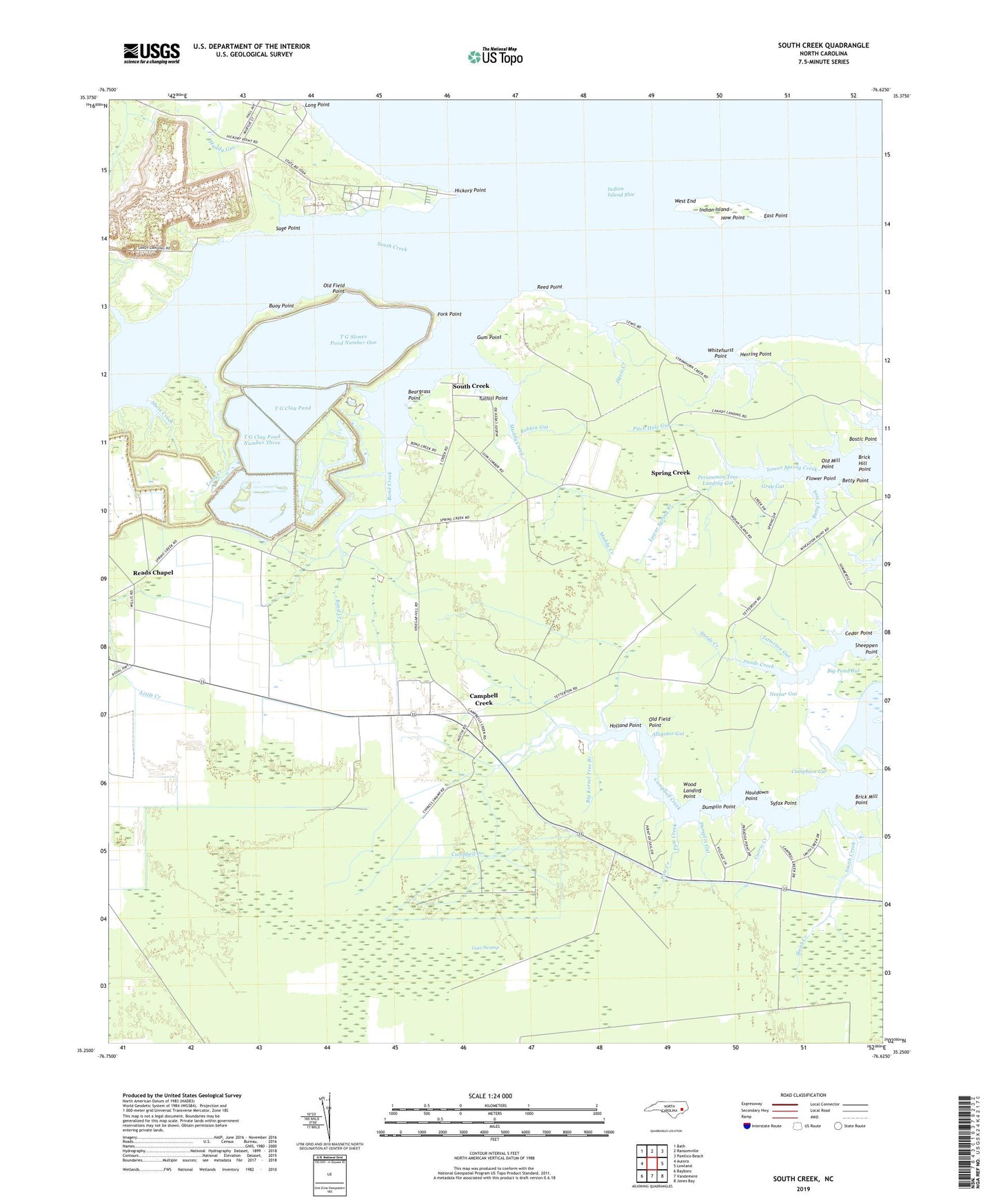
2022 topographic map quadrangle South Creek in the state of North Carolina. Scale: 1:24000. Based on the newly updated USGS 7.5' US Topo map series, this map is in the following counties: Beaufort, Pamlico. The map contains contour data, water features, and other items you are used to seeing on USGS maps, but also has updated roads and other features. This is the next generation of topographic maps. Printed on high-quality waterproof paper with UV fade-resistant inks.
Quads adjacent to this one:
West: Aurora
Northwest: Bath
North: Ransomville
Northeast: Pamlico Beach
East: Lowland
Southeast: Jones Bay
South: Vandemere
Southwest: Bayboro
This map covers the same area as the classic USGS quad with code o35076c6.
Contains the following named places: Alliance Landing, Alligator Gut, Barnett Gut, Beargrass Point, Betty Creek, Betty Point, Big Kernel Tree Branch, Big Pond Gut, Bond Creek, Bostic Point, Brick Hill Point, Brick Mill Point, Buoy Point, Campbell Creek, Campbells Creek Church, Camphion Gut, Carrie Creek, Cedar Point, Cuff Tarkiln Creek, Cypress Branch, Davis Creek, Dumplin Gut, Dumplin Point, East Point, East Prong Cypress Branch, Facing Gut, Flannigan Gut, Flower Point, Fork Point, Gray Gut, Gum Point, Hatter Creek, Hauldown Point, Herring Point, Hickory Point, Holland Point, How Point, Huddy Gut, Indian Island, Indian Island Slue, Jones, Lee Creek, Little Kernel Tree Branch, Long Creek, Long Point, Mill Creek, Muddy Creek, Myrtle Marsh Gut, Neezar Gut, Northeast Prong, Old Field Point, Old House Cove, Old Mill Point, Overton Creek, Pate Creek, Persimmon Tree Landing Gut, Pitch Hole Gut, Pot Gut, Reads Chapel, Reed Point, Robbin Gut, Sage Point, Saint Kets Church, Sandy Landing, Schoolhouse Gut, Shady Grove Church, Sheeppen Point, Sheepskin Creek, Shop Gut, Short Creek, Smith Creek, South Creek, Spring Creek, Strawhorn Creek, Syfax Point, T G Clay Pond, T G Clay Pond Dam Number Three, T G Clay Pond Dam Number Two, T G Clay Pond Number Three, T G Slimes Pond Dam Number One, T G Slimes Pond Number One, Tar Landing Gut, Tetterton Gut, Tetterton Landing, Tooley Creek, Tuthill Point, Vinegar Hill, Welshman Gut, West End, Whitehurst Point, Wilson Gut, Wood Landing Point