MyTopo
Jackson North Carolina US Topo Map
Couldn't load pickup availability
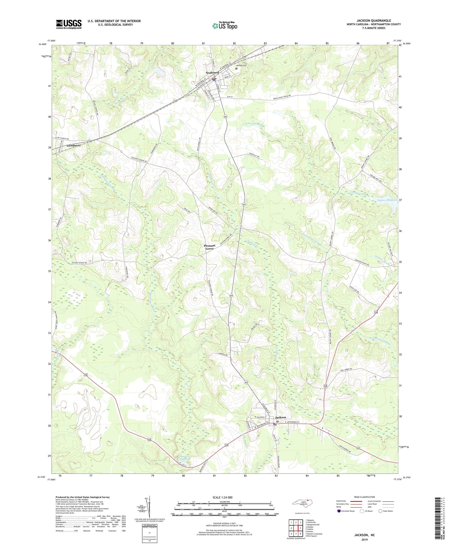
2022 topographic map quadrangle Jackson in the state of North Carolina. Scale: 1:24000. Based on the newly updated USGS 7.5' US Topo map series, this map is in the following counties: Northampton. The map contains contour data, water features, and other items you are used to seeing on USGS maps, but also has updated roads and other features. This is the next generation of topographic maps. Printed on high-quality waterproof paper with UV fade-resistant inks.
Quads adjacent to this one:
West: Weldon
Northwest: Skippers
North: Claresville
Northeast: Margarettsville
East: Galatia
Southeast: Rich Square
South: Boones Crossroads
Southwest: Halifax
This map covers the same area as the classic USGS quad with code o36077d4.
Contains the following named places: Bethel Church, Boones Mill Pond Dam, Boones Millpond, Gumberry, Gumberry Swamp, Hill Chapel, Jackson, Jackson Post Office, Jackson Rescue Squad, Jackson Volunteer Fire Department, Jackson-Eastside Elementary School, Mount Carmel Church, Mount Hope Church, Northampton County, Northampton County Ambulance Service, Northampton County Sheriff's Office, Phillips Cemetery, Piney Grove Church, Pleasant Grove, Seaboard, Seaboard Fire Department, Seaboard Police Department, Seaboard Post Office, Seaboard-Coates Elementary School, Taylors Millpond, Town of Jackson, Town of Seaboard, Township of Jackson, Township of Seaboard, ZIP Code: 27876