MyTopo
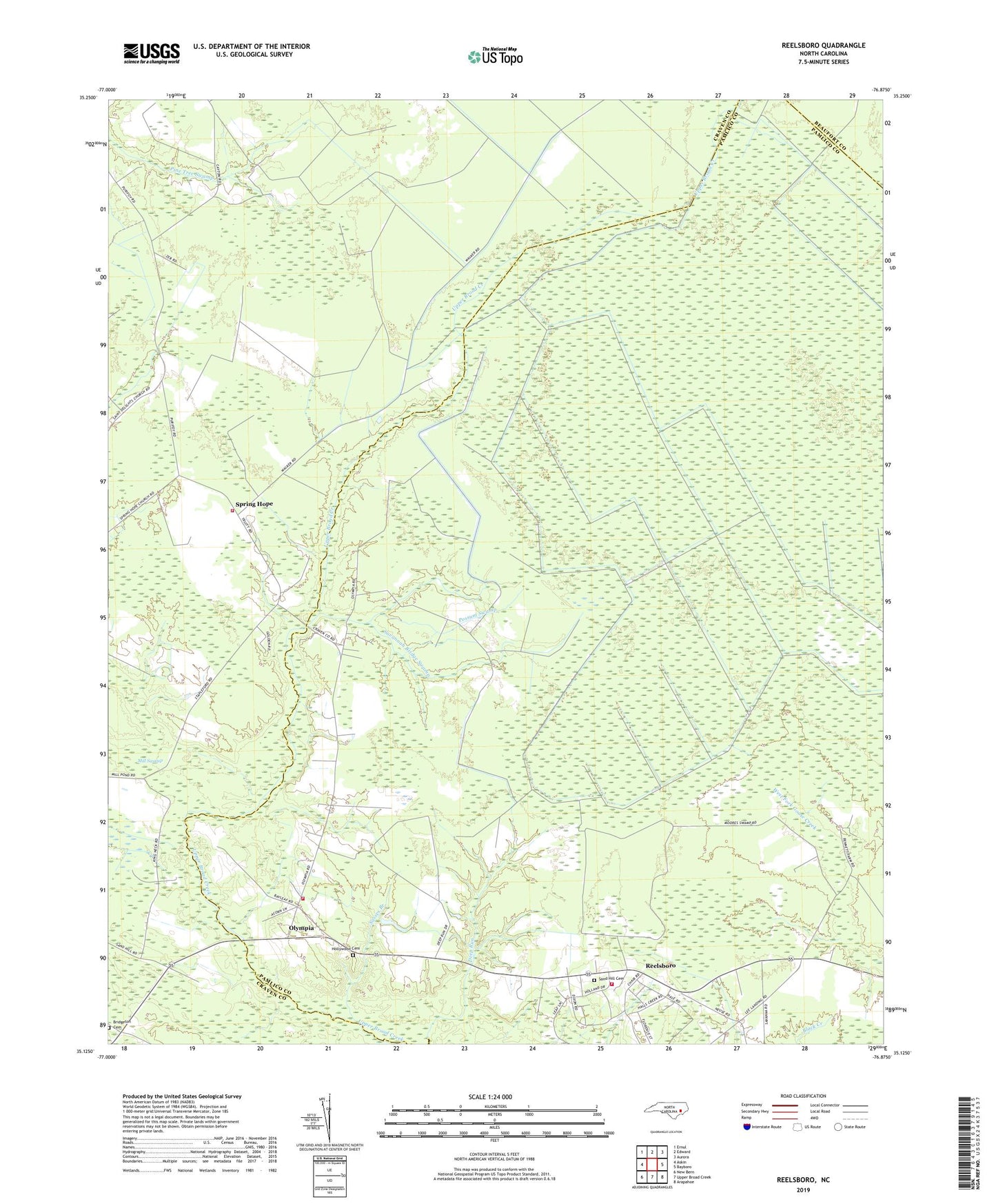
Reelsboro North Carolina US Topo Map
Couldn't load pickup availability
2022 topographic map quadrangle Reelsboro in the state of North Carolina. Scale: 1:24000. Based on the newly updated USGS 7.5' US Topo map series, this map is in the following counties: Pamlico, Craven, Beaufort. The map contains contour data, water features, and other items you are used to seeing on USGS maps, but also has updated roads and other features. This is the next generation of topographic maps. Printed on high-quality waterproof paper with UV fade-resistant inks.
Quads adjacent to this one:
West: Askin
Northwest: Ernul
North: Edward
Northeast: Aurora
East: Bayboro
Southeast: Arapahoe
South: Upper Broad Creek
Southwest: New Bern
This map covers the same area as the classic USGS quad with code o35076b8.
Contains the following named places: Bridgeton Cemetery, Broad Creek Christian Church, Hollywood Cemetery, Mill Swamp, New Hope Church, Olympia, Olympia Volunteer Fire Department, Possum Swamp, Reelsboro, Reelsboro Fire Department, Sand Hill Cemetery, Sasses Branch, Savannah Bridge Swamp, Spring Hope, Spring Hope Church, Township 1, Township 2, Tri - Community Volunteer Fire Department, WAZZ-FM (New Bern), ZIP Code: 28560