MyTopo
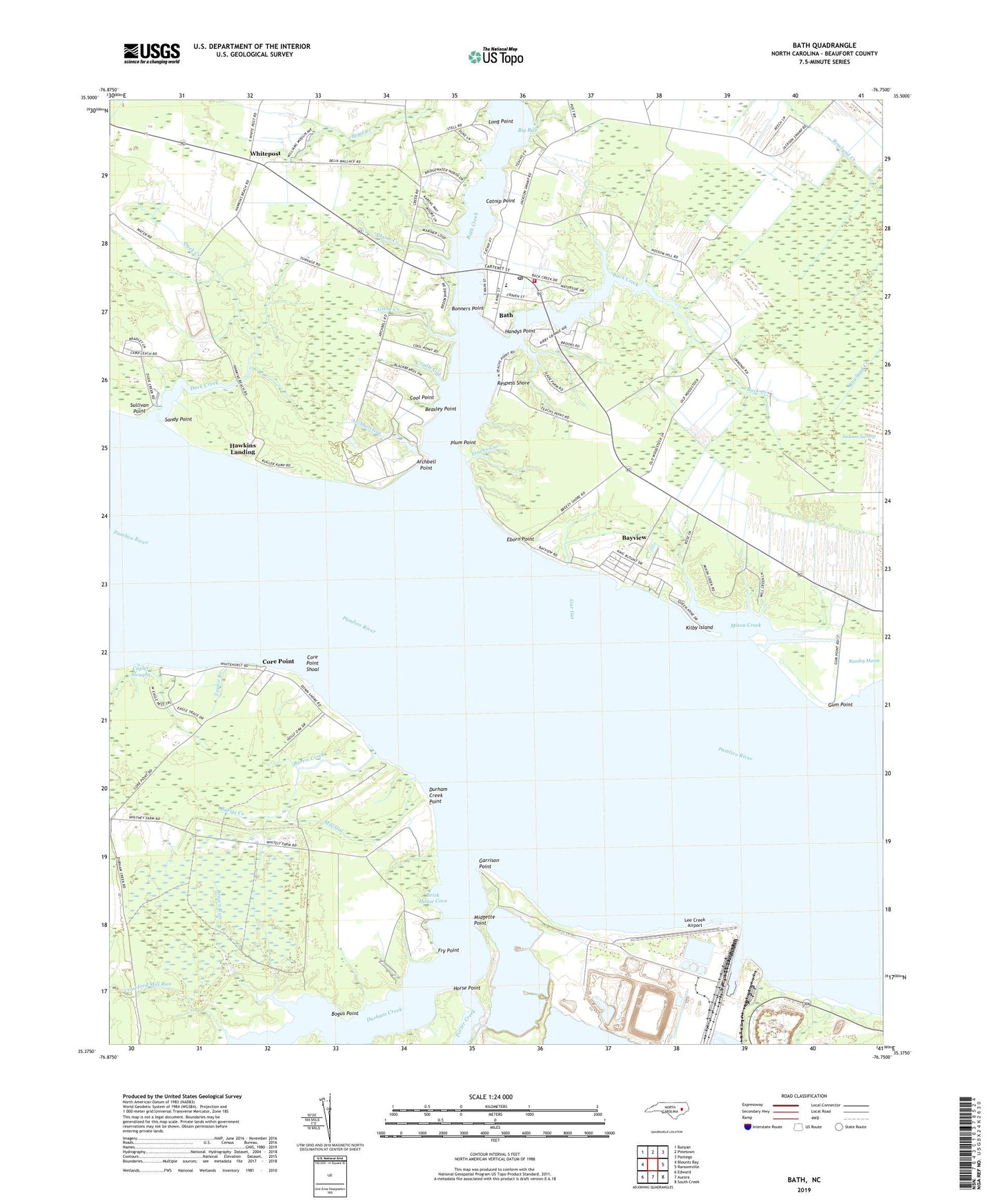
Bath North Carolina US Topo Map
Couldn't load pickup availability
2022 topographic map quadrangle Bath in the state of North Carolina. Scale: 1:24000. Based on the newly updated USGS 7.5' US Topo map series, this map is in the following counties: Beaufort. The map contains contour data, water features, and other items you are used to seeing on USGS maps, but also has updated roads and other features. This is the next generation of topographic maps. Printed on high-quality waterproof paper with UV fade-resistant inks.
Quads adjacent to this one:
West: Blounts Bay
Northwest: Bunyan
North: Pinetown
Northeast: Pantego
East: Ransomville
Southeast: South Creek
South: Aurora
Southwest: Edward
This map covers the same area as the classic USGS quad with code o35076d7.
Contains the following named places: Adams Creek, Archbell Gut, Archbell Point, Athens Chapel, Back Creek, Barris Creek, Bath, Bath Christian Church, Bath Church of God, Bath Creek, Bath Post Office, Bath School, Bath Volunteer Fire Department, Bayside School, Bayview, Bayview Census Designated Place, Bayview Church, Bear Grass Point, Beasley Point, Beaufort County, Big Bay, Bogus Point, Bonners Point, Brick House Cove, Brown Run, Catnip Point, Cool Point, Core Point, Core Point Chapel, Core Point Shoal, Cradle Gut, Crawford Mill Run, Cupler Sloughs, Duck Creek, Durham Creek, Durham Creek Point, Eborn Point, Fry Point, Gar Gut, Garrison Point, Glebe Creek, Gum Point, Handys Point, Hawkins Landing, Horse Point, Kilby Island, Lee Creek Airport, Long Point, Midgette Point, Mill Gut, Mixon Creek, Plum Point, Plum Point Gut, Pomouk Indian Village, Porter Creek, Reedy Branch Church, Respess Shore, Rumley Marsh, Sandy Point, Shell Landing, Slade Gut, Stevens Church, Sullivan Point, Taylor Branch, Teachs Gut, Town of Bath, Whitepost, ZIP Code: 27808