MyTopo
Saluda North Carolina US Topo Map
Couldn't load pickup availability
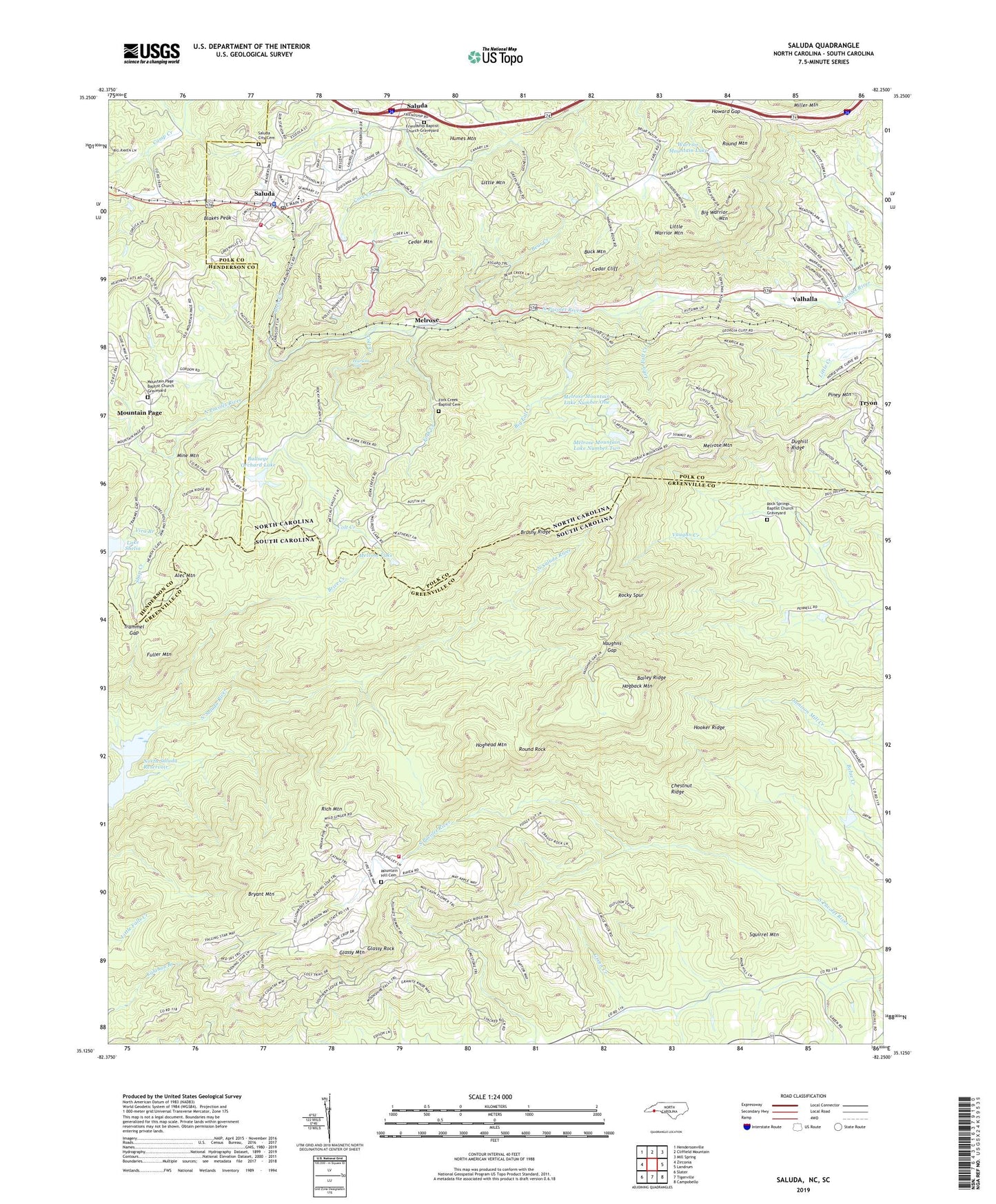
2022 topographic map quadrangle Saluda in the states of South Carolina, North Carolina. Scale: 1:24000. Based on the newly updated USGS 7.5' US Topo map series, this map is in the following counties: Polk, Greenville, Henderson. The map contains contour data, water features, and other items you are used to seeing on USGS maps, but also has updated roads and other features. This is the next generation of topographic maps. Printed on high-quality waterproof paper with UV fade-resistant inks.
Quads adjacent to this one:
West: Zirconia
Northwest: Hendersonville
North: Cliffield Mountain
Northeast: Mill Spring
East: Landrum
Southeast: Campobello
South: Tigerville
Southwest: Slater
Contains the following named places: Alec Mountain, Bailey Ridge, Bear Creek, Big Fall Creek, Big Warrior Mountain, Blakes Peak, Blue Ridge Baptist Church Graveyard, Blue Ridge Church, Brice Creek, Brushy Creek, Brushy Ridge, Bryant Mountain, Buck Mountain, Bullseye Orchard Lake, Cedar Cliff, Cedar Mountain, Chestnut Ridge, City of Saluda, Colt Creek, Dughill Ridge, Fork Creek, Fork Creek Baptist Cemetery, Fork Creek Church, Friendship Baptist Church Graveyard, Friendship Church, Fuller Mountain, Glassy Mountain, Glassy Mountain Fire Department Station 37, Glassy Rock, Grace Church, Hogback Mountain, Hoghead Mountain, Hooker Ridge, Howard Gap, Humes Mountain, Joels Creek, John T Coates Dam, Lake Shelia Dam, Little Fall Creek, Little Mountain, Little Warrior Mountain, Melrose, Melrose Lake, Melrose Mountain, Melrose Mountain Dam Number One, Melrose Mountain Dam Number Two, Melrose Mountain Lake Number One, Melrose Mountain Lake Number Two, Mine Mountain, Mountain Hill Church, Mountain Hill Community Church Graveyard, Mountain Page, Mountain Page Baptist Church Graveyard, Orchard Lake Dam, Pearsons Falls, Piney Grove Church, Piney Mountain, Rich Mountain, Rock Springs Baptist Church Graveyard, Rock Springs Church, Rocky Spur, Round Mountain, Round Rock, Saluda, Saluda City Cemetery, Saluda Elementary, Saluda Fire and Rescue, Saluda Junior High School, Saluda Police Department, Saluda Post Office, Shop Creek, Spring Branch, Squirrel Mountain, Township of Tryon, Trammel Gap, Valhalla, Vaughns Gap, Vira Branch, Warrior Mountain Church, Warrior Mountain Lake, WSPA-FM (Spartanburg), WSPA-TV (Spartanburg), ZIP Code: 29356