
MyTopo
Tuckasegee North Carolina US Topo Map
Couldn't load pickup availability
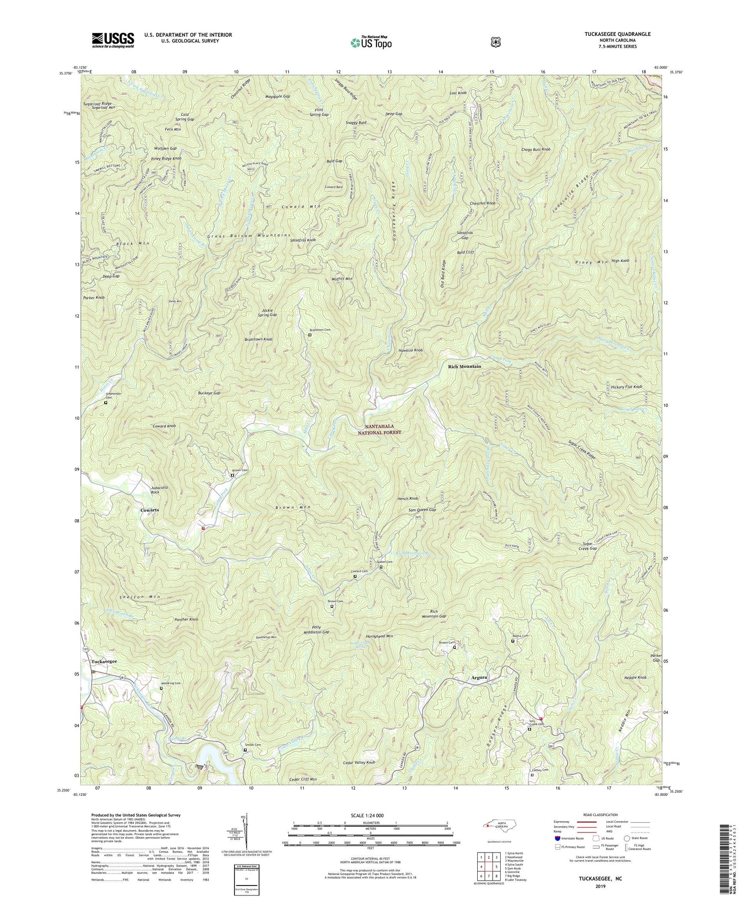
2019 topographic map quadrangle Tuckasegee in the state of North Carolina. Scale: 1:24000. Based on the newly updated USGS 7.5' US Topo map series, this map is in the following counties: Jackson, Haywood. The map contains contour data, water features, and other items you are used to seeing on USGS maps, but also has updated roads and other features. This is the next generation of topographic maps. Printed on high-quality waterproof paper with UV fade-resistant inks.
Quads adjacent to this one:
West: Sylva South
Northwest: Sylva North
North: Hazelwood
Northeast: Waynesville
East: Sam Knob
Southeast: Lake Toxaway
South: Big Ridge
Southwest: Glenville
Contains the following named places: Abbs Creek, Argura, Bald Cliff, Bald Gap, Balsam Grove Church, Bearwallow Creek, Beechflat Creek, Birch Ridge Creek, Black Mountain, Brasstown Cemetery, Brasstown Knob, Broom Cemetery, Brown Cemetery, Brown Mountain, Buckeye Gap, Canada Volunteer Fire Department, Caney Fork School, Canoe Creek, Catherine Chapel, Cathey Cemetery, Cedar Cliff Church, Cedar Cliff Dam, Cedar Cliff Mountain, Cedar Valley Creek, Cedar Valley Knob, Cedar Valley Spring, Chastine Creek, Chestnut Knob, Chestnut Ridge, Chestnut Ridge Creek, Choga Butt Knob, Cold Spring Gap, Coppermine Creek, Coward Bald, Coward Cemetery, Coward Knob, Coward Mountain, Cowarts, Craig Creek, Cullowhee Volunteer Fire Department Station 2, Cullowhee Volunteer Fire Department Station 3, Deep Gap, Dodgen Ridge, Doubletop Mountain, Dryland Laurel Branch, East Fork Moses Creek, Fern Mountain, Flint Spring Gap, Frady Creek, Gooseberry Ridge, Hawkins Knob, Hench Knob, Hickory Flat Knob, High Knob, Hornyhead Mountain, Indian Camp Branch, Jackie Spring Gap, Jeff Creek, Johns Creek, Judaculla Ridge, Judaculla Rock, Lost Knob, Mathis Cemetery, Mayapple Gap, Moffitt Mountain, Moses Creek Church, Mull Creek, Neddie Knob, Panther Knob, Parker Gap, Parker Knob, Piney Mountain, Piney Mountain Creek, Piney Ridge Knob, Polly Middleton Gap, Queen Cemetery, Rich Mountain, Rich Mountain Branch, Rich Mountain Gap, Rough Butt Creek, Roy Taylor Forest, Sam Queen Gap, Sassafras Gap, Sassafras Knob, Sheep Mountain, Shelton Mountain, Smook Cemetery, Snaggy Bald, Snaggy Bald Ridge, Sols Creek Cemetery, Sols Creek Church, Stephenson Cemetery, Sugar Creek, Sugar Creek Gap, Sugar Creek Ridge, Sugarloaf Mountain, Sugarloaf Ridge, Township of Caney Fork, Township of River, Tuckasegee, Tuckasegee Post Office, West Fork Moses Creek, West Fork Tuckasegee River, Wolfpen Gap, Woodring Cemetery, Woods Branch, ZIP Codes: 28723, 28783


