MyTopo
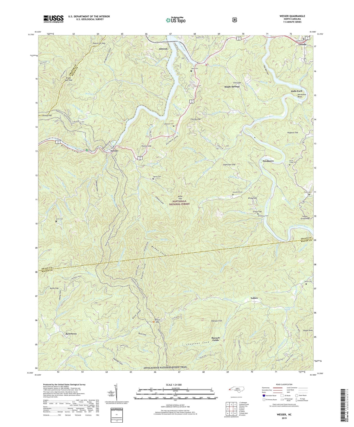
Wesser North Carolina US Topo Map
Couldn't load pickup availability
Also explore the Wesser Forest Service Topo of this same quad for updated USFS data
2022 topographic map quadrangle Wesser in the state of North Carolina. Scale: 1:24000. Based on the newly updated USGS 7.5' US Topo map series, this map is in the following counties: Swain, Macon, Graham. The map contains contour data, water features, and other items you are used to seeing on USGS maps, but also has updated roads and other features. This is the next generation of topographic maps. Printed on high-quality waterproof paper with UV fade-resistant inks.
Quads adjacent to this one:
West: Hewitt
Northwest: Tuskeegee
North: Noland Creek
Northeast: Bryson City
East: Alarka
Southeast: Franklin
South: Wayah Bald
Southwest: Topton
This map covers the same area as the classic USGS quad with code o35083c5.
Contains the following named places: Almond, Almond School, Ammons Knob, Bald Branch, Bald Cove, Bearpen Ridge, Bee Branch, Big Branch, Big Creek, Big Ridge, Bird Falls Branch, Blacksnake Branch, Breedlove Cemetery, Breedlove Mountain, Briertown, Broke Yoke Gap, Brush Creek, Brush Creek Cemetery, Brush Creek Church, Buck Cove, Buckner Branch, Burnett Fields, Cabe Branch, Charley Branch, Charley Gap, Cherry Branch, Chestnut Cove, Cliff Ridge, Collins Gap, DeHart Bald, DeHart Branch, DeHart Creek, Duck Branch, Euchella Branch, Euchella Church, Euchella Cove, Fall Branch, Flint Ridge, Fork Mountain, Gibson Cove, Grant Cemetery, Grapevine Cove, Grassy Branch, Grassy Gap, Grave Gap, Halls Ford, Hickory Cove, Hightower Church, Hightower Gap, Hogback Gap, Horseshoe Bend, Hurricane Branch, Indian Branch, Indian Grave Gap, Jake Branch, Jane Otter Branch, Johnson Cove, Lauada, Lauada Cemetery, Laurel Branch, Ledbetter Branch, Ledbetter Cemetery, Left Fork Partridge Creek, Lettuce Branch, Licklog Creek, Long Branch, Loudermilk Creek, Lowing Bald, Maple Springs, McHan Cove, Miller Cove, Monkey John Branch, Morris Branch, Nantahala Church, Nantahala Gorge, Needmore, Otter Creek School, Owenby Cove, Paint Mountain, Painter Branch, Peachtree Gap, Pinnacle, Poplar Cove, Pump Branch, Ramsey Cliff, Rattlesnake Creek, Rattlesnake Ridge, Rhinehart Creek, Right Fork Wesser Creek, Rock Church, Rocky Bald, Rocky Cove, Rocky Gap, Sawmill Branch, Sawmill Creek, Sawmill Hill Church, Scald Branch, Shope Knob, Short Branch, Siles Gap, Silver Creek Church, Silvermine Church, Silvermine Creek, Stiles Branch, Straight Ridge, Sugar Cove Creek, Sulphur Spring, Tabor Cemetery, Tarkiln Branch, Teague Branch, Tellico, Tellico Cemetery, Tellico Church, Tellico Gap, The Narrows, Totherow Branch, Townhouse Branch, Township of Nantahala, Truitt Cemetery, Turkey Knob, Tyre Knob, Watia Church, Watia Creek, Watia School, Wesser, Wesser Bald, Wesser Bald Lookout, Wesser Cemetery, Wesser Creek, Wesser Creek Shelter, Wesser Creek Trail, West Swain Fire Department, White Top, Wiggins Creek, Wikle Branch, Wildcat Branch, Wilke Gap, Windy Gap, Windy Gap Cemetery, Wright Place


