MyTopo
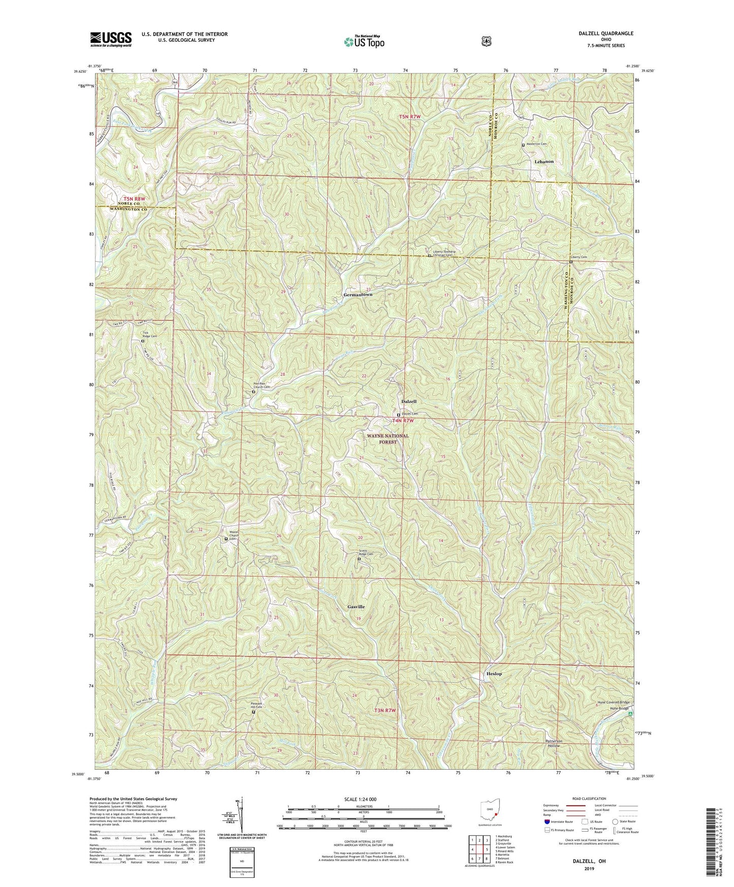
Dalzell Ohio US Topo Map
Couldn't load pickup availability
Also explore the Dalzell Forest Service Topo of this same quad for updated USFS data
2023 topographic map quadrangle Dalzell in the state of Ohio. Scale: 1:24000. Based on the newly updated USGS 7.5' US Topo map series, this map is in the following counties: Washington, Noble, Monroe. The map contains contour data, water features, and other items you are used to seeing on USGS maps, but also has updated roads and other features. This is the next generation of topographic maps. Printed on high-quality waterproof paper with UV fade-resistant inks.
Quads adjacent to this one:
West: Lower Salem
Northwest: Macksburg
North: Stafford
Northeast: Graysville
East: Rinard Mills
Southeast: Raven Rock
South: Belmont
Southwest: Marietta
This map covers the same area as the classic USGS quad with code o39081e3.
Contains the following named places: Coon Run, Dalzell, Dalzell Cemetery, Deans Fork, Fifteen, Gasville, Germantown, Halls Chapel, Heslop, Hune Bridge, Hune Bridge Canoe Access Area, Hune Covered Bridge, Lebanon, Liberty Cemetery, Liberty Church, Liberty Township Christian Cemetery, Masterton Cemetery, Middle Fork Duck Creek, Paw Paw Church Cemetery, PawPaw Church, Pleasant Hill Cemetery, Pleasant Hill Church, Rowland Landing, Scotts Ridge Cemetery, Scotts Ridge Church, Sycamore Fork, Tick Ridge Cemetery, Township of Liberty, Waxler Church, Waxler Church Cemetery, Zion Church, ZIP Codes: 45745, 45788, 45789