MyTopo
Lower Salem Ohio US Topo Map
Couldn't load pickup availability
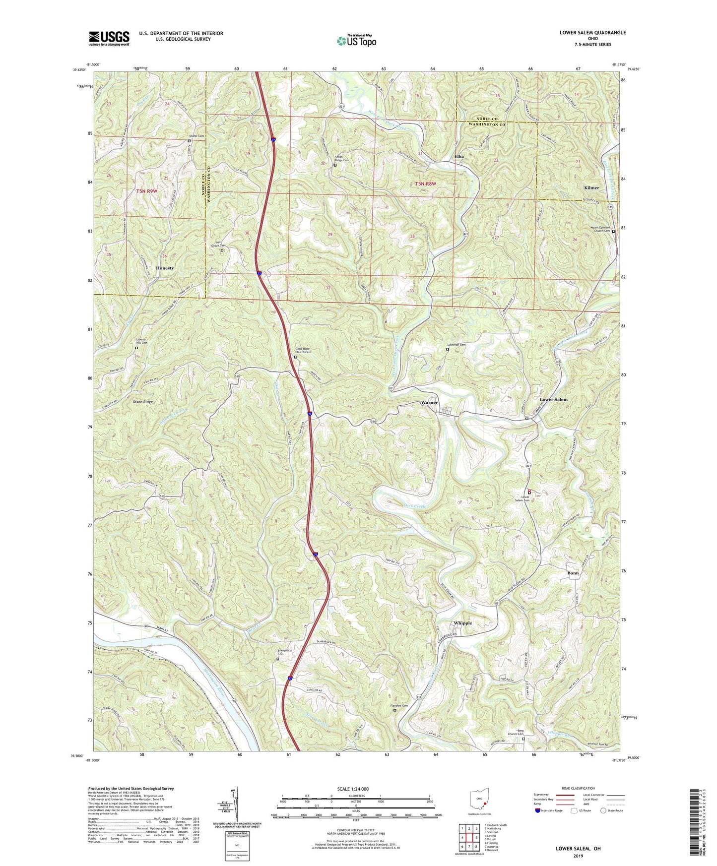
2023 topographic map quadrangle Lower Salem in the state of Ohio. Scale: 1:24000. Based on the newly updated USGS 7.5' US Topo map series, this map is in the following counties: Washington, Noble. The map contains contour data, water features, and other items you are used to seeing on USGS maps, but also has updated roads and other features. This is the next generation of topographic maps. Printed on high-quality waterproof paper with UV fade-resistant inks.
Quads adjacent to this one:
West: Lowell
Northwest: Caldwell South
North: Macksburg
Northeast: Stafford
East: Dalzell
Southeast: Belmont
South: Marietta
Southwest: Fleming
This map covers the same area as the classic USGS quad with code o39081e4.
Contains the following named places: Bear Creek, Berg Church, Berg Church Cemetery, Bonn, Buells, Dixon Ridge, East Fork Duck Creek, Elba, Evangelical Cemetery, Flanders Cemetery, Good Hope Church, Good Hope Church Cemetery, Highland Ridge Community Church, Hill Grove Cemetery, Hill Grove Church, Honesty, Honesty Post Office, Kilmer, Kilmer Post Office, Liberty Hill Cemetery, Lower Salem, Lower Salem Cemetery, Lower Salem Post Office, Lutheran Cemetery, Mount Ephraim Church, Mount Ephriam Church Cemetery, New Years Creek, Pawpaw Creek, Salem Township Volunteer Fire Department, Salem-Liberty Elementary School, Salem-Liberty High School, Shafer Cemetery, Shafers Church, Smith Ridge Cemetery, Smith Ridge Church, Township of Aurelius, Township of Salem, Village of Lower Salem, Warner, West Fork Duck Creek, Whipple, Whipple Community Church, Whipple Run, ZIP Codes: 45744, 45746