MyTopo
Stafford Ohio US Topo Map
Couldn't load pickup availability
Also explore the Stafford Forest Service Topo of this same quad for updated USFS data
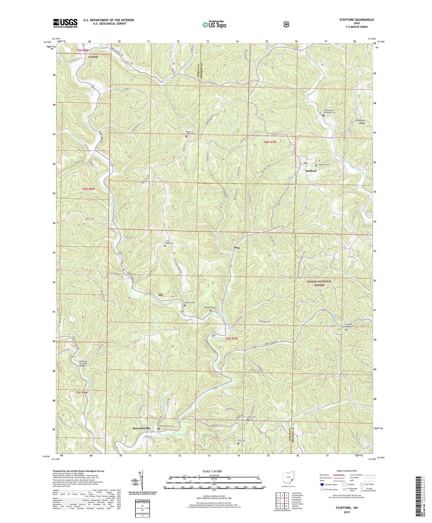
2023 topographic map quadrangle Stafford in the state of Ohio. Scale: 1:24000. Based on the newly updated USGS 7.5' US Topo map series, this map is in the following counties: Noble, Monroe. The map contains contour data, water features, and other items you are used to seeing on USGS maps, but also has updated roads and other features. This is the next generation of topographic maps. Printed on high-quality waterproof paper with UV fade-resistant inks.
Quads adjacent to this one:
West: Macksburg
Northwest: Sarahsville
North: Summerfield
Northeast: Lewisville
East: Graysville
Southeast: Rinard Mills
South: Dalzell
Southwest: Lower Salem
This map covers the same area as the classic USGS quad with code o39081f3.
Contains the following named places: Carlisle, Cliffyville, Cliffyville Post Office, Creighton Ridge Cemetery, Creighton Ridge Church of Christ, Creighton Run, Crum Ridge Cemetery, Crum Ridge Church, Elk, Elk Fork, Elk Post Office, Elk Township School, Flag, Flag Post Office, Flag Run, Greasy Run, Harriettsville, Harriettsville Cemetery, Harriettsville Post Office, Huffman Covered Bridge, Jerles, Jerles Post Office, McBride Run, Mount Tabor Cemetery, Mount Tabor Church, Road Fork, Road Fork Baptist Church, Road Fork Cemetery, Rocky Run, Saint Henry Roman Catholic Church, Schwab Run, Southerland Methodist Cemetery, Stafford, Stafford Cemetery, Stafford Post Office, Stewart Cemetery, Sutherland Church, Township of Elk, Township of Franklin, Township of Stock, Village of Stafford, Zion Cemetery, ZIP Code: 43786