MyTopo
Moyers Oklahoma US Topo Map
Couldn't load pickup availability
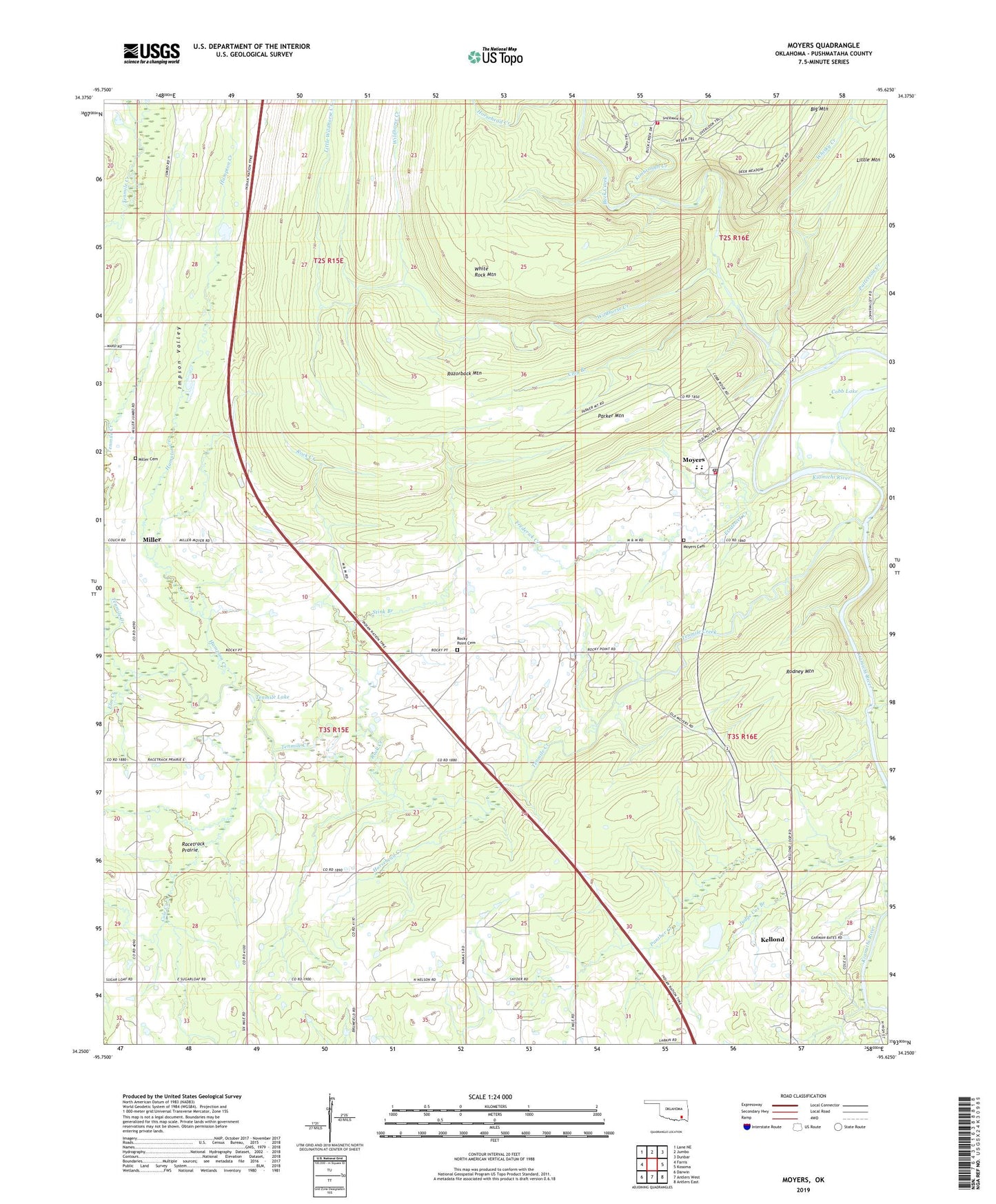
2022 topographic map quadrangle Moyers in the state of Oklahoma. Scale: 1:24000. Based on the newly updated USGS 7.5' US Topo map series, this map is in the following counties: Pushmataha. The map contains contour data, water features, and other items you are used to seeing on USGS maps, but also has updated roads and other features. This is the next generation of topographic maps. Printed on high-quality waterproof paper with UV fade-resistant inks.
Quads adjacent to this one:
West: Farris
Northwest: Lane NE
North: Jumbo
Northeast: Dunbar
East: Kosoma
Southeast: Antlers East
South: Antlers West
Southwest: Darwin
This map covers the same area as the classic USGS quad with code o34095c6.
Contains the following named places: Antlers Division, Antlers Waterworks, Buck Creek, Clay Branch, Cobb Lake, Cole Creek, Elm Creek, Frederick Creek, Hampton Creek, Horsehead Creek, Kellond, Kiamichi Wilderness Volunteer Fire Department, Kimbrough Creek, Little Kimbrough Creek, Little Wildhorse Creek, Miller, Miller Cemetery, Moyers, Moyers Cemetery, Moyers Census Designated Place, Moyers Elementary School, Moyers High School, Moyers Post Office, Moyers Rural Fire Department, North Nelson School, Panther Creek, Parker Mountain, Patterson Creek, Pleasant Cove Church, Racetrack Prairie, Razorback Mountain, Rock Creek, Rock Point Church, Rocky Point Cemetery, Rodney Mountain, Stink Branch, Sugarloaf School, Tenmile Creek, Tenmile Lake, Whisky Creek, White Rock Mountain, Wildhorse Creek