MyTopo
Aydelotte Oklahoma US Topo Map
Couldn't load pickup availability
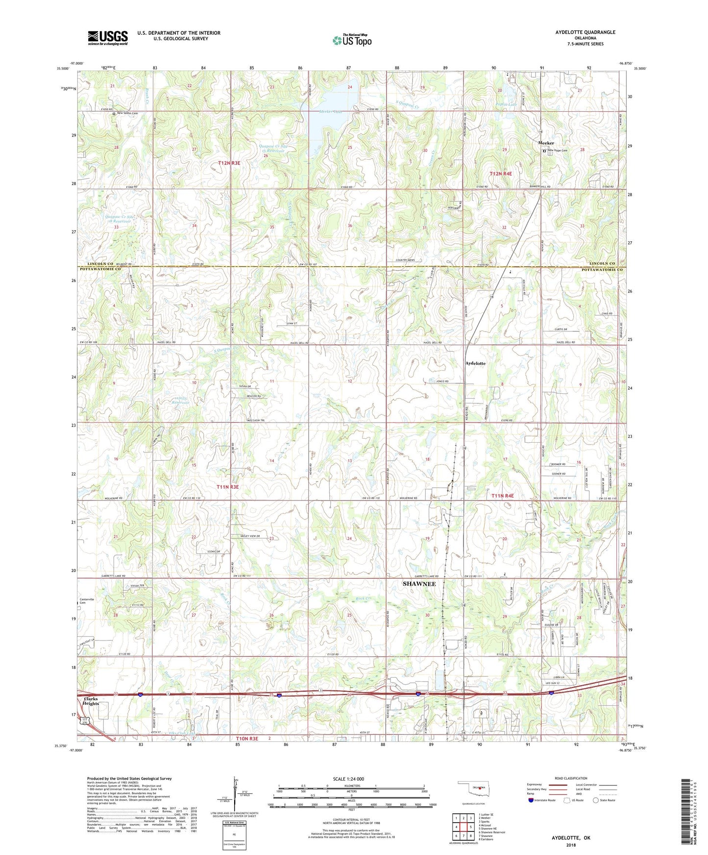
2018 topographic map quadrangle Aydelotte in the state of Oklahoma. Scale: 1:24000. Based on the newly updated USGS 7.5' US Topo map series, this map is in the following counties: Pottawatomie, Lincoln. The map contains contour data, water features, and other items you are used to seeing on USGS maps, but also has updated roads and other features. This is the next generation of topographic maps. Printed on high-quality waterproof paper with UV fade-resistant inks.
Quads adjacent to this one:
West: McLoud
Northwest: Luther SE
North: Meeker
Northeast: Sparks
East: Shawnee NE
Southeast: Earlsboro
South: Shawnee
Southwest: Shawnee Reservoir
Contains the following named places: Aydelotte, Bob White Dam, Bob White Reservoir, Family of Faith Christian School, Gordon Cooper Technology Center, Green Creek, Meeker Elementary School, Meeker Lake, New Hope Cemetery, New Salem Cemetery, North Rock Creek Elementary School, Oknoname 111050 Dam, Oknoname 111050 Reservoir, Oknoname 111055 Dam, Oknoname 111055 Reservoir, Poplin Dam, Poplin Lake, Quapaw Creek Site 13 Dam, Quapaw Creek Site 13 Reservoir, Quapaw Creek Site 15 Dam, Quapaw Creek Site 15 Reservoir, Quapaw Creek Site 18 Dam, Quapaw Creek Site 18 Reservoir, Shawnee Mall, Shawnee Oil Field, Town of Meeker, Township of Davis, West Red Hill Oil and Gas Field, ZIP Code: 74804